The Trail of the Cedars at
Glacier National Park near West Glacier, Montana is an easy universally-accessible 1-mile loop hike that leads through an old growth forest of western red cedar trees and features stunning views of Avalanche Creek's turquoise water as it flows through a moss-covered gorge.
Hiking the Trail of the Cedars
This ultra-popular hike at
Glacier National Park begins on the east side of the
Going-to-the-Sun Road, north of Lake McDonald. Hikers can't miss the trailhead as this is by-far one of the most popular and crowded spots in the park with cars lining the road's parking spaces and nearby parking lots. The trail can be found at several trailheads, but this route begins at the most-obvious trailhead located on the east side of the
Going-to-the-Sun Road, just a few-hundred feet north of Avalanche Creek.
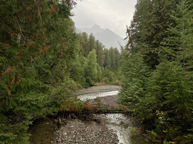
The trail is easy to follow with boardwalks and smooth dirt paths that comprise the loop. The trail begins on a boardwalk before taking a right-hand turn to cross a footbridge over Avalanche Creek. From the footbridge, hikers will find a nice view of the creek below your feet and the alpine mountains to the southeast.
South side of the Loop - Mile 0.1 to 0.53
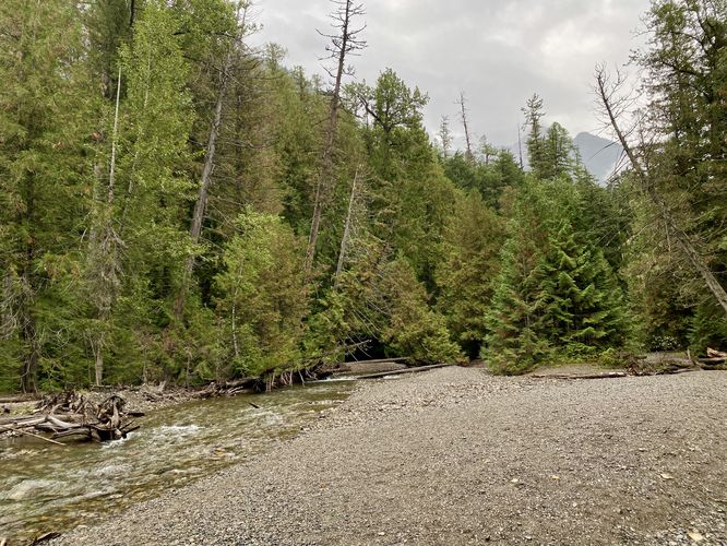
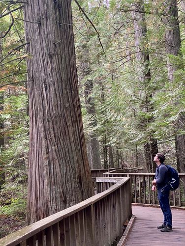
The south side of the Trail of the Cedars loop follows a dirt path as it leads through the old growth western red cedar forest. Note that during our hike in September 2024, a small portion of the
trail was closed for construction, hence the very short road walk
included in this route. The trail also features a couple of offshoot trails that lead out to benches that sit along Avalanche Creek. These views are a nice way to break up the walk and take-in different scenery, however, the best views are yet to come. As the trail traverses the southern side of the loop, you'll pass several large old growth western red cedar trees. Around mile 0.53, hikers will reach the trailhead for the
Avalanche Lake Trail.
Hike the Avalanche Lake Trail
The trailhead for
Avalanche Lake can be found at the very southern end of this loop, located near mile 0.53, and is well worth it if you have the time and energy. Hiking the
Avalanche Lake Trail is a great way to explore this entire area while hiking the Trail of the Cedars in-full with
Avalanche Lake breaking up the loop.
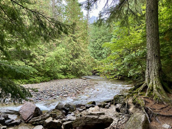
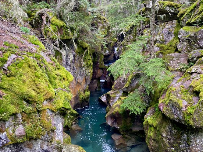
Avalanche Creek's Turquoise Water - Mile 0.56
Just beyond the
Avalanche Lake Trail, continuing along the loop will lead hikers to another footbridge that spans Avalanche Creek. Just before the bridge is a beautiful view of the creek with its crystal-clear water below as it passes over them in a shallow flow. The bridge, however, has the best view of Avalanche Creek. Walking over the bridge unveils the deep turquoise water within a mossy gorge of Avalanche Creek. The water, still crystal clear, has a stunning turquoise tint with colorful rocks below and small waterfalls located upstream. This part of the trail is the main attraction and thus you'll likely find other visitors exploring the colorful water from the bridge.
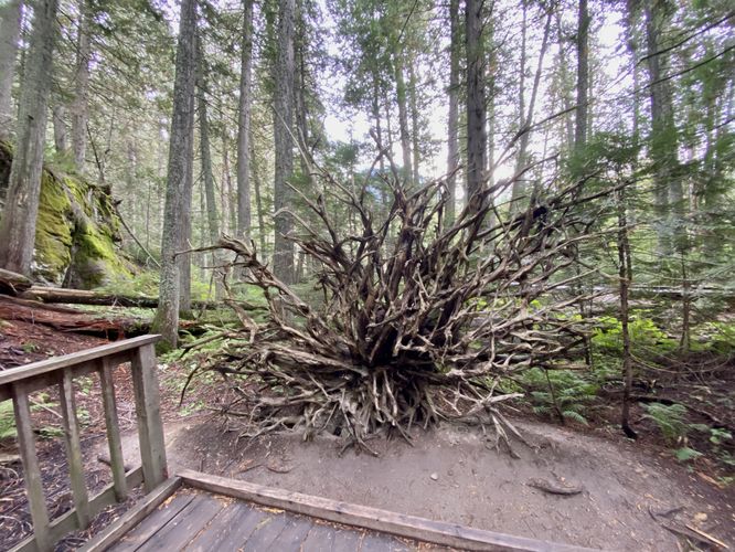
Boardwalk through Old Growth Cedars - Mile 0.56 to 1
The trail from the turquoise water view back to parking follows a boardwalk as it passes through more old growth western red cedar trees. Notably, around mile 0.75 is one of the largest of the old growth trees sitting right on-trail. The trail passes several moss-covered rock ledges and even a fallen tree with its root system completely exposed, with no dirt attached, located around mile 0.85 and is the last point-of-interest along the route. Hikers will reach the parking lot at mile 1.
Parking
Hikers will find several parking lots and turnout locations for this hike, located near the coordinates provided along the
Going-to-the-Sun Road. The coordinates will bring you to the parking turnout spaces located on-road where you'll find a couple dozen parking spaces. Just before this turnout, located on the west side of the road is a smaller turnout area with about 1 dozen parking spaces. To the west of the southern turnout location is a larger parking lot complex that can hold a few dozen vehicles. Despite the excessive parking, hikers will find that these spaces fill up quickly each day and you might need to wait around for a parking space to open.
Popularity
This is one of the most popular and crowded spots within
Glacier National Park.
Vehicle Reservations
Depending on what time of year you visit, you may need to
reserve a vehicle entrance pass
to get into the park, in addition to a park entry fee (or annual
National Parks pass). Before planning this hike, ensure you've checked
the
NPS website for when and where Glacier NP vehicle reservations are required.
Pets
Dogs are
not allowed on any trails at Glacier National Park.
Warning
Grizzly bears:
This trail can be frequented by grizzly bears, especially in late
Summer and early Fall as they scrounge for 20 hours/day bulking for the
winter. Always give wild animals plenty of space, including several
hundred feet for grizzlies. It's best to bring bear spray on this hike
as a last defense just in case a grizzly were to charge at you. Always
make plenty of noise while hiking to alert animals to your presence long
before you see them. It's also smart to hike with another person.