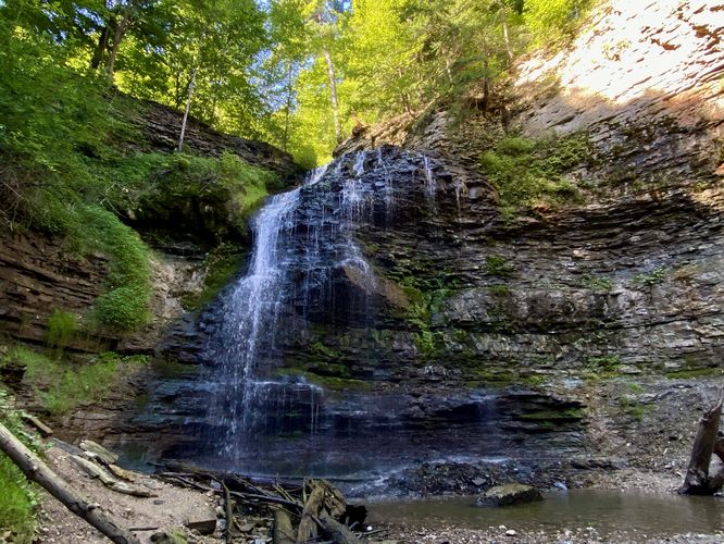
The Tiffany Falls Trail at Tiffany Falls Conservation Area in Hamilton, Ontario is an easy 0.8 km out-and-back hike that leads to the 19.7 m (69-foot tall) waterfall, Tiffany Falls.
Hike to Tiffany Falls
The trailhead for the Tiffany Falls Trail is located on the east side of the main parking area at the coordinates provided. Hikers will follow the blue blazes of the trail as it leads up the Tiffany Creek gorge. The trail is easy to follow as it ascends its way toward Tiffany Falls. Hikers will cross a scenic footbridge that spans the creek before the trail bends southward, passing boulders in the gorge, before reaching Tiffany Falls around 0.4 km from the trailhead. Tiffany Falls cascades down the bedrock at about 19.7m or 69-feet tall as it feeds a shallow pool of water below before it continues down Tiffany Creek. After exploring Tiffany Falls, the trail leads right back to parking for a short 0.8 km out-and-back hike.
Parking & Fees
Hikers will find a medium-sized parking lot for Tiffany Falls Conservation Area at the coordinates provided, located on the south side of Wilson Street East in Hamilton, Ontario. The lot is large enough to fit just over a dozen vehicles as of August 2024. During our visit in August 2024, we purchased a day pass good for all of HCA's properties, which cost ~$35 or so, but the individual parking fee is $11.
Pets
Dogs are allowed only if leashed and must be cleaned up after.