Loading...

🎉 Enjoy a Free 7-Day Supporter Trial and Unlock Exclusive Perks — No Credit Card Required. Learn more.

Three Rivers Heritage Trail - Strip District

Directions
Map
Pictures
Send to App
Distance:
3.0 Miles / 4.8 km
Type:
Out-and-Back
Difficulty:
Easy
Time to Hike:
1 hour, ~30 minutes
Features:
Surface Type:
Universal Access
Park:
Three Rivers Heritage Trail
Town:
Pittsburgh, Pennsylvania
Directions:
40.455541, -79.983234
Added:
August 27, 2017
Updated:
January 23, 2020
Copy Trail Link Hiking this trail? Send a friend or family member a link to this trail guide for your own safety. Hike at your own risk (disclaimer)
Loading...
Loading...
31'

Total Change
99'

Ascent
100'

Descent

Download the Trail Route for Offline Use

Supporters get exclusive access to download trail routes to the MyHikes app for offline use. Stay prepared on your adventure, even without an internet connection! Become a Supporter today to unlock this feature and hike with confidence.

Send to App

Three Rivers Heritage Trail - Strip District

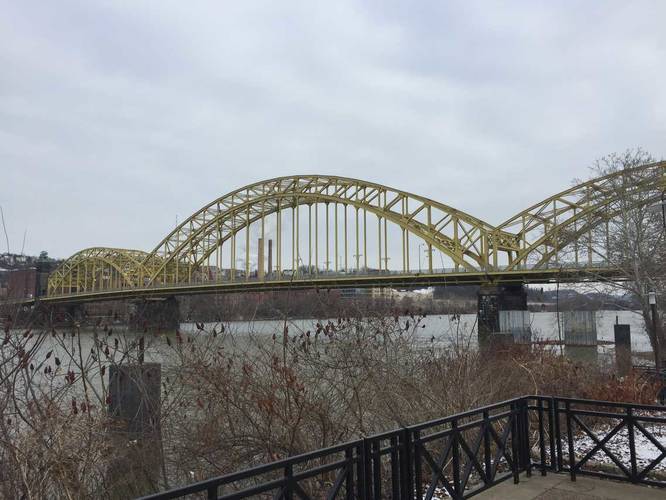
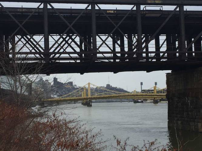
The Strip District section of the Three Rivers Heritage Trail is an easy 3 mile out-and-back hike that leads from 27th street to the Rachel Carson Bridge and the Downtown TRHT and Point State Park section and back. The trail has a few main view points - you can see Herrs Island in the Allegheny River, the Rachel Carson Bridge, Andy Warhol Bridge, Roberto Clemente Bridge, Downtown Pittsburgh, and the convention center right on the edge of the trail.

Parking can be found for free at the end of 24th street - there are 2 or 3 public parking spaces; however, there's plenty of parking found in/around the Strip District. Parking over by the 27th Street entrance appears to be permit-only parking on the street, but I did not confirm that.

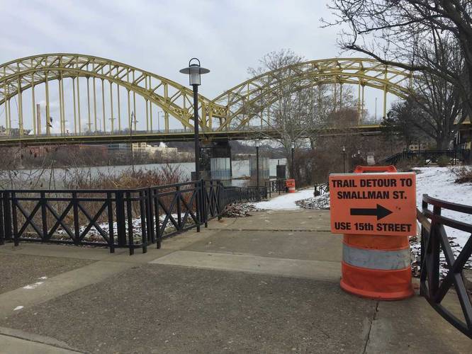
Note: As of early February 2018, there's still construction going on between 15th and 21st street and the trail is closed between these streets. The GPS data provided includes the detour portion of the trail that heads over to Smallman Street and then back to the trail. This construction has been going on since Spring 2017.
Explore 219 trails near Pittsburgh, PA
  1. Parking

    40.455541, -79.983234
  2. Main Trailhead

    40.457999, -79.979662
  3. View of 16th Street Bridge

    40.449969, -79.990853
    View of 16th Street Bridge
  4. View of Mt Washington and Pittsburgh's bridges

    40.447328, -79.995072
    View of Mt Washington and Pittsburgh's bridges
  5. Detour along trail in 2018

    40.449894, -79.990744
    Detour along trail in 2018
  6. View of Pittsburgh along trail detour (2018)

    40.453208, -79.984733
    View of Pittsburgh along trail detour (2018)
No community routes found. To add your own hike as a Community Route for this Trail guide, leave a Trip Report with an attached GPX file.

Hazards

Ticks - Lyme Disease More Info (CDC)

Seasons

All

Photo Albums

Trip Reports

Trail Guide By:
Admin user profile picture
3.0 miles / 4.8 km
0.5 miles / 0.8 km
August 27, 2017
Hiking

Weather Forecast

In Pittsburgh, PA

Explore Hiking Trails

You May Also Like

Colorado's Million Dollar Highway - Plan a day's drive adventure along the iconic Million Dollar Highway in Colorado. Explore the best short trails, roadside stops, waterfalls, vistas, ghost towns, and hot springs within a ~6 hour road trip.
Explore

Colorado's Million Dollar Highway

Plan a day's drive adventure along the iconic Million Dollar Highway in Colorado. Explore the best short trails, roadside stops, waterfalls, vistas, ghost towns, and hot springs within a ~6 hour road trip.

Read
New York's Best Waterfalls - Whether you're planning a day hike, roadside stop, or a leisurely short walk, this guide provides hikers, travelers, and locals alike with 63 different locations to over 100 scenic waterfalls to help plan your next adventure!
Explore

New York's Best Waterfalls

Whether you're planning a day hike, roadside stop, or a leisurely short walk, this guide provides hikers, travelers, and locals alike with 63 different locations to over 100 scenic waterfalls to help plan your next adventure!

Read

Before you boogie...

Find our trail guides useful? Consider becoming a Supporter to unlock perks!

MyHikes is an indie platform that makes exploring public trails easier for everyone. The platform has no investors, no ads, and is owned and operated by one person, Dave Miller. Dave has personally mapped and written over 1,800 trail guides on MyHikes for the public to explore. MyHikes has helped millions outdoor enthusiasts plan their next adventure.

But it takes a lot of time 🕦, money 💰, work, and espresso shots ☕ to run MyHikes, including hiking , mapping , writing , and publishing new trails with high-quality (accurate) information... along with software engineering (coding) the platform like building new features, website and mobile app development (iOS and Android), site maintainance . and much much more.

Supporters unlock website and mobile app perks with an annual one-time payment of $25 (you renew) 😎👍. Or you can simply make a Donation of your choice. Otherwise, you can support us by telling your friends about MyHikes - both quick and free 🎉

Admin user profile picture

Dave Miller
MyHikes Founder