The Knob at Cornelia Carey Sanctuary in Falmouth, Massachusetts is a moderate 1-mile out-and-back hike that leads to stunning panoramic views from a peninsula summit known as The Knob.
Hike Description
This hike begins along Casey Lane near the parking and trailhead coordinates provided. Public trail access is easily identified by the signage - walk along the edge of the harbor to find a small path that leads to official trailhead signage just about 100-feet down the trail.
Fork Keep-Left - Mile 0.06
Not long into the hike, around mile 0.06, sits a fork in the trail. If you wish to simply walk to the top of The Knob for views, you can take a right-hand turn here for a slightly shorter hike. This GPS track takes a left-hand turn to visit some Quissett Harbor views first.
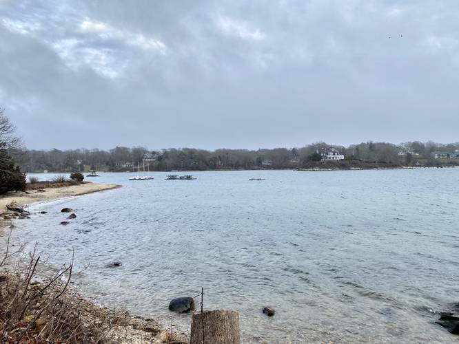
Quissett Harbor Views - Mile 0.15 and 0.3
At miles 0.15 and 0.3 are nice views of the Quissett Harbor that hikers can take a quick stop to enjoy. The trail then connects by heading north to reach the main route to reach The Knob.
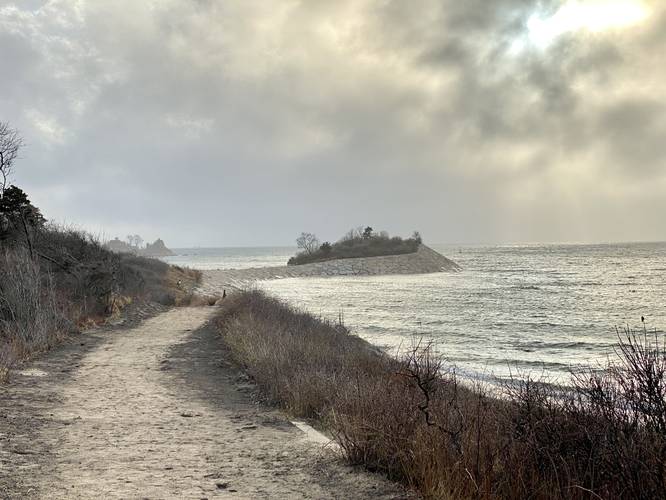
The Knob Views - Mile 0.35
Around mile 0.35 hikers will get some of the best views of The Knob as you make your way closer to the end of the peninsula. From this vantage point, you can see the trail as it stretches out into the ocean before climbing to the top of The Knob.
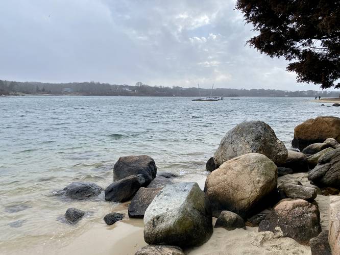
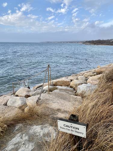
Rock Jetty to The Knob - Mile 0.45
Around mile 0.45, hikers will reach the skinny stretch of land, that's been built-up like a rock jetty, that connects to The Knob. Views of The Knob here are really nice too, but as of April 2023, fencing to keep people away from the rock slopes obstructs the view a bit.
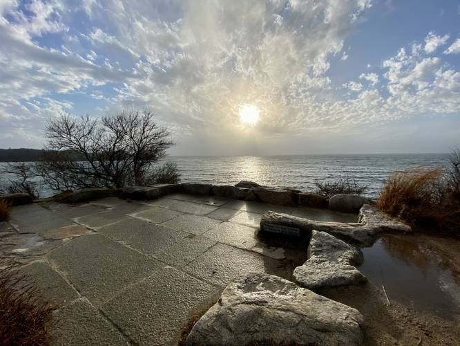
Top of The Knob - Mile 0.55
At mile 0.55, hikers will reach the top of The Knob. From the top, you get panoramic views of the surrounding area including Quissett Harbor, Crescent Beach, Buzzards Bay, Race Beach, and more.
Hiking Out
To hike out, the easier route is to take the main path straight from The Knob. There's one right-hand turn in the trail that leads hikers away from private property, but with the signage it's fairly obvious.
History
As stated on the signage at the trailhead: "Cornelia L. Cary left this sanctuary for the enjoyment of all those who love to walk and take pleasure in the quiet beauty of the woods and the sea. Consequently, no cars, motorcycles, or bicycles allowed. Also no fires or overnight camping. We hope that you will help preserve the beautify of the sanctuary by not littering and will leave it as you found it."
Parking
Hikers will find a small parking lot at the coordinates provided located along Casey Lane in Falmouth. The lot is large enough for about a dozen vehicles or so.
Pets
Dogs are allowed only if leashed and must be cleaned up after.
Hike Description
This hike begins along Casey Lane near the parking and trailhead coordinates provided. Public trail access is easily identified by the signage - walk along the edge of the harbor to find a small path that leads to official trailhead signage just about 100-feet down the trail.
Fork Keep-Left - Mile 0.06
Not long into the hike, around mile 0.06, sits a fork in the trail. If you wish to simply walk to the top of The Knob for views, you can take a right-hand turn here for a slightly shorter hike. This GPS track takes a left-hand turn to visit some Quissett Harbor views first.
Quissett Harbor Views - Mile 0.15 and 0.3
At miles 0.15 and 0.3 are nice views of the Quissett Harbor that hikers can take a quick stop to enjoy. The trail then connects by heading north to reach the main route to reach The Knob.
The Knob Views - Mile 0.35
Around mile 0.35 hikers will get some of the best views of The Knob as you make your way closer to the end of the peninsula. From this vantage point, you can see the trail as it stretches out into the ocean before climbing to the top of The Knob.
Rock Jetty to The Knob - Mile 0.45
Around mile 0.45, hikers will reach the skinny stretch of land, that's been built-up like a rock jetty, that connects to The Knob. Views of The Knob here are really nice too, but as of April 2023, fencing to keep people away from the rock slopes obstructs the view a bit.
Top of The Knob - Mile 0.55
At mile 0.55, hikers will reach the top of The Knob. From the top, you get panoramic views of the surrounding area including Quissett Harbor, Crescent Beach, Buzzards Bay, Race Beach, and more.
Hiking Out
To hike out, the easier route is to take the main path straight from The Knob. There's one right-hand turn in the trail that leads hikers away from private property, but with the signage it's fairly obvious.
History
As stated on the signage at the trailhead: "Cornelia L. Cary left this sanctuary for the enjoyment of all those who love to walk and take pleasure in the quiet beauty of the woods and the sea. Consequently, no cars, motorcycles, or bicycles allowed. Also no fires or overnight camping. We hope that you will help preserve the beautify of the sanctuary by not littering and will leave it as you found it."
Parking
Hikers will find a small parking lot at the coordinates provided located along Casey Lane in Falmouth. The lot is large enough for about a dozen vehicles or so.
Pets
Dogs are allowed only if leashed and must be cleaned up after.