Loading...

🎉 Enjoy a Free 7-Day Supporter Trial and Unlock Exclusive Perks — No Credit Card Required. Learn more.

Teaticket Park Loop

Directions
Map
Pictures
Send to App
Distance:
0.5 Miles / 0.8 km
Type:
Loop
Difficulty:
Easy
Time to Hike:
~15 minutes
Features:
Surface Type:
Universal Access
Park:
Teaticket Park
Town:
Falmouth, Massachusetts
Directions:
41.566188, -70.595053
Added:
April 07, 2023
Updated:
April 07, 2023
Copy Trail Link Hiking this trail? Send a friend or family member a link to this trail guide for your own safety. Hike at your own risk (disclaimer)
Loading...
Loading...
25'

Total Change
28'

Ascent
10'

Descent

Download the Trail Route for Offline Use

Supporters get exclusive access to download trail routes to the MyHikes app for offline use. Stay prepared on your adventure, even without an internet connection! Become a Supporter today to unlock this feature and hike with confidence.

Send to App

Teaticket Park Loop

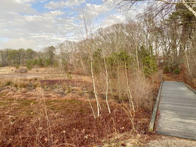
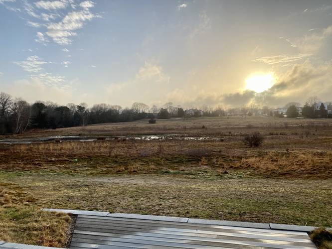
The Teaticket Park Loop in Falmouth, Massachusetts is an easy 0.6-mile loop trail that features wildflower meadows, a cranberry bog swamp, viewing platforms, and benches for relaxing.

This is not a hike but rather a short walk that follows both a universally-accessible gravel path and a forested path around the bog area to the east. From the bog area, the track heads back along the accessible path, passing benches, to reach an uphill grass trail that leads back to parking.

Universal Access
Parts of this trail are universally accessible from the trailhead until you reach the far end of the bog area. The rest of the trails that connect are not universally accessible. Note that where this GPS track starts is next to the accessible parking spots as well.

Parking
Walkers will find plenty of parking at the medium-sized parking lot at the coordinates provided. The lot is large enough to fit just over a dozen vehicles.

Pets
Dogs are allowed only if leashed and must be cleaned up after.
Explore 27 trails near Falmouth, MA
  1. Parking

    41.566188, -70.595053
  2. Main Trailhead

    41.5663, -70.594497
  3. Bog boardwalk

    41.565139, -70.593292
    Bog boardwalk
  4. Viewing Platform

    41.565953, -70.592292
    Viewing Platform
No community routes found. To add your own hike as a Community Route for this Trail guide, leave a Trip Report with an attached GPX file.

Hazards

Ticks - Lyme Disease More Info (CDC)
Poison Ivy/Oak

Seasons

All

Weather Forecast

In Falmouth, MA

Explore Hiking Trails

You May Also Like

Colorado's Million Dollar Highway - Plan a day's drive adventure along the iconic Million Dollar Highway in Colorado. Explore the best short trails, roadside stops, waterfalls, vistas, ghost towns, and hot springs within a ~6 hour road trip.
Explore

Colorado's Million Dollar Highway

Plan a day's drive adventure along the iconic Million Dollar Highway in Colorado. Explore the best short trails, roadside stops, waterfalls, vistas, ghost towns, and hot springs within a ~6 hour road trip.

Read
Glacier's Going-to-the-Sun Road - Discover the breathtaking beauty of Glacier National Park along the iconic Going-to-the-Sun Road. From stunning roadside stops to picturesque waterfalls and vistas, this engineering marvel offers endless opportunities for exploration.
Explore

Glacier's Going-to-the-Sun Road

Discover the breathtaking beauty of Glacier National Park along the iconic Going-to-the-Sun Road. From stunning roadside stops to picturesque waterfalls and vistas, this engineering marvel offers endless opportunities for exploration.

Read
New York's Best Waterfalls - Whether you're planning a day hike, roadside stop, or a leisurely short walk, this guide provides hikers, travelers, and locals alike with 63 different locations to over 100 scenic waterfalls to help plan your next adventure!
Explore

New York's Best Waterfalls

Whether you're planning a day hike, roadside stop, or a leisurely short walk, this guide provides hikers, travelers, and locals alike with 63 different locations to over 100 scenic waterfalls to help plan your next adventure!

Read

Before you boogie...

Find our trail guides useful? Consider becoming a Supporter to unlock perks!

MyHikes is an indie platform that makes exploring public trails easier for everyone. The platform has no investors, no ads, and is owned and operated by one person, Dave Miller. Dave has personally mapped and written over 1,800 trail guides on MyHikes for the public to explore. MyHikes has helped millions outdoor enthusiasts plan their next adventure.

But it takes a lot of time 🕦, money 💰, work, and espresso shots ☕ to run MyHikes, including hiking , mapping , writing , and publishing new trails with high-quality (accurate) information... along with software engineering (coding) the platform like building new features, website and mobile app development (iOS and Android), site maintainance . and much much more.

Supporters unlock website and mobile app perks with an annual one-time payment of $25 (you renew) 😎👍. Or you can simply make a Donation of your choice. Otherwise, you can support us by telling your friends about MyHikes - both quick and free 🎉

Admin user profile picture

Dave Miller
MyHikes Founder