Tannery Creek Falls near Canton, New York is an easy 0.1-mile out-and-back walk that leads to the 6-foot tall waterfall, Tannery Creek Falls.
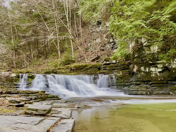
This is not a hike but rather a very short roadside walk to reach the base of Tannery Creek Falls. After parking, visitors will find the trailhead on the south side of Tannery Creek Road, located directly across from the parking turnout. Hop over the guardrail to find a small gravel trail that leads downhill to the base of the waterfall. The trail and bedrock surrounding the base of Tannery Creek Falls can be slippery, watch out. Once at the base of Tannery Creek Falls, visitors will find a nice deep pool of water in the creek below -- likely good for fishing. The waterfall itself is approximately 6-feet tall and ~20-feet wide. It spills down the creek's bedrock alongside hemlock trees and a small rock ledge. I've personally drive by this scenic waterfall numerous times without stopping, but it was well-worth the short visit once I did on Jan 1, 2024.
Parking
Visitors will find a small parking turnout at the coordinates provided, located on the north side of Tannery Creek Road in Canton approximately 500-feet East of Davis Road. The turnout is large enough to fit a couple of vehicles. Careful, the turnout sits on a blind curve.
Pets
Dogs are allowed only if leashed and must be cleaned up after.