Loading...

WINTER SALE! 50% OFF Supporter Accounts — now through January 31st. Learn More.

Swift River Trail

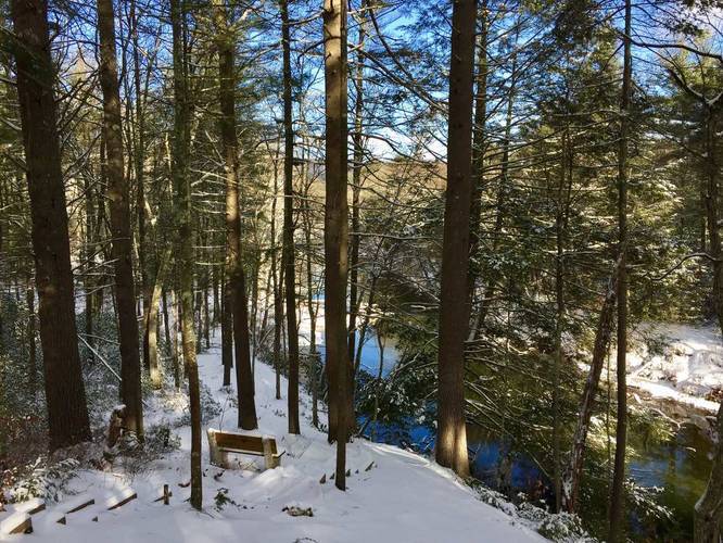
The Swift River Trail at the Quabbin Reservoir in Belchertown, Massachusetts is a short 1.2 mile hike that runs along the Swift River. This popular trail is mostly flat and leads into Quabbin just south of Winsor Dam. The trail starts off by heading uphill to a split - keep right at the fork and head downhill along the stairs before crossing a small creek that feeds into the Swift River.

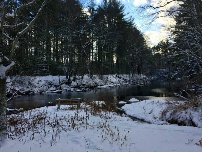
Further into the hike, the trail will again split - if you stay right you cross another bridge that leads over a large runoff creek that feeds into the Swift River as well. This runoff creek is the runoff water from the Winsor Dam. You can head to the end of the bridge which leads into the field just below Winsor Dam where the trail essentially ends. You can make a small loop of the trail by heading north and coming back along the water if you want as well.

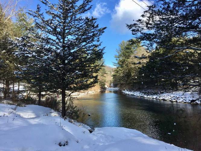
This is one of the most scenic trails in Belchertown and in Quabbin, especially in the winter. There are also a ton of other trails in this area as well that lead up to the visitor's center and Winsor Dam, so be sure to check out the park's trail map.

Fishing
This trail is very popular for fly fishing along the Swift River and is a designated for fly fishing only.

Pets
Dogs are not allowed on any trails at Quabbin.
Explore 206 trails near Belchertown, MA

Know Before You Go

  • The Swift River Trail in Belchertown, MA, is a 1.2-mile flat hike along the Swift River near the Quabbin Reservoir and Winsor Dam, offering scenic views.
  • The trail involves some minor stream crossings and a bridge over a runoff creek from Winsor Dam, with an option to extend the hike into a loop near the dam.
  • Fly fishing is a popular activity on this trail (designated fly fishing only), but dogs are prohibited on all Quabbin trails.
Interactive topographic map for Swift River Trail located in Belchertown, MA. Click the "View Map" button to load GPS coordinates and trail markers.
Get directions
Distance
1.2 mi
Difficulty
Easy
Type
Out-and-Back
Est. Time
36 min
Elev. Gain
59'
Rating
0.0
Added
December 31, 2017
Updated
April 27, 2020

Weather Forecast

This Afternoon
High 25°F
Mostly Cloudy
Tonight
Low 25°F
Chance Light Snow
Thursday
High 38°F
Mostly Sunny
Thursday Night
Low 17°F
Partly Cloudy
Friday
High 27°F
Partly Sunny
Friday Night
Low 0°F
Partly Cloudy
Saturday
High 11°F
Mostly Sunny
Saturday Night
Low 0°F
Mostly Cloudy then Slight Chance Light Snow
Sunday
High 15°F
Chance Light Snow
Sunday Night
Low 6°F
Chance Light Snow
Monday
High 20°F
Chance Light Snow
Monday Night
Low 5°F
Chance Light Snow then Partly Cloudy
Tuesday
High 23°F
Sunny
Tuesday Night
Low 7°F
Partly Cloudy
Loading...
Total Change
22'
Ascent
59'
Descent
59'
Loading...

Download the GPX Data for Offline Use

Supporters get exclusive access to download trail routes to the MyHikes app for offline use. Stay prepared on your adventure, even without an internet connection! Become a Supporter today to unlock this feature and hike with confidence.

Download Swift River Trail GPX Data to the MyHikes Mobile App

Features

Water Source

Points of interest

  1. Parking

    42.273428, -72.338098
  2. Main Trailhead

    42.273692, -72.338216
  3. Next to a bench with a small view of the Swift River

    42.274678, -72.338997
    Next to a bench with a small view of the Swift River
  4. Bench along the river

    42.275394, -72.339081
    Bench along the river

Safety information

For your own safety: plan ahead, let someone know where you'll be, and hike at your own risk.

Availability

All seasons

Surface type

Dirt

Trip Reports (Reviews)

Your opinion matters! Be the first to rate this trail.

Ready to help fellow hikers? Add a trip report to share your experience and provide valuable insights for other hikers!

No community routes found. To add your own hike as a Community Route for this Trail guide, leave a Trip Report with an attached GPX file.

Popular categories

Scenic mountain view representing vista trails
Vista trails
Scenic gorge of cascades representing waterfall trails
Waterfall hikes
Rugged mountain terrain representing summit trails
Summit trails
Scenic mountain view representing dog-friendly trails
Dog-friendly
Scenic campsite with a view representing camping trails
Camping trails
Appalachian Trail logo representing A.T. hikes
A.T. hikes

You May Also Like

Colorado's Million Dollar Highway - Plan a day's drive adventure along the iconic Million Dollar Highway in Colorado. Explore the best short trails, roadside stops, waterfalls, vistas, ghost towns, and hot springs within a ~6 hour road trip.
Explore

Colorado's Million Dollar Highway

Plan a day's drive adventure along the iconic Million Dollar Highway in Colorado. Explore the best short trails, roadside stops, waterfalls, vistas, ghost towns, and hot springs within a ~6 hour road trip.

Read
Glacier's Going-to-the-Sun Road - Discover the breathtaking beauty of Glacier National Park along the iconic Going-to-the-Sun Road. From stunning roadside stops to picturesque waterfalls and vistas, this engineering marvel offers endless opportunities for exploration.
Explore

Glacier's Going-to-the-Sun Road

Discover the breathtaking beauty of Glacier National Park along the iconic Going-to-the-Sun Road. From stunning roadside stops to picturesque waterfalls and vistas, this engineering marvel offers endless opportunities for exploration.

Read
🍪 We use cookies to learn about site usage and to serve map tiles. You may block cookies manually in the browser. By continuing you agree. Learn more