The Susquehanna River Walk in Williamsport, Pennsylvania is an easy 1.7-mile out-and-back paved trail that runs along the northern side of the river and features views of the surrounding mountains, the river, and the spillway waterfall.
Walk Description
This is not a hike but rather a nice walk that follows a paved path along the river. The walk begins at the main trailhead located next to the parking lot where a gravel trail heads up a moderate-grade hill to reach the paved trail.
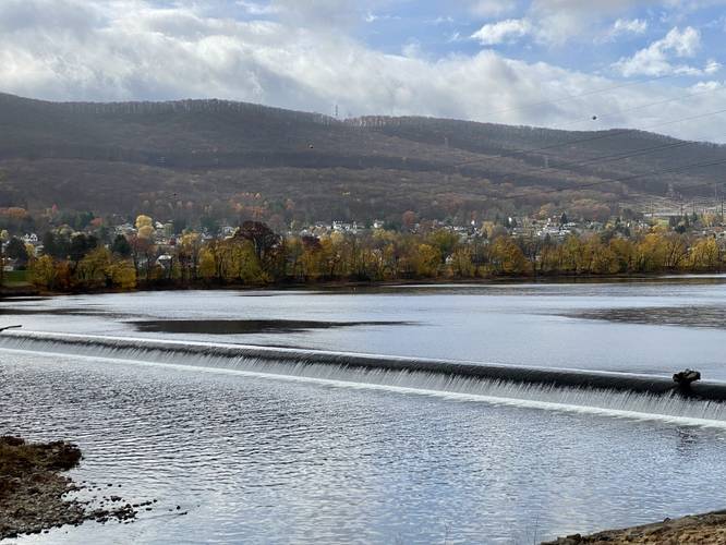
Susquehanna River Spillway Waterfall - Mile 0.06
Right when you get onto the paved trail, walkers get a view of the Susquehanna River Spillway which is a human-made waterfall built to provide power to mills, back in the 1800s. Today, what's leftover, is the spillway and some concrete dock-like platforms that sit in the water. This spillway, today, is a popular fishing location. Do not attempt to swim or enter the water near the spillway as the force from the waterfall can cause serious injury or death.
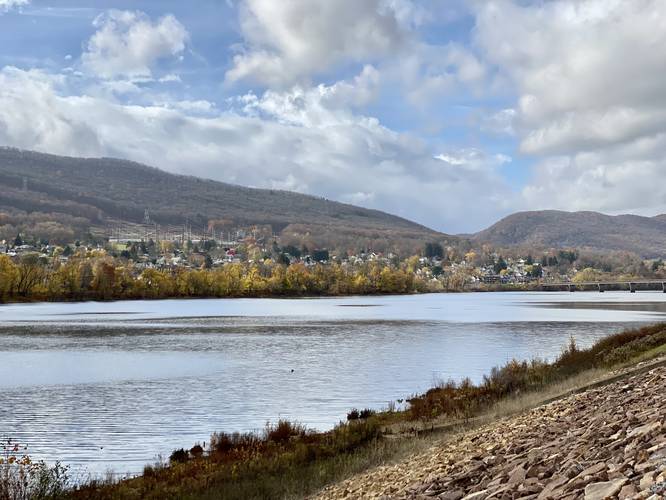
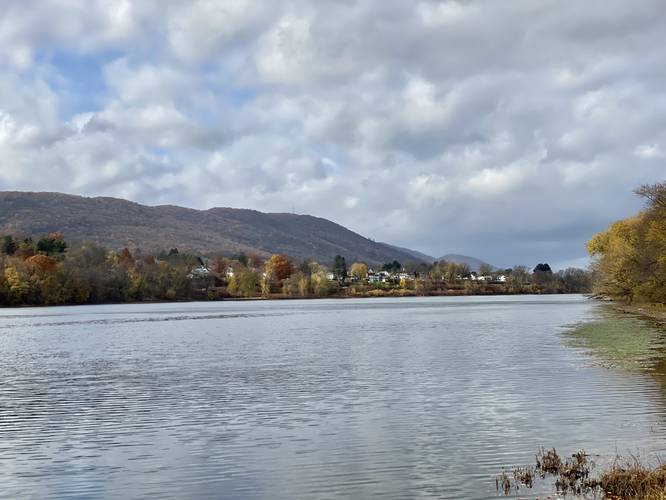
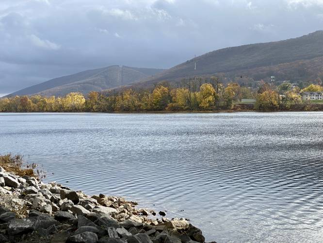
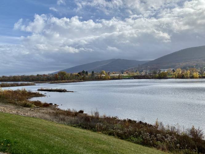
Views - Miles 0 to 0.2 and 0.85
After passing the spillway, walkers will head west to reach the Maynard St Bridge. Along the way are views of the mountains that line the southern side of the Susquehanna River. Views can be found between the trailhead and mile 0.2 and further down the trail, near the bridge, around mile 0.85. At mile 0.85 at the bridge, we turned back to make this a 1.7-mile out-and-back walk.
Parking
Walkers and hikers will find parking at the coordinates provided. The lot is large enough to fit several dozen vehicles.
Pets
Dogs are allowed if leashed and their waste must be carried out by the hiker.
Biking
Biking is allowed on this trail, so stay to the right-hand side at all times and watch out for bikers passing by.
Walk Description
This is not a hike but rather a nice walk that follows a paved path along the river. The walk begins at the main trailhead located next to the parking lot where a gravel trail heads up a moderate-grade hill to reach the paved trail.
Susquehanna River Spillway Waterfall - Mile 0.06
Right when you get onto the paved trail, walkers get a view of the Susquehanna River Spillway which is a human-made waterfall built to provide power to mills, back in the 1800s. Today, what's leftover, is the spillway and some concrete dock-like platforms that sit in the water. This spillway, today, is a popular fishing location. Do not attempt to swim or enter the water near the spillway as the force from the waterfall can cause serious injury or death.
Views - Miles 0 to 0.2 and 0.85
After passing the spillway, walkers will head west to reach the Maynard St Bridge. Along the way are views of the mountains that line the southern side of the Susquehanna River. Views can be found between the trailhead and mile 0.2 and further down the trail, near the bridge, around mile 0.85. At mile 0.85 at the bridge, we turned back to make this a 1.7-mile out-and-back walk.
Parking
Walkers and hikers will find parking at the coordinates provided. The lot is large enough to fit several dozen vehicles.
Pets
Dogs are allowed if leashed and their waste must be carried out by the hiker.
Biking
Biking is allowed on this trail, so stay to the right-hand side at all times and watch out for bikers passing by.