Loading...

Distance:
0.1 Miles / 0.2 km
Type:
Out-and-Back
Difficulty:
Easy
Time to Hike:
~5 minutes
Features:
Surface Type:
Paved
Town:
Keokea, Hawaii
Directions:
20.691271, -156.37862
Added:
February 15, 2023
Updated:
February 15, 2023
Please consider making a donation to the Maui Strong Fund to help the victims of Hawaii's recent wildfires.
Loading...
Loading...
12 '

Total Change
13 '

Ascent
13 '

Descent

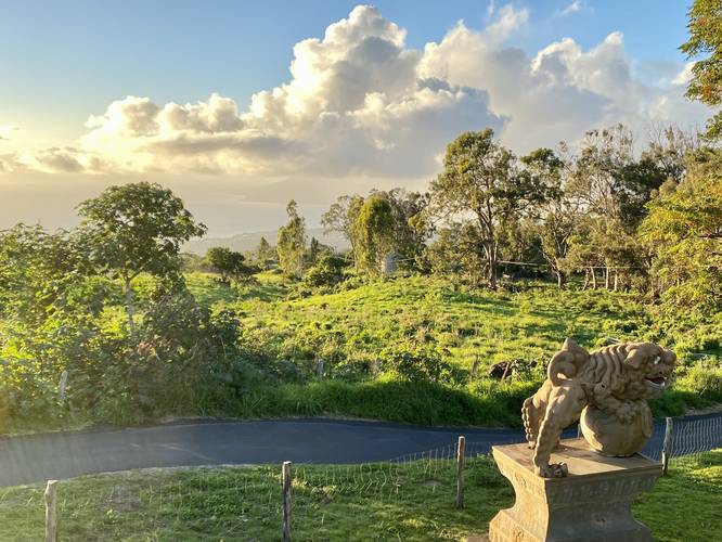
The Sun Yat Sen Park Trail near Keokea, Hawaii (Maui) is an easy 0.1-mile out-and-back walk that leads to the heart of the very small park and features a view of the West Maui Mountains, Maalaea Bay, Chinese statues and architecture, and picnic tables.

Accessibility
This very short trail is fully accessible and paved as of February 2023.

Parking
Visitors will find parking at the coordinates provided. The lot is a small lot but can fit about a half-dozen vehicles.

Pets Dogs are allowed if leashed and should be clean up after.

Hours
The park is open from 7AM to 7PM each day.

Respecting the Land
Hawaiian land is considered sacred to native Hawaiians and many locals, so please stay on-trail, take nothing but photos, and leave nothing but footprints. Respect the locals - don't stay for long and have a backup hike planned in case the parking lot is full.

Explore 58 trails near Keokea, HI
  1. Parking

    20.691271, -156.37862
  2. Main Trailhead

    20.691481, -156.378493
  3. Vista at Sun Yat Sen Park

    20.691492, -156.378631
    Vista at Sun Yat Sen Park
No community routes found. To add your own hike as a Community Route for this Trail guide, leave a Trip Report with an attached GPX file.

Seasons

All

Photo Albums

2 Trip Reports

No Star-Ratings
Write-up by:
Admin user profile picture
0.1 miles / 0.2 km
Trail added
February 15, 2023
Hiked on
February 15, 2023
Updated on
February 15, 2023
0.1 miles / 0.2 km
February 14, 2023
Hiking

Weather Forecast

In Keokea, HI

Explore Hiking Trails

New Hikes

Weston Lake Loop
3.2 Miles
5.1 km
Easy
Loop
Congaree Boardwalk Loop
2.5 Miles
4 km
Easy
Loop
Battery Warren Trail
1 Mile
1.6 km
Easy
Out-and-Back
Coquina Loop (Old Levi Mill Waterfall)
1.7 Miles
2.7 km
Moderate
Loop

Before you leave...

MyHikes is an indie web platform aimed to make exploring public trails easier for everyone. The site has no investors and is owned and operated by one person, Dave Miller (Founder & Admin). As the Founder, main contributor, and doer-of-all-things for MyHikes, I share my trips with over-detailed write-ups for fun on a volunteer basis and I believe that public trail information should be available to everyone.

It takes a lot of time 🕦, money 💰, and effort (including espresso shots ☕) to run MyHikes, including hiking , mapping , writing , and publishing new trails with high-quality content... along with building new features, moderating, site maintainance, and app development for iOS and Android . I simply ask that if you find MyHikes' trail guides helpful to please consider becoming a Supporter to help keep the site, iOS, and Android apps available to everyone.

Supporters unlock website and in-app perks with a one-time payment of $25 (you renew) 😎👍. Or you can simply make a Donation of your choice without a MyHikes user account. Otherwise, telling your friends about MyHikes is the next-best thing - both quick and free 🎉

Thanks for visiting MyHikes and have a great hike!️

Admin user profile picture

Dave Miller
MyHikes Founder & Admin