The Summerson - Trout Ridge - Lock Branch Loop at Susquehannock State Forest, within the Hammersley Wild Area, near Cross Fork, Pennsylvania is a moderate 10.8-mile loop hike that features small waterfall cascades, native trout fishing opportunities, and the Dutlinger Natural Area with old growth hemlocks and other species of old growth trees.
Trails
This track follows four named trails: John Summerson Trail, Trout Ridge Trail, Beech Bottom Trail, Lock Branch Trail.
Points-of-Interest
Note the points-of-interest (POI) are labeled with the mileage given in the GPS track. Your hike and mileage markers may differ.
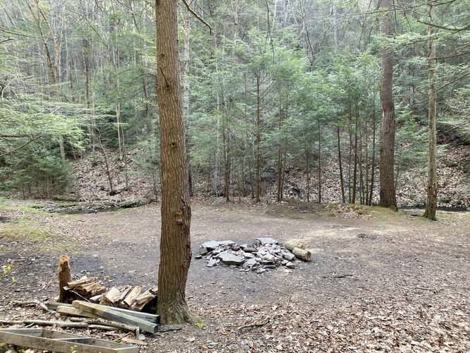
Campsites: between miles 0.15 and 0.2 are two very large campsites. There are no other designated campsites along this hike, but there are plenty of places where backpackers can setup tents.
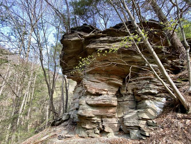
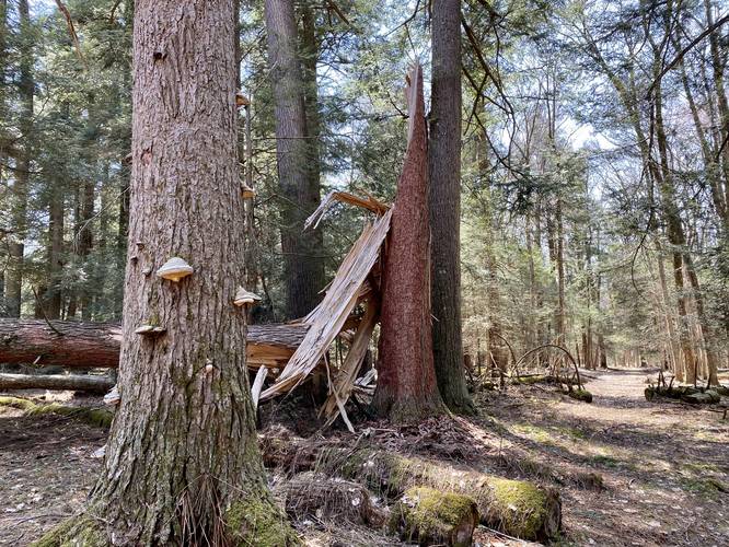
Hemlock Rock: around mile 1.05 is a large rock outcropping that follows the mountain's spine. This bedrock has hemlock trees growing off the top of it, so we nicknamed it Hemlock Rock. It's a neat formation along this trail.
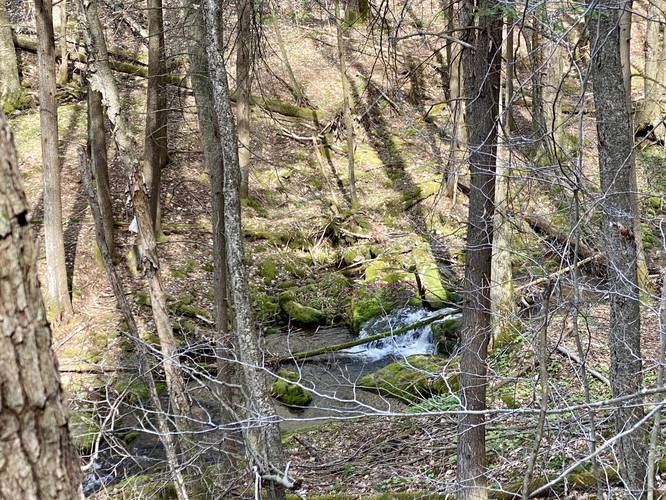
3-foot slide waterfall: around mile 1.28 is a slide waterfall, no more than 3-feet tall, that cascades in the creek below; however, the walk to reach the waterfall is steep and not easy.
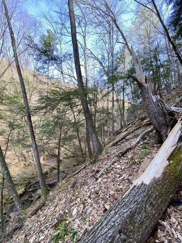
Dangerously steep terrain: around mile 1.35 the trail follows an extremely steep hillside with very-little footing along the trail itself. Watch your step and bring trekking poles to aid in this section of the trail.
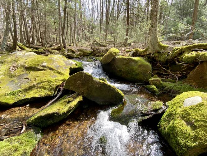
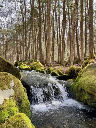
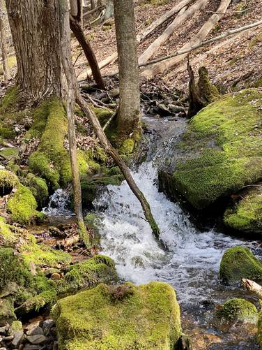
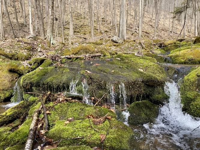
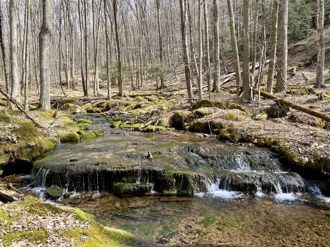
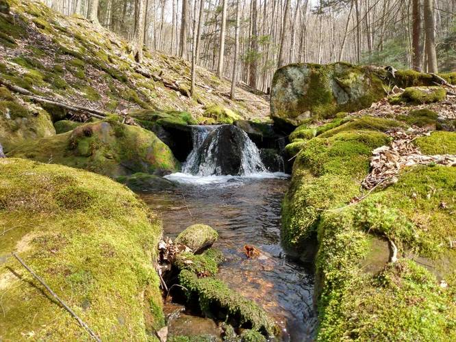
Many small waterfalls: between miles 2.3 and 2.9 are numerous small waterfall cascades that are between 1 and 3 feet tall. These small cascades add some scenery to this hike. One waterfall, about 2-feet tall, was created from a standing rock in the middle of the creek where it splits the flow of water into two falling streams, so we named this small cascade "Standing Rock Falls" - check out the pictures and the trail map to try and find it on your hike.
Junction with Trout Ridge Trail: around mile 3.7 hikers will reach the Trout Ridge Trail junction - take a right-hand turn here.
Trout Ridge and Pipeline Junction: around mile 5.1, the trail continues straight however the "most open" path takes a right-hand curve heading toward a pipeline. If you hit the pipeline, you've gone too far - turn back and hike 0.25 miles to backtrack to this junction. Look for a hard-to-find brown wooden sign labeled "Beech Bottom Trail >".
Pipeline - wrong turn: if, around mile 5.4, you reach a pipeline, you've missed the previous trail junction. Turn back here and hike 0.25 miles back to the junction. Look for a hard-to-find brown wooden sign labeled "Beech Bottom Trail >".
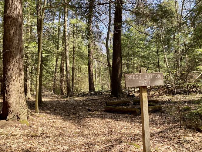
Beech Bottom Trail trailhead: at mile 6.4, hikers will reach the Beech Bottom Trail trailhead that leads to the largest old growth hemlocks within the Dutlinger Natural Area.
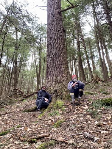
Old growth hemlock: around mile 6.8, hikers will reach the largest hemlocks located within the Dutlinger Natural Area. On this hike, we measured the largest hemlock to be 3.955-feet in diameter; 150 inch circumference.
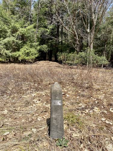
Penzoil land lease marker: around mile 7.6 lies an old stone obelisk that marks, what's assumed to be, an old natural gas or oil well extraction site. The obelisk is labeled "P-1 Penzoil United Inc Permit CLI-45".
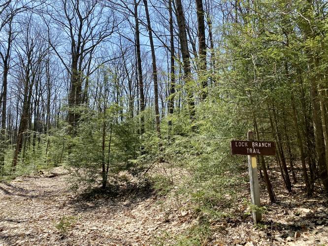
Lock Branch Trail trailhead: around mile 7.8 is the trailhead sign for the Lock Branch Trail.
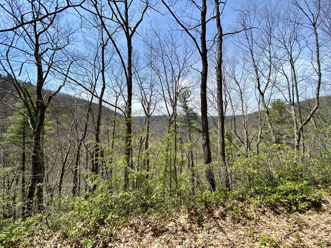
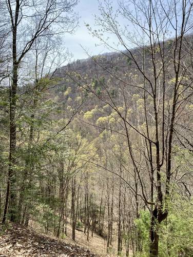
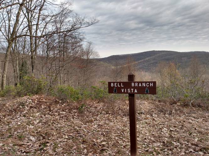
Obstructed seasonal vistas: around mile 9.3 is an area where the trail curves around a mountainside, giving hikers an "ok" obstructed seasonal vista of the surrounding mountains. It's not great, but it's well-welcomed after 9 miles of hiking. Note, there's another seasonal vista around mile 9.6 and 10.1; however, the one around mile 10.1 is "nicer" albeit not the best view.
Hike Description
This trek follows 4 named trails within the Hammersley Wild Area and begins at the John Summerson Trail trailhead. Hikers need to get their feet wet or bring extra boots with waders to change in/out of to complete this hike as the first couple of miles require creek crossings.
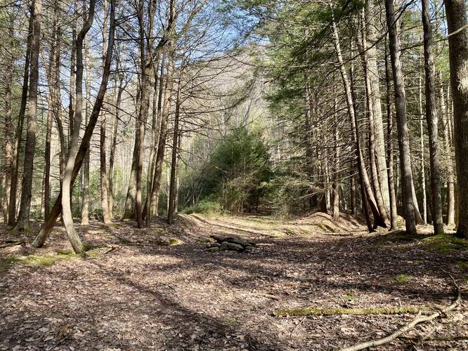
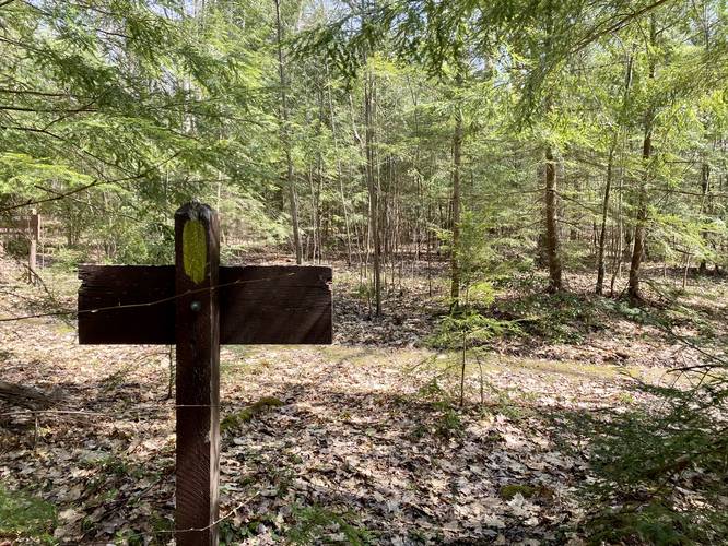
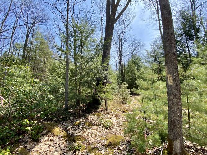
The hike heads in for the first 0.2 miles to reach a campsite area and then stays left at the campsite to then follow very-scarcely placed yellow blazes on the trees. These blazes are not easy to follow along the John Summerson Trail, so plan accordingly.
The John Summeron Trail has plenty to offer including a mountain spine bedrock outcropping we've nicknamed "Hemlock Rock" along with a series of small waterfalls, between 1 and 3-feet tall, that cascade down the creek. These cascades usually create pools that are worthy of native trout fishing. One section of the John Summerson Trail includes a very-steep hillside where the trail narrows to less than 1-foot across, so plan accordingly and bring trekking poles if necessary.
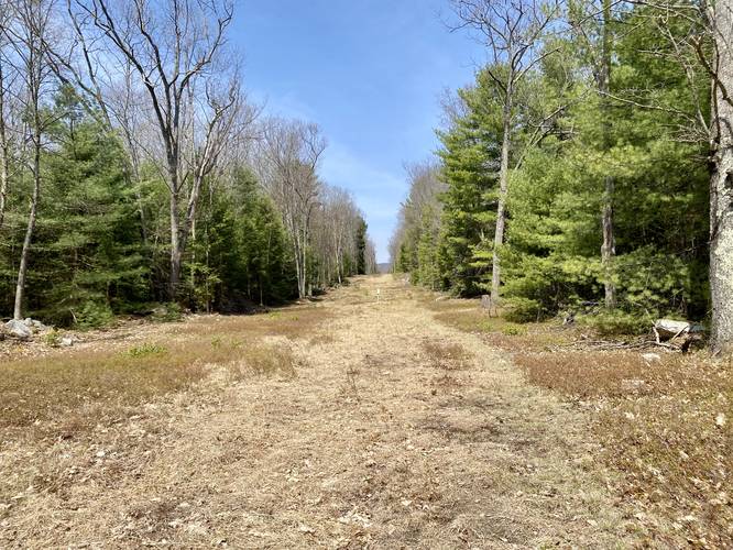
Hikers will slowly climb out of the hollow that the John Summerson Trail follows to reach the Trout Ridge Trail (red blazes - multi-purpose trail). Here, take a right-hand turn to hike for 1.3-miles before reaching a bend in the trail - this bend in the trail is technically a service road that connects to a pipeline. Here, you will want to scan the trees for a brown wooden sign (or pink ribbons) that mark the "junction" in the trail, as this section is not well-marked at all and hikers usually pass right by it. Rule of thumb: if you've hit the pipeline before reaching the Beech Bottom Trail, you need to hike back to find the junction.
After finding the junction to continue onward along the Trout Ridge Trail, hikers will continue heading east until they reach the Beech Bottom Trail just 0.6-miles after the pipeline curve junction. Hikers will want to follow the scarcely-placed yellow blazes (and orange and pink ribbons) to reach the old growth hemlocks within the Dutlinger Natural Area. On this hike, we measured the diameter of the largest hemlock to be 3.955-feet.
After visiting the Dutlinger old growth hemlocks (and signing the trail registry), hikers will head back to the Trout Ridge Trail to head east, passing an old oil well marker obelisk, before reaching the Lock Branch Trail trailhead.
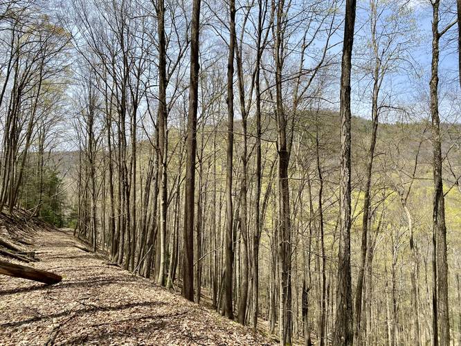
The Lock Branch Trail is wide and for the most-part, easy hiking. It passes through the one last section of the Dutlinger Natural Area while featuring some old growth trees; however none appeared to be as large as the hemlock grove earlier in the hike. Hikers will end up hiking downhill for about 2.5-miles, so the elevation grade is fairly gradual the entire way. There are about three spots on the trail where - during the cooler months when no leaves are on the trees - vistas that give an "ok" obstructed view of the mountain terrain in this section of the Hammersley Wild Area.
After hiking down from the Lock Branch Trail, hikers will cross 2 creeks, if not 3 - during months of high snow melt or heavy rain - before reaching the parking lot to complete the hike for approximately 10.8-miles.
Parking
Hikers will find parking just below the trailhead sign for the John Summerson Trail. The lot is large enough for about 3 vehicles or so.
Fishing
This trail has excellent native trout fishing opportunities, despite the creeks being on the smaller scale.
Pets
Dogs are allowed and should be leashed to prevent losing your companion.
Backpacking and Camping
Camping is permitted and backpackers will find plenty of places to setup a tent along this trail along really any section of the loop. Backpackers need to follow the state forest rules and regulations when dispersed / primitive / backcountry camping.
Warning
The timber rattlesnake lives in these woods between the end of April and late September. Watch your step and give any rattlers you find space.
Blaze Color
All of the trails, except for Trout Ridge Trail, follow yellow blazes. Trout Ridge Trail follows red blazes. All of the blazes appear to be ~15 years old and are fading. They are scarce as well, so they may be difficult to follow during the Summer.
Old Growth Hemlocks
This hike includes a stop at the Dutlinger Natural Area's old growth hemlock grove. During this hike, we measured the largest hemlock we could find to be approximately 3.955-feet in diameter; 150 inch circumference. For a shorter way to reach this old growth hemlock grove, check out our other guide - F. H. Dutlinger Old Growth Hemlock Hike.
Trails
This track follows four named trails: John Summerson Trail, Trout Ridge Trail, Beech Bottom Trail, Lock Branch Trail.
Points-of-Interest
Note the points-of-interest (POI) are labeled with the mileage given in the GPS track. Your hike and mileage markers may differ.
Campsites: between miles 0.15 and 0.2 are two very large campsites. There are no other designated campsites along this hike, but there are plenty of places where backpackers can setup tents.
Hemlock Rock: around mile 1.05 is a large rock outcropping that follows the mountain's spine. This bedrock has hemlock trees growing off the top of it, so we nicknamed it Hemlock Rock. It's a neat formation along this trail.
3-foot slide waterfall: around mile 1.28 is a slide waterfall, no more than 3-feet tall, that cascades in the creek below; however, the walk to reach the waterfall is steep and not easy.
Dangerously steep terrain: around mile 1.35 the trail follows an extremely steep hillside with very-little footing along the trail itself. Watch your step and bring trekking poles to aid in this section of the trail.
Many small waterfalls: between miles 2.3 and 2.9 are numerous small waterfall cascades that are between 1 and 3 feet tall. These small cascades add some scenery to this hike. One waterfall, about 2-feet tall, was created from a standing rock in the middle of the creek where it splits the flow of water into two falling streams, so we named this small cascade "Standing Rock Falls" - check out the pictures and the trail map to try and find it on your hike.
Junction with Trout Ridge Trail: around mile 3.7 hikers will reach the Trout Ridge Trail junction - take a right-hand turn here.
Trout Ridge and Pipeline Junction: around mile 5.1, the trail continues straight however the "most open" path takes a right-hand curve heading toward a pipeline. If you hit the pipeline, you've gone too far - turn back and hike 0.25 miles to backtrack to this junction. Look for a hard-to-find brown wooden sign labeled "Beech Bottom Trail >".
Pipeline - wrong turn: if, around mile 5.4, you reach a pipeline, you've missed the previous trail junction. Turn back here and hike 0.25 miles back to the junction. Look for a hard-to-find brown wooden sign labeled "Beech Bottom Trail >".
Beech Bottom Trail trailhead: at mile 6.4, hikers will reach the Beech Bottom Trail trailhead that leads to the largest old growth hemlocks within the Dutlinger Natural Area.
Old growth hemlock: around mile 6.8, hikers will reach the largest hemlocks located within the Dutlinger Natural Area. On this hike, we measured the largest hemlock to be 3.955-feet in diameter; 150 inch circumference.
Penzoil land lease marker: around mile 7.6 lies an old stone obelisk that marks, what's assumed to be, an old natural gas or oil well extraction site. The obelisk is labeled "P-1 Penzoil United Inc Permit CLI-45".
Lock Branch Trail trailhead: around mile 7.8 is the trailhead sign for the Lock Branch Trail.
Obstructed seasonal vistas: around mile 9.3 is an area where the trail curves around a mountainside, giving hikers an "ok" obstructed seasonal vista of the surrounding mountains. It's not great, but it's well-welcomed after 9 miles of hiking. Note, there's another seasonal vista around mile 9.6 and 10.1; however, the one around mile 10.1 is "nicer" albeit not the best view.
Hike Description
This trek follows 4 named trails within the Hammersley Wild Area and begins at the John Summerson Trail trailhead. Hikers need to get their feet wet or bring extra boots with waders to change in/out of to complete this hike as the first couple of miles require creek crossings.
The hike heads in for the first 0.2 miles to reach a campsite area and then stays left at the campsite to then follow very-scarcely placed yellow blazes on the trees. These blazes are not easy to follow along the John Summerson Trail, so plan accordingly.
The John Summeron Trail has plenty to offer including a mountain spine bedrock outcropping we've nicknamed "Hemlock Rock" along with a series of small waterfalls, between 1 and 3-feet tall, that cascade down the creek. These cascades usually create pools that are worthy of native trout fishing. One section of the John Summerson Trail includes a very-steep hillside where the trail narrows to less than 1-foot across, so plan accordingly and bring trekking poles if necessary.
Hikers will slowly climb out of the hollow that the John Summerson Trail follows to reach the Trout Ridge Trail (red blazes - multi-purpose trail). Here, take a right-hand turn to hike for 1.3-miles before reaching a bend in the trail - this bend in the trail is technically a service road that connects to a pipeline. Here, you will want to scan the trees for a brown wooden sign (or pink ribbons) that mark the "junction" in the trail, as this section is not well-marked at all and hikers usually pass right by it. Rule of thumb: if you've hit the pipeline before reaching the Beech Bottom Trail, you need to hike back to find the junction.
After finding the junction to continue onward along the Trout Ridge Trail, hikers will continue heading east until they reach the Beech Bottom Trail just 0.6-miles after the pipeline curve junction. Hikers will want to follow the scarcely-placed yellow blazes (and orange and pink ribbons) to reach the old growth hemlocks within the Dutlinger Natural Area. On this hike, we measured the diameter of the largest hemlock to be 3.955-feet.
After visiting the Dutlinger old growth hemlocks (and signing the trail registry), hikers will head back to the Trout Ridge Trail to head east, passing an old oil well marker obelisk, before reaching the Lock Branch Trail trailhead.
The Lock Branch Trail is wide and for the most-part, easy hiking. It passes through the one last section of the Dutlinger Natural Area while featuring some old growth trees; however none appeared to be as large as the hemlock grove earlier in the hike. Hikers will end up hiking downhill for about 2.5-miles, so the elevation grade is fairly gradual the entire way. There are about three spots on the trail where - during the cooler months when no leaves are on the trees - vistas that give an "ok" obstructed view of the mountain terrain in this section of the Hammersley Wild Area.
After hiking down from the Lock Branch Trail, hikers will cross 2 creeks, if not 3 - during months of high snow melt or heavy rain - before reaching the parking lot to complete the hike for approximately 10.8-miles.
Parking
Hikers will find parking just below the trailhead sign for the John Summerson Trail. The lot is large enough for about 3 vehicles or so.
Fishing
This trail has excellent native trout fishing opportunities, despite the creeks being on the smaller scale.
Pets
Dogs are allowed and should be leashed to prevent losing your companion.
Backpacking and Camping
Camping is permitted and backpackers will find plenty of places to setup a tent along this trail along really any section of the loop. Backpackers need to follow the state forest rules and regulations when dispersed / primitive / backcountry camping.
Warning
The timber rattlesnake lives in these woods between the end of April and late September. Watch your step and give any rattlers you find space.
Blaze Color
All of the trails, except for Trout Ridge Trail, follow yellow blazes. Trout Ridge Trail follows red blazes. All of the blazes appear to be ~15 years old and are fading. They are scarce as well, so they may be difficult to follow during the Summer.
Old Growth Hemlocks
This hike includes a stop at the Dutlinger Natural Area's old growth hemlock grove. During this hike, we measured the largest hemlock we could find to be approximately 3.955-feet in diameter; 150 inch circumference. For a shorter way to reach this old growth hemlock grove, check out our other guide - F. H. Dutlinger Old Growth Hemlock Hike.