The Sue Reichert Discovery Trail at the Matthaei Botanical Gardens in Ann Arbor, Michigan is an easy 0.4-mile loop trail that encompasses Willow Pond and includes opportunities for bird watching and wildlife observation.
Hike Description
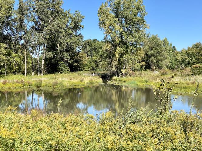
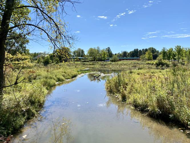
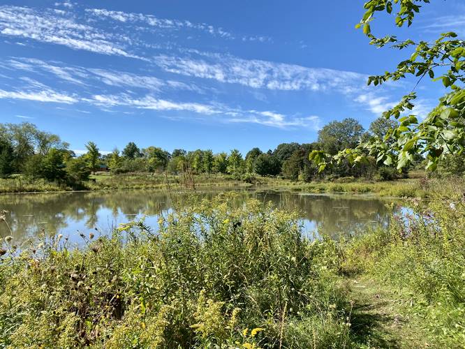
While this trail is less of a hike and more of a nice nature walk, it begins just across the street from the main parking lot at the botanical garden. This track leads in a clockwise direction, by taking a left-hand turn at the trailhead. The trail is mostly undefined along the southern side of Willow Pond as it meanders its way west. Just before the trail turns north, there's a small out-and-back pond "island" walk that you can follow that provides more views of Willow Pond; however, this track skips that short trail. The trail will then head north and curve around a bend as it begins to head east. The trail will cross a bridge that spans a small stream that flows out from Willow Pond, around mile 0.25. Just after that is a small hillside view above Willow Pond. The trail then heads alongside the entrance road, heading south, to reach the trailhead.
Parking & Fees
Hikers will find parking at the coordinates provided at the main lot for the Matthaei Botanical Garden. There's a small fee of $5 for the day or $1.50/hour to park - rates may change, please check their website before visiting. Note that there are technically no fees to walk the grounds or enter the botanical garden.
Pets
Dogs are not allowed on any trails at the Matthaei Botanical Garden.
Wildlife Viewing
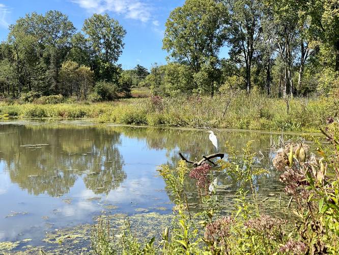
Visitors will find the best wildlife viewing along this trail because Willow Pond provides habitats for heron, turtles, fish, and other species of birds. Upon our visit we found two heron resting and several turtles sunning on a downed tree in the pond.
Water Source
The botanical garden has a free water fountain inside the main building that hikers can use to refill their water bottles.
Restrooms
There are restrooms inside the botanical garden's main building.
Warning
Rattlesnakes: This area is known to inhabit rattlesnakes. They tend to sun themselves on trails, rocky spots, or bare areas with gravel or rocks. These rattlesnakes could be anywhere during warm months (April - October), so be on the lookout and give any rattlers you find plenty of space.
Hike Description
While this trail is less of a hike and more of a nice nature walk, it begins just across the street from the main parking lot at the botanical garden. This track leads in a clockwise direction, by taking a left-hand turn at the trailhead. The trail is mostly undefined along the southern side of Willow Pond as it meanders its way west. Just before the trail turns north, there's a small out-and-back pond "island" walk that you can follow that provides more views of Willow Pond; however, this track skips that short trail. The trail will then head north and curve around a bend as it begins to head east. The trail will cross a bridge that spans a small stream that flows out from Willow Pond, around mile 0.25. Just after that is a small hillside view above Willow Pond. The trail then heads alongside the entrance road, heading south, to reach the trailhead.
Parking & Fees
Hikers will find parking at the coordinates provided at the main lot for the Matthaei Botanical Garden. There's a small fee of $5 for the day or $1.50/hour to park - rates may change, please check their website before visiting. Note that there are technically no fees to walk the grounds or enter the botanical garden.
Pets
Dogs are not allowed on any trails at the Matthaei Botanical Garden.
Wildlife Viewing
Visitors will find the best wildlife viewing along this trail because Willow Pond provides habitats for heron, turtles, fish, and other species of birds. Upon our visit we found two heron resting and several turtles sunning on a downed tree in the pond.
Water Source
The botanical garden has a free water fountain inside the main building that hikers can use to refill their water bottles.
Restrooms
There are restrooms inside the botanical garden's main building.
Warning
Rattlesnakes: This area is known to inhabit rattlesnakes. They tend to sun themselves on trails, rocky spots, or bare areas with gravel or rocks. These rattlesnakes could be anywhere during warm months (April - October), so be on the lookout and give any rattlers you find plenty of space.