One of the best day hikes in the Hudson Valley of New York State is on the west side of the river, located directly on Storm King Mountain.
This moderate 2.4-mile loop hike near Cornwall-on-Hudson, New York leads hikers up to the top of Butter Hill and Storm King Mountain where you'll find breathtaking views of the Hudson River, the Hudson Valley, Bannerman Castle, the snaking mountain road of US-9W, and more.
Poison ivy: Like other trails in the area, this hike features poison ivy located just off-trail throughout various sections of the loop. Be on the lookout and understand what poison ivy looks like at its various stages of life to ensure you avoid it at all costs.
Cliffs: This hike leads to areas with cliffs and drop-offs. Be aware of your surroundings and stay away from the edge of cliffs for your own safety.
This moderate 2.4-mile loop hike near Cornwall-on-Hudson, New York leads hikers up to the top of Butter Hill and Storm King Mountain where you'll find breathtaking views of the Hudson River, the Hudson Valley, Bannerman Castle, the snaking mountain road of US-9W, and more.
Trails
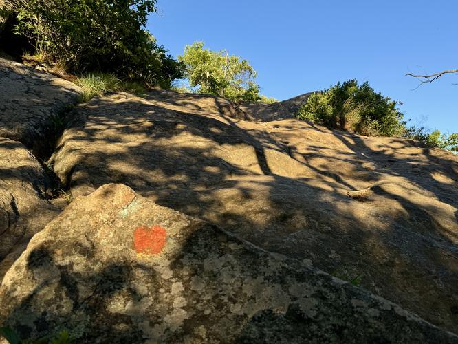
This hike follows several named trails in a clockwise order: Butter Hill Trail (orange blazes), Highland Trail (teal blazes) / Stillmans Trail (yellow blazes), and the Bypass Trail (white blazes).Hiking Storm King Mountain
The hike up Storm King Mountain begins along the east side of the scenic US-9W route. Located on the north side of the parking lot, hikers will find the trailhead for the Butter Hill Trail (orange blazes) where the hike begins.Butter Hill Summit - Mile 0 to 0.55
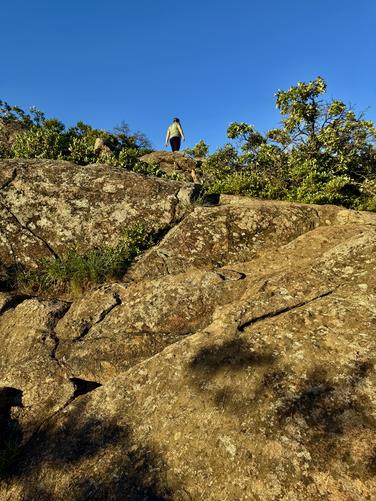
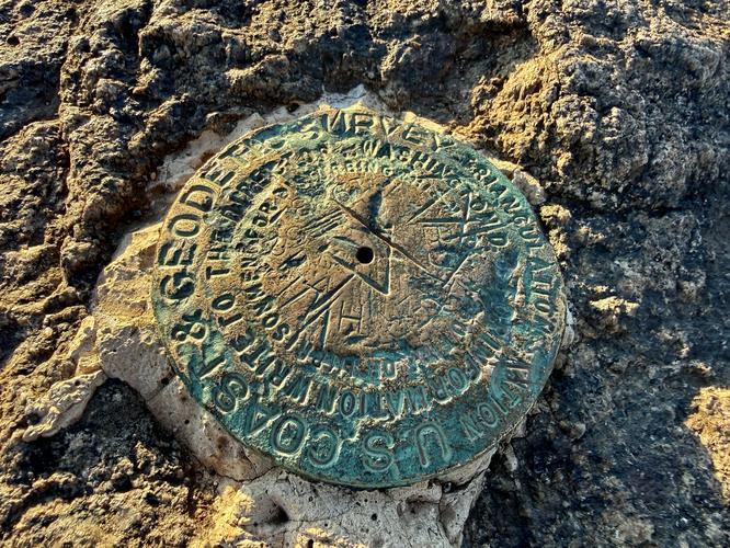
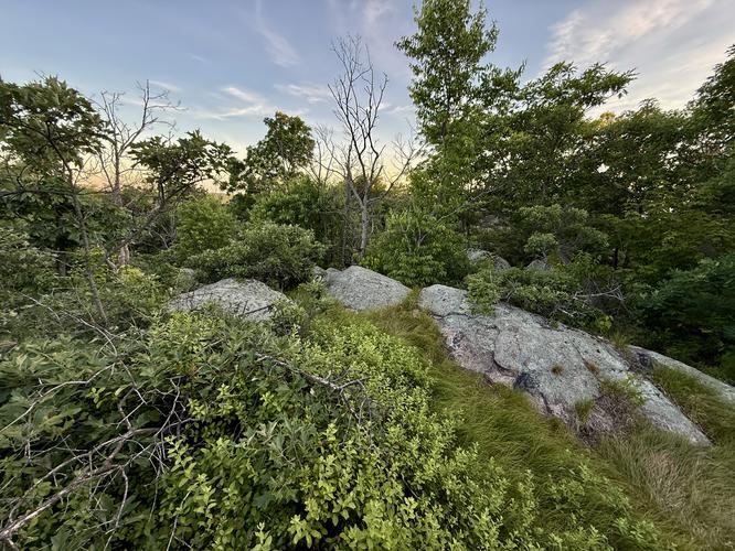
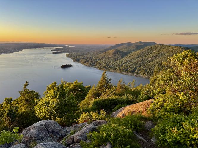
The hike up to the summit of Butter Hill begins at the trailhead where you'll follow the orange blazes of the Butter Hill Trail as it quickly ascends the exposed granite bedrock of Butter Hill. Starting off, the trail follows a flat grade before it quickly switches to stone steps. Along the way are various rock outcroppings and small cliffs, short rock scrambles, and views of the river and US-9W. The most challenging part of this trail is its elevation grade and two short rock scrambles. Hikers will find beautiful views along the way up at a multitude of vista points. Views from Butter Hill include southern views of the Hudson River, the snaking mountain highway of US-9W, westward views, and surrounding mountains and hills. Hikers will reach the top of Butter Hill near mile 0.55 where you'll find two USGS survey markers.Storm King Mountain Summit - Mile 0.55 to 1.3
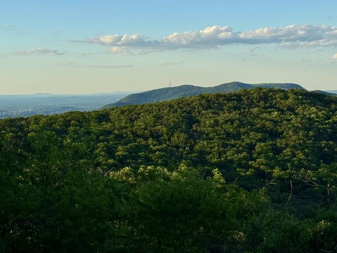
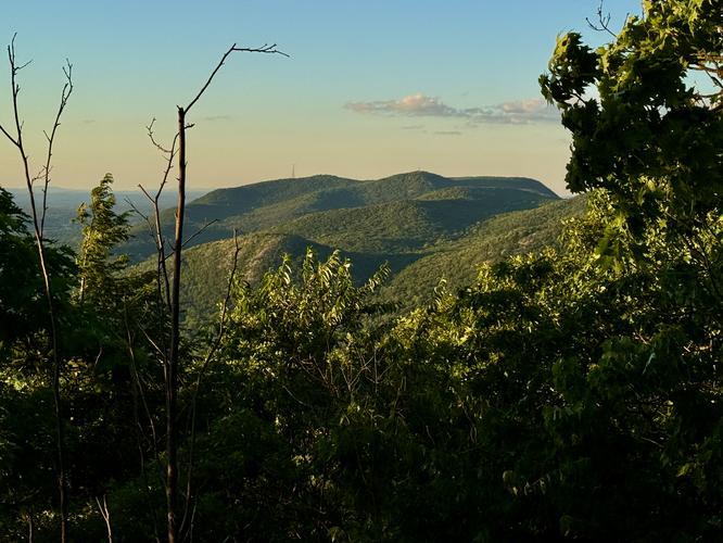
From the summit of Butter Hill, your next objective along the route is to summit Storm King Mountain. The hike to reach the official summit of Storm King Mountain leads you back down Butter Hill and through the forest as the Highlands / Stillman Trail (teal and yellow blazes) leads to the very top of the mountain. Along the way to the true summit, there isn't much for hikers to see but you'll have to navigate the proper paths to reach the top. Ensure you follow the teal and yellow blaze markers as they first descend from Butter Hill, then begin their slow ascent toward the top of Storm King Mountain. Along the way are a couple of steeper sections of rock steps and undulation that makes the ascent feel like it has a couple of false summits. The very top of Storm King Mountain, located at mile 1.3, is located in the forest with no views... but just wait, the best views open up just beyond the summit!Storm King Mountain Views - Mile 1.3 to 1.9
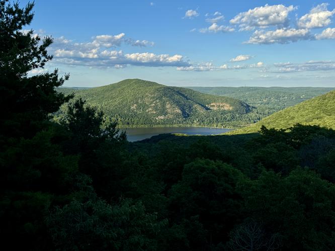
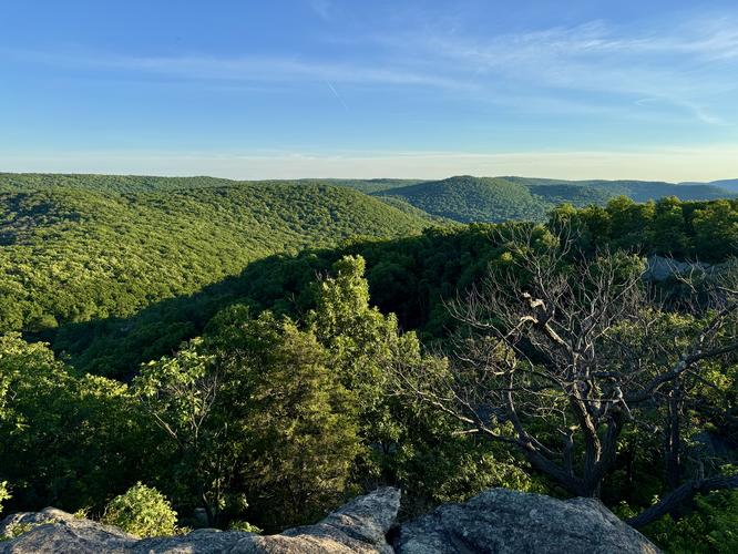
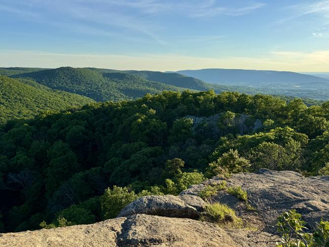
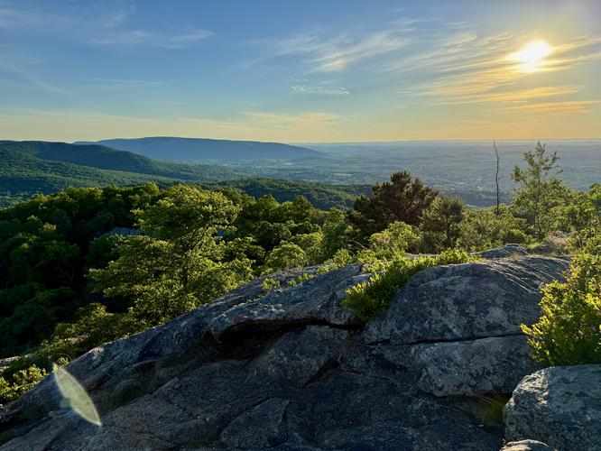
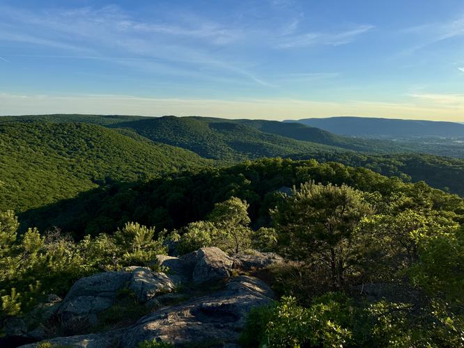
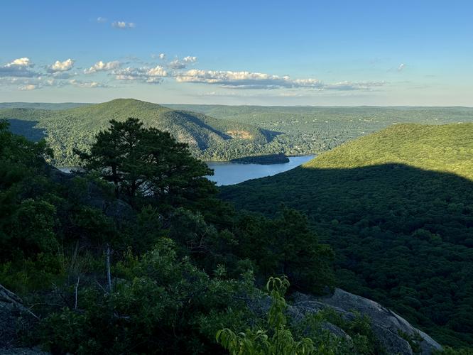
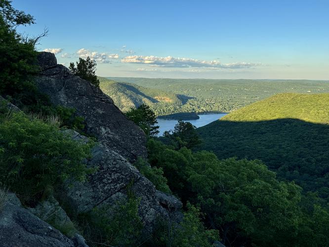
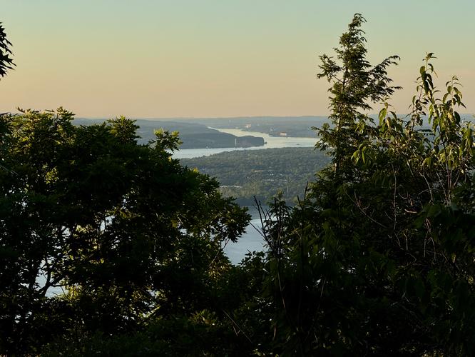
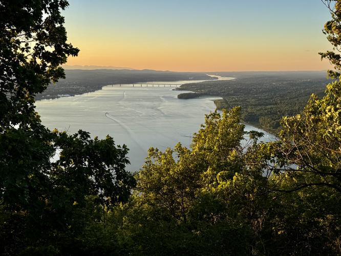
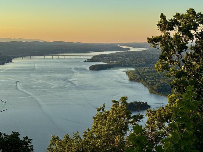
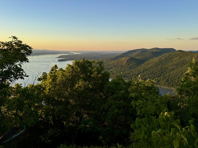
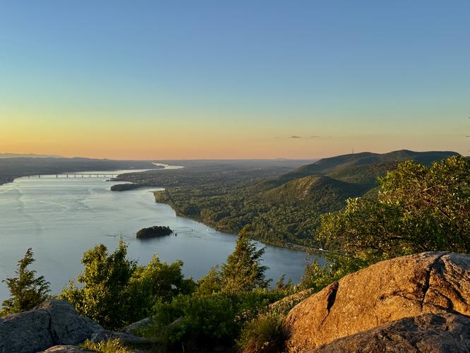
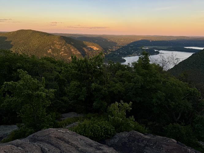
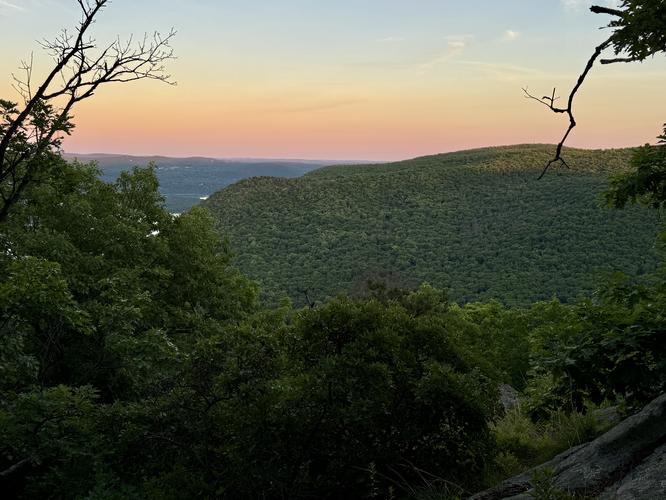
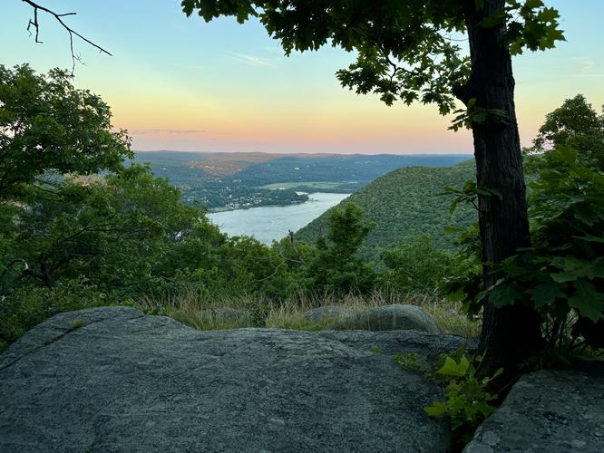
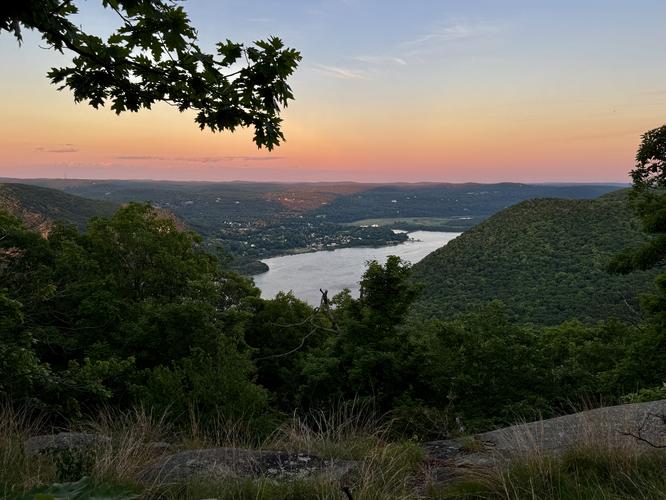
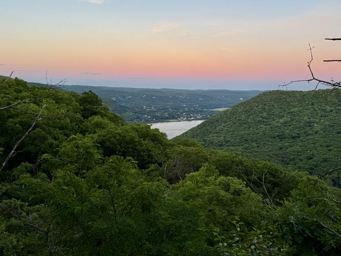
After passing the summit of Storm King Mountain, the views begin to open up around mile 1.3. Here, hikers will find northern views of the Hudson River and surrounding points-of-interest like the famous Bannerman Castle that sits just below your feet in the middle of the river along with Sugarloaf Mountain and the Breakneck Ridge area to the east. We hiked this loop at sunset and as such, the colors and lighting were perfect for pictures from these vistas while we enjoyed the trail with 0 other people - highly recommend! Note that the views can be found at various points along Storm King Mountain mainly at miles 1.3, 1.4, 1.45, 1.5, and along the Bypass Trail (white blazes).Completing the Loop - Mile 1.5 to 2.4
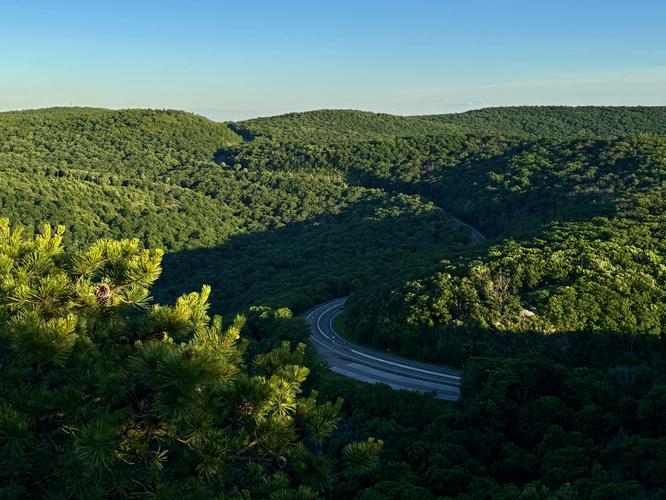
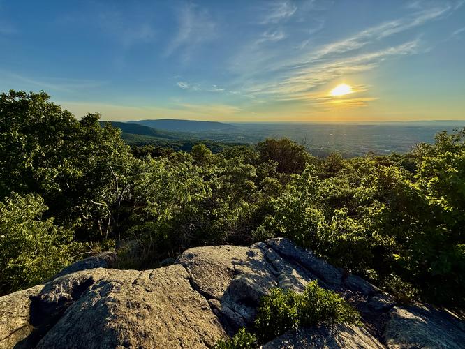
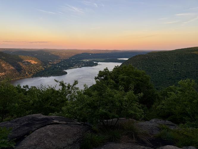
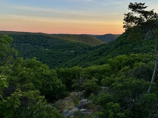
After exploring the eastern views of Storm King Mountain, hikers will take a right-hand turn along the white blazed Bypass Trail near mile 1.5. This trail leads directly back to the parking area, but includes a few viewpoints along the way. All of the views along the Bypass Trail are south-facing and include views mostly of the Hudson River and Bull Hill located on the east side of the river. Views can be found at miles 1.5, 1.6, 1.65, 1.7, and 1.9. The Bypass Trail has some "hidden" undulation and uphill sections that must be traversed in order to reach the parking lot, but for the most-part it's almost all downhill hiking. Hikers will reach the parking lot at mile 2.4 to complete this moderate loop hike on Storm King Mountain.Parking
Hikers will find a medium-sized parking lot at the coordinates provided (41.423184, -74.001262), located on the east side of US-9W. Note that to reach the parking lot, you must be traveling north along US-9W. The lot is large enough to fit a couple dozen vehicles (max) as of 2026.Pets
Dogs are allowed only if leashed and must be cleaned up after.Warning
Rock scrambles: The Butter Hill section of this hike includes at least two short rock scrambles. Most are relatively easy, but they might not be suited for all visitors.Poison ivy: Like other trails in the area, this hike features poison ivy located just off-trail throughout various sections of the loop. Be on the lookout and understand what poison ivy looks like at its various stages of life to ensure you avoid it at all costs.
Cliffs: This hike leads to areas with cliffs and drop-offs. Be aware of your surroundings and stay away from the edge of cliffs for your own safety.