Stony Peak & Twin Top Peak at Susquehannock State Forest near Abbott, Pennsylvania is a moderate 6.2-mile out-and-back hike that features two mountain top summits that both feature rare 360-degree views of Potter County's mountainous plateau including a view into the Hammersley Wild Area and Elk Lick Knob.
Trails & Mountain Names
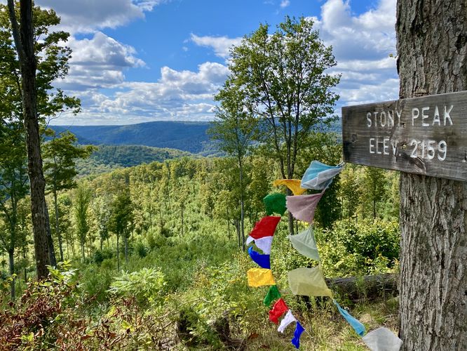
This hike follows unnamed service roads that lead to mountain summits, which we (Dave Miller & Tony Van Vugt) named Stony Peak and Twin Top Peak upon our first exploration hike here. At the time neither mountain was named. Due to the topography, we named the northern-most peak is named "Stony Peak" and the southern-most peak Twin Top Peak with a nickname of "Camel Hump Knob". As of March 2023, the USGS' Board on Geographic Names accepted Stony Peak as an official mountain summit name and as of August 10, 2023 Twin Top Peak was accepted. Both peaks now appear on federal land maps.
Mountain Top Logging Vistas
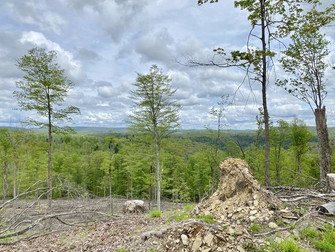
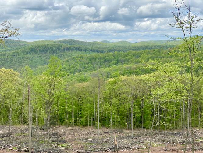
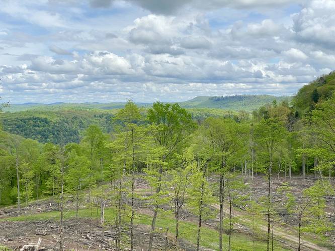
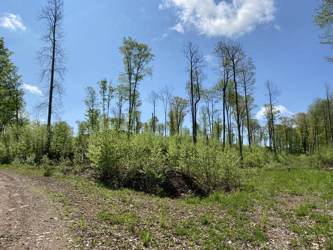
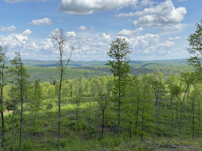
Please note that these vistas were created by logging. While the mountain tops are taller than the slow-growing underbrush and saplings, eventually these views will be taken back by nature. Stony Peak appears to have been logged circa 2017 while Twin Top Peak appears to have been logged in Winter 2022. Hikers should have about 15 years to enjoy these spots before the 360-degree views begin to fill in forever.
Hike Description
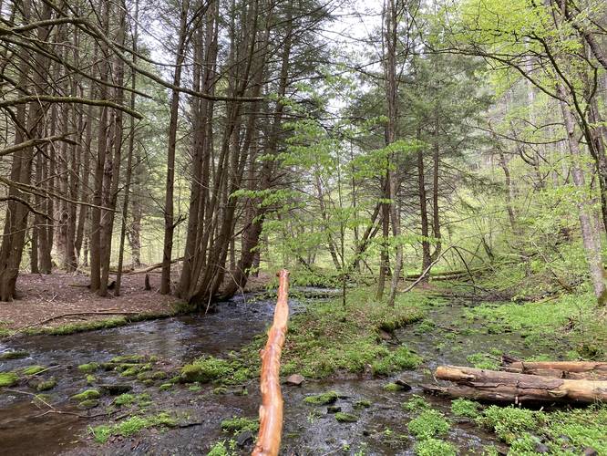
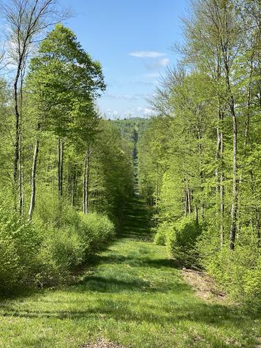
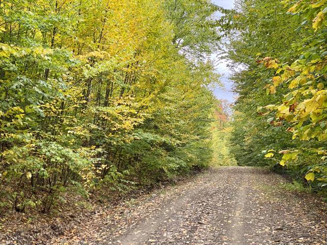
This hike begins along Windfall Road and follows the unnamed service road (no motorized vehicles; biking, horseback riding, walking are permitted). The service road is shaded for the first 0.5-miles or so before the mountain top deforestation zone begins.
On-Trail Views - Mile 0.64 to Mile 1
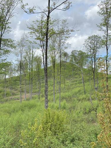
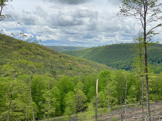
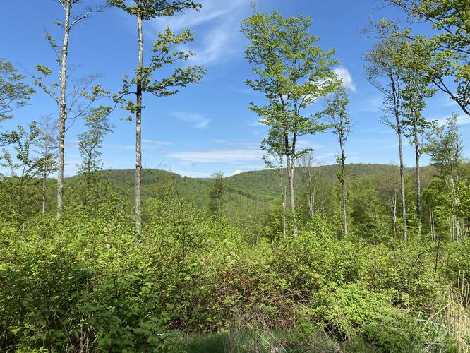
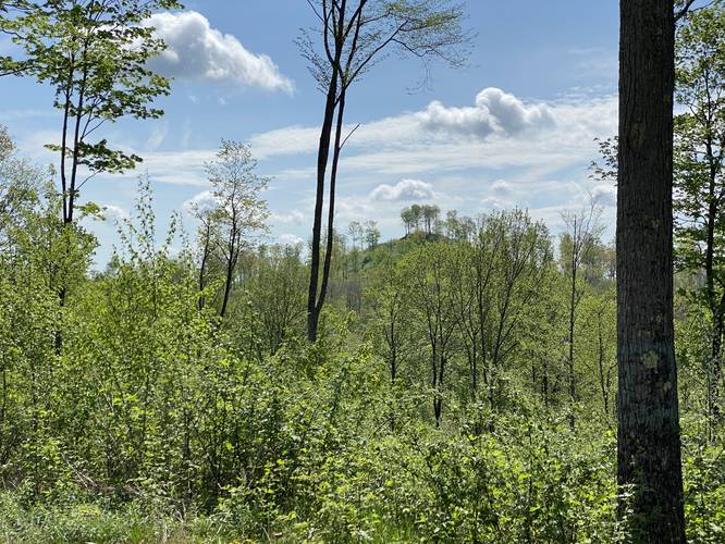
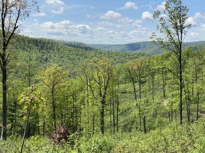
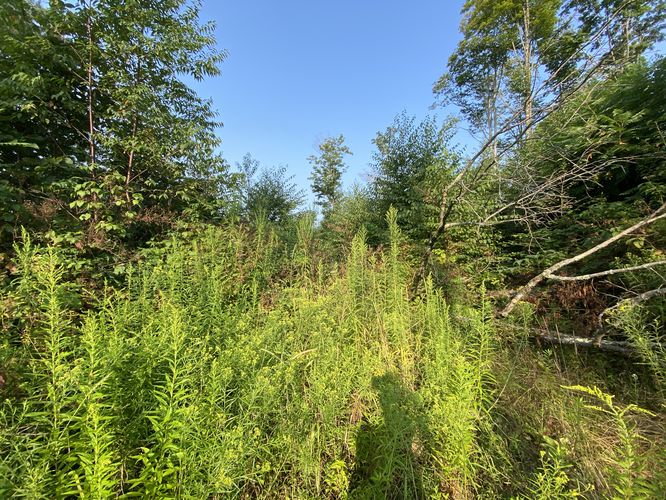
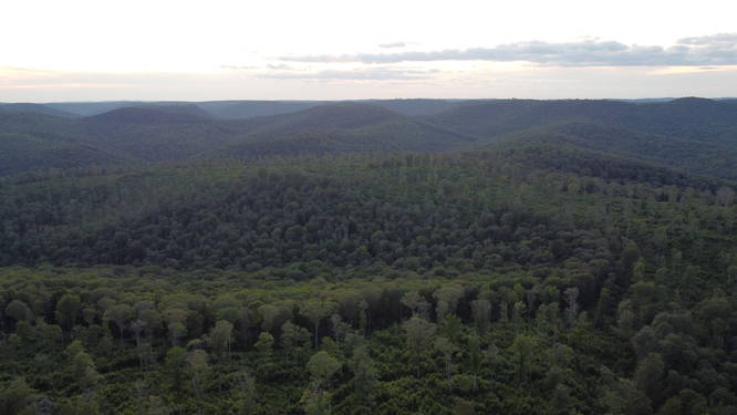
Around mile 0.64, hikers will pass a pipeline view facing west. Shortly after, as of May 2022, hikers will pass low-growth shrubs in a clear deforested section that gives views facing west and northwest - with some views peering into the Hammersley Wild Area. Around this vista is also where the trail becomes more exposed to the sun due to the lack of trees, which lasts for a good remainder of the hike. The low-growing brush here will likely fill in by 2027, obstructing the view forever, as it's already chest-high. Around mile 1, hikers will find a view of Stony Peak while standing on the adjacent mountain. It's a nice pick-me-up after walking along the exposed trail in the hot sun - giving the hiker a reason to keep going, as they'll soon be walking atop it's rocky summit with a 360-degree view.
Right-hand Turn - Mile 1.3
At mile 1.3, hikers will reach a grassy logging road that wraps around the northern slopes of Stony Peak. On our hike out a "road closed" sign indicated that due to erosion, vehicles (likely service vehicles or hunters) should not drive that route. Follow this grassy road as it winds its way up to the western and eventually southeastern side of the mountain.
Stony Peak Summit Junction - Mile 1.8
At mile 1.8, hikers will be faced with yet another trail junction - two trails seemingly lead "up" the mountain path; however, just one actually does while the other deceivingly makes its way east and around the mountain top. Take the left-hand turn and follow the last turn of the service road as it makes the final ascent up to the top of Stony Peak. Along the way up, hikers will find awesome views of the surrounding mountains, but just wait until the top.
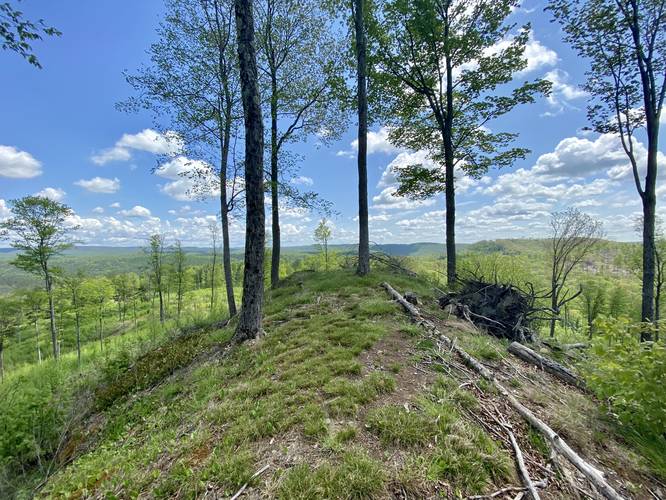
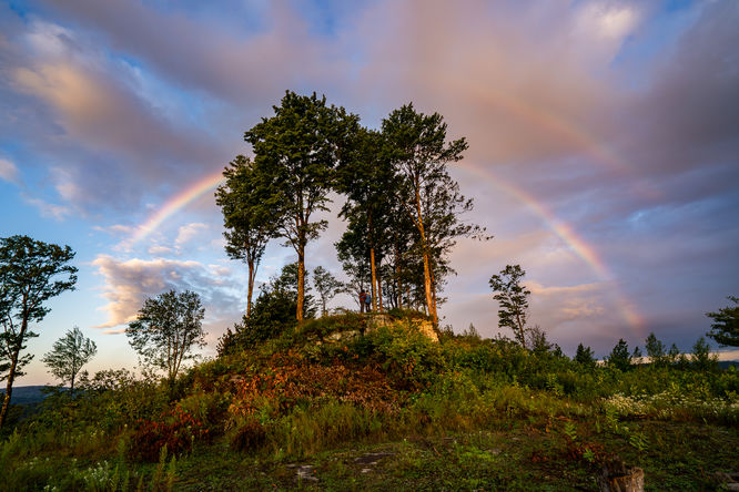
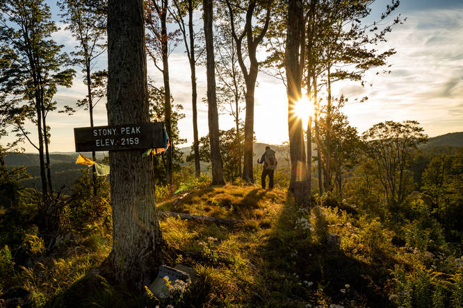
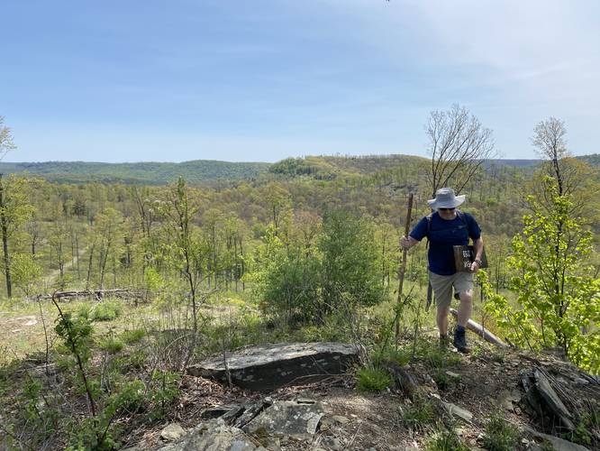
Stony Peak Ledge, Summit, & 360-degree Views - Mile 1.95 to 2
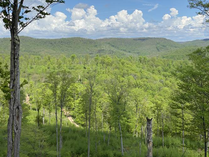
Finally, hikers will make it just below the summit of Stony Peak - at the 250-degree vista located on a flat slab of bedrock around mile 1.95. Just behind is a ~10-15-foot tall rock ledge that can be seen from miles away at different vistas (including the Horton Run Vista) - helping making up the name of this mountain, Stony Peak. Hikers will want to officially "summit" Stony Peak. There's an easy way up and around the rock ledge - to the right-hand side - if you lightly scramble up the rocky hillside. Be on the lookout for rattlesnakes! At the top of Stony Peak, hikers can walk the ~15-foot wide by 40-foot long summit to get different vantage points for views within 360-degrees. This view is by far one of the most stunning, and rare, for Potter County and the PA Wilds considering there aren't many rocky mountain peaks with views like this anywhere else nearby.
Hiking to Twin Top Peak
After visiting the summit of Stony Peak, hikers will make their way back down the mountain to reach the grassy logging road junctions just below the summit. Here, take a left-hand turn to head east along the overgrown and thorny road as it meanders its way to connect to the wide, open, and gravel-laden service road that runs along the pipeline. Once at the service road, head south to follow the road for about 0.4-miles before reaching the northern slopes of Twin Top Peak.
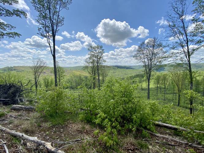
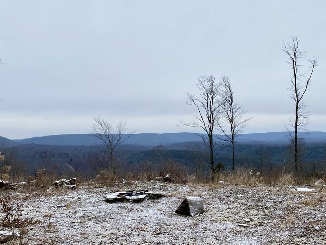
Twin Top Peak Summit & 360-degree Views - Mile 3.1 - 3.3
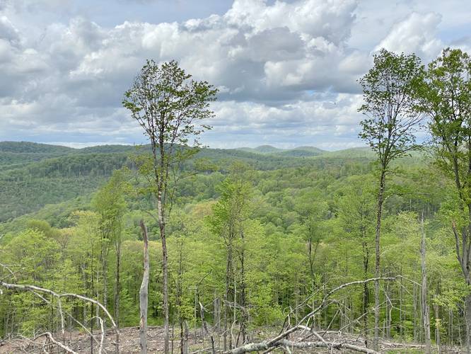
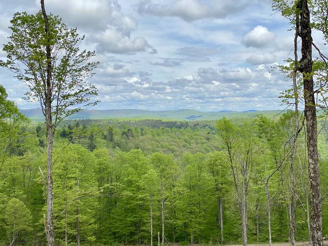
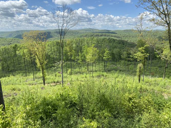
After climbing up the ~80-foot ascent of Twin Top Peak, hikers will make it to the top where they'll find views. The best views are located just south between miles 3.1 and 3.3 at the top of Twin Top Peak. Hikers have to expend more energy on this mountain top to enjoy the views since the best vistas are generally ~100-feet or more apart from one another. On each slope of the mountain, hikers get stunning views of Potter County's mountainous terrain, making for another mountain top with 360-degree views.
Hiking Out
The hike out is opposite to the hike in; however, hikers should note that they can skip the grassy service roads of Stony Peak and just stick to the gravel service road to make the hike easier. Note that the hike out in this GPS file does not include the north/northeast gravel service road that skirts around Stony Peak, but it does exist.
Parking
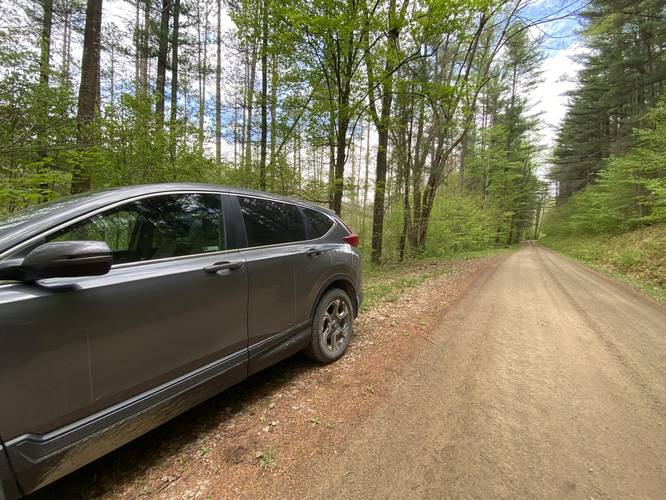
Hikers will find a very small parking turnout across from the service road gate at the trailhead. It's large enough for a couple of vehicles. Please do not block the service road gate.
Pets
Dogs are allowed if leashed and their waste should be carried out by the hiker.
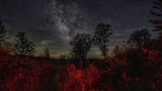
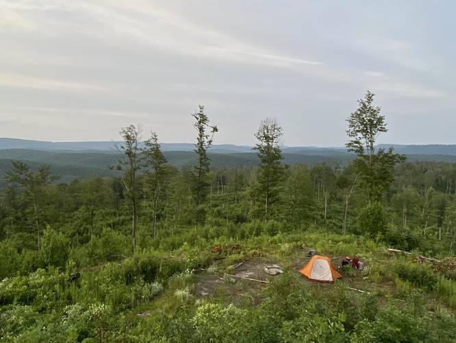
Backpacking and Camping
Backpacking and camping are both allowed along this trail. Please follow all state forest rules and regulations when dispersed / primitive / backcountry camping.
Warnings
Sun exposure: This hike follows a mountain ridge service road with a lot of exposed sunny areas. Most of the hike does not include a lot of shade and when there is shade, you're generally hiking from one shady spot to the next. Bring sunscreen.
No water: Bring plenty of water (64oz is preferable) since there are no mountain streams to filter water from.
Rattlesnakes: The Timber Rattlesnake calls these mountains - and rocky outcroppings - their home. While, upon two different hikes here, we did not see any rattlers, we did find some Eastern Garter snakes who appeared to have just hatched from brown-speckled white eggshells that were scattered along the gravely road (see the pictures). Go slow in the grassy and rocky areas and if you find a rattler, give it space.
Official USGS Mountain Names (Aug 2023)
As of March 2023, my (Dave / Admin) submission to the USGS Board of Geographic Names was accepted for Stony Peak as an official mountain name! Due to needing at least one backing organization, DCNR submitted four additional names alongside Camel Hump Knob to the PA committee from my request. "Camel Hump Knob" did not pass their naming standards and recommended "Twin Top Peak" instead. Note that I personally did not come up with Twin Top Peak, but rather accepted this name from the PA committee - though, neither organization wanted claim of the name - so with that said, I personally removed Camel Hump Knob from the name submission in favor of Twin Top Peak with the DCNR's backing. On August 10, 2023 the USGS Board on Geographic Names accepted Twin Top Peak as an official mountain name and appears on all federal land maps.
Trails & Mountain Names
This hike follows unnamed service roads that lead to mountain summits, which we (Dave Miller & Tony Van Vugt) named Stony Peak and Twin Top Peak upon our first exploration hike here. At the time neither mountain was named. Due to the topography, we named the northern-most peak is named "Stony Peak" and the southern-most peak Twin Top Peak with a nickname of "Camel Hump Knob". As of March 2023, the USGS' Board on Geographic Names accepted Stony Peak as an official mountain summit name and as of August 10, 2023 Twin Top Peak was accepted. Both peaks now appear on federal land maps.
Mountain Top Logging Vistas
Please note that these vistas were created by logging. While the mountain tops are taller than the slow-growing underbrush and saplings, eventually these views will be taken back by nature. Stony Peak appears to have been logged circa 2017 while Twin Top Peak appears to have been logged in Winter 2022. Hikers should have about 15 years to enjoy these spots before the 360-degree views begin to fill in forever.
Hike Description
This hike begins along Windfall Road and follows the unnamed service road (no motorized vehicles; biking, horseback riding, walking are permitted). The service road is shaded for the first 0.5-miles or so before the mountain top deforestation zone begins.
On-Trail Views - Mile 0.64 to Mile 1
Around mile 0.64, hikers will pass a pipeline view facing west. Shortly after, as of May 2022, hikers will pass low-growth shrubs in a clear deforested section that gives views facing west and northwest - with some views peering into the Hammersley Wild Area. Around this vista is also where the trail becomes more exposed to the sun due to the lack of trees, which lasts for a good remainder of the hike. The low-growing brush here will likely fill in by 2027, obstructing the view forever, as it's already chest-high. Around mile 1, hikers will find a view of Stony Peak while standing on the adjacent mountain. It's a nice pick-me-up after walking along the exposed trail in the hot sun - giving the hiker a reason to keep going, as they'll soon be walking atop it's rocky summit with a 360-degree view.
Right-hand Turn - Mile 1.3
At mile 1.3, hikers will reach a grassy logging road that wraps around the northern slopes of Stony Peak. On our hike out a "road closed" sign indicated that due to erosion, vehicles (likely service vehicles or hunters) should not drive that route. Follow this grassy road as it winds its way up to the western and eventually southeastern side of the mountain.
Stony Peak Summit Junction - Mile 1.8
At mile 1.8, hikers will be faced with yet another trail junction - two trails seemingly lead "up" the mountain path; however, just one actually does while the other deceivingly makes its way east and around the mountain top. Take the left-hand turn and follow the last turn of the service road as it makes the final ascent up to the top of Stony Peak. Along the way up, hikers will find awesome views of the surrounding mountains, but just wait until the top.
Stony Peak Ledge, Summit, & 360-degree Views - Mile 1.95 to 2
Finally, hikers will make it just below the summit of Stony Peak - at the 250-degree vista located on a flat slab of bedrock around mile 1.95. Just behind is a ~10-15-foot tall rock ledge that can be seen from miles away at different vistas (including the Horton Run Vista) - helping making up the name of this mountain, Stony Peak. Hikers will want to officially "summit" Stony Peak. There's an easy way up and around the rock ledge - to the right-hand side - if you lightly scramble up the rocky hillside. Be on the lookout for rattlesnakes! At the top of Stony Peak, hikers can walk the ~15-foot wide by 40-foot long summit to get different vantage points for views within 360-degrees. This view is by far one of the most stunning, and rare, for Potter County and the PA Wilds considering there aren't many rocky mountain peaks with views like this anywhere else nearby.
Hiking to Twin Top Peak
After visiting the summit of Stony Peak, hikers will make their way back down the mountain to reach the grassy logging road junctions just below the summit. Here, take a left-hand turn to head east along the overgrown and thorny road as it meanders its way to connect to the wide, open, and gravel-laden service road that runs along the pipeline. Once at the service road, head south to follow the road for about 0.4-miles before reaching the northern slopes of Twin Top Peak.
Twin Top Peak Summit & 360-degree Views - Mile 3.1 - 3.3
After climbing up the ~80-foot ascent of Twin Top Peak, hikers will make it to the top where they'll find views. The best views are located just south between miles 3.1 and 3.3 at the top of Twin Top Peak. Hikers have to expend more energy on this mountain top to enjoy the views since the best vistas are generally ~100-feet or more apart from one another. On each slope of the mountain, hikers get stunning views of Potter County's mountainous terrain, making for another mountain top with 360-degree views.
Hiking Out
The hike out is opposite to the hike in; however, hikers should note that they can skip the grassy service roads of Stony Peak and just stick to the gravel service road to make the hike easier. Note that the hike out in this GPS file does not include the north/northeast gravel service road that skirts around Stony Peak, but it does exist.
Parking
Hikers will find a very small parking turnout across from the service road gate at the trailhead. It's large enough for a couple of vehicles. Please do not block the service road gate.
Pets
Dogs are allowed if leashed and their waste should be carried out by the hiker.
Backpacking and Camping
Backpacking and camping are both allowed along this trail. Please follow all state forest rules and regulations when dispersed / primitive / backcountry camping.
Warnings
Sun exposure: This hike follows a mountain ridge service road with a lot of exposed sunny areas. Most of the hike does not include a lot of shade and when there is shade, you're generally hiking from one shady spot to the next. Bring sunscreen.
No water: Bring plenty of water (64oz is preferable) since there are no mountain streams to filter water from.
Rattlesnakes: The Timber Rattlesnake calls these mountains - and rocky outcroppings - their home. While, upon two different hikes here, we did not see any rattlers, we did find some Eastern Garter snakes who appeared to have just hatched from brown-speckled white eggshells that were scattered along the gravely road (see the pictures). Go slow in the grassy and rocky areas and if you find a rattler, give it space.
Official USGS Mountain Names (Aug 2023)
As of March 2023, my (Dave / Admin) submission to the USGS Board of Geographic Names was accepted for Stony Peak as an official mountain name! Due to needing at least one backing organization, DCNR submitted four additional names alongside Camel Hump Knob to the PA committee from my request. "Camel Hump Knob" did not pass their naming standards and recommended "Twin Top Peak" instead. Note that I personally did not come up with Twin Top Peak, but rather accepted this name from the PA committee - though, neither organization wanted claim of the name - so with that said, I personally removed Camel Hump Knob from the name submission in favor of Twin Top Peak with the DCNR's backing. On August 10, 2023 the USGS Board on Geographic Names accepted Twin Top Peak as an official mountain name and appears on all federal land maps.