The Stephenhouse Trail at Ives Run Recreation Area near Middlebury Township, Pennsylvania is a moderate 1.4-mile loop trail that circles Stephenhouse Run creek through a beautiful woodland setting.
The trailhead can be found directly behind the picnic shelter at the parking lot and hikers have a choice to go left or right at the trailhead fork. This track heads right at the trailhead going in a counter clockwise direction and crosses the bridge for Stephenhouse Run. After crossing the creek, the trail will head uphill almost the entire time until you reach a trail junction with the Archery Trail.
At the Archery Trail, hikers will take a left-hand turn to stay along the Stephenhouse Trail - at this trail junction, there's a large sign with arrows, so hikers should not get lost. After the trail junction, the Stephenhouse Trail meanders above Stephenhouse Run before eventually heading down a steep hillside and down to the banks of the creek. This hillside should be hiked with caution if heading down to the creek, as footing in this section is not easy.
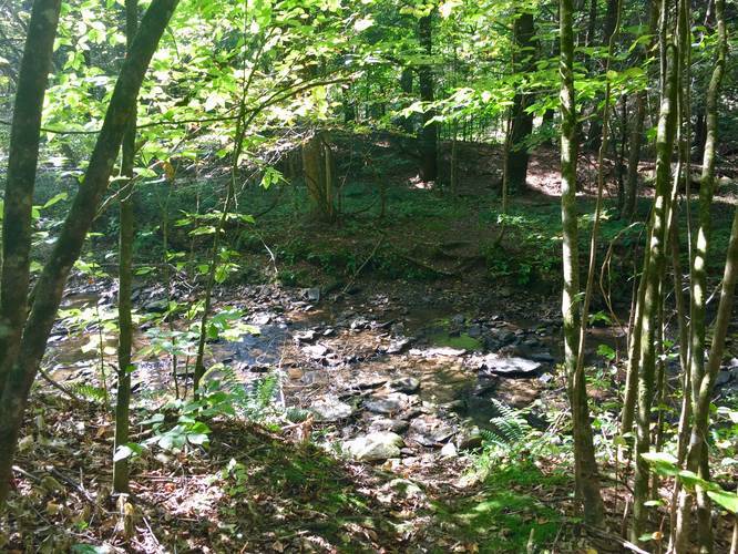
At the creek junction, hikers will continue following the yellow blazes, which cross the creek. The creek crossing is easy since the water level is not much more than 5 inches at the deepest point and there are plenty of larger rocks to step on to make your way across.
The trail continues heading north, after crossing the creek, following the yellow blazes until it reaches the parking lot. The two scenic areas of the trail are at the northern section and southern section where hikers cross the creek - either by bridge or by rocks. The rest of the trail is not scenic, but is a great hike through the woods nonetheless.
Parking
Hikers can find a large parking lot at the coordinates provided. The lot is large enough to fit about 15 vehicles.
Pets
Dogs are allowed if leashed and their waste must be carried out by the hiker.
The trailhead can be found directly behind the picnic shelter at the parking lot and hikers have a choice to go left or right at the trailhead fork. This track heads right at the trailhead going in a counter clockwise direction and crosses the bridge for Stephenhouse Run. After crossing the creek, the trail will head uphill almost the entire time until you reach a trail junction with the Archery Trail.
At the Archery Trail, hikers will take a left-hand turn to stay along the Stephenhouse Trail - at this trail junction, there's a large sign with arrows, so hikers should not get lost. After the trail junction, the Stephenhouse Trail meanders above Stephenhouse Run before eventually heading down a steep hillside and down to the banks of the creek. This hillside should be hiked with caution if heading down to the creek, as footing in this section is not easy.
At the creek junction, hikers will continue following the yellow blazes, which cross the creek. The creek crossing is easy since the water level is not much more than 5 inches at the deepest point and there are plenty of larger rocks to step on to make your way across.
The trail continues heading north, after crossing the creek, following the yellow blazes until it reaches the parking lot. The two scenic areas of the trail are at the northern section and southern section where hikers cross the creek - either by bridge or by rocks. The rest of the trail is not scenic, but is a great hike through the woods nonetheless.
Parking
Hikers can find a large parking lot at the coordinates provided. The lot is large enough to fit about 15 vehicles.
Pets
Dogs are allowed if leashed and their waste must be carried out by the hiker.