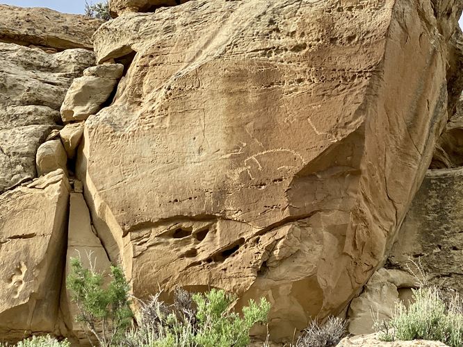
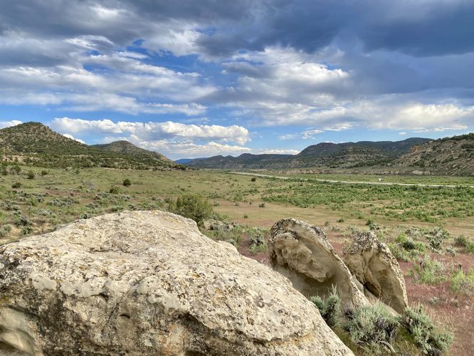
The State Bridge Interpretive Site at Canyon Pintado National Historical District south of Rangely, Colorado is an easy 0.2-mile out-and-back trail that leads to views of the Canyon Pintado and ancient Fremont petroglyphs.
Walk
This short walk begins at the main parking lot for the State Bridge Interpretive Site and follows the discrete trail located on the south side of the dirt road. The trail passes through scrubland within the Canyon Pintado valley before it ascends a short hill. The trail curves around to reach a viewing platform of the petroglyphs, located on the rock walls near the top of the hill. From the viewing platform, you can learn more about the Fremont people and the different types of pictographs and petroglyphs found within the canyon. You'll also find nice valley views of the Canyon Pintado from the trail, mostly located near the petroglyphs area. After exploring, the walk back to parking is a short jaunt to complete this 0.2-mile out-and-back trail.
Parking
Hikers will find a large parking lot at the coordinates provided, located on the east side of CO-139. The lot is large enough to fit about a dozen vehicles.
Pets
Dogs are allowed only if leashed and must be cleaned up after.
Warning
Ancient petroglyphs: This trail leads beyond the recorded route provided to ancient petroglyphs and pictographs that were created hundreds of years ago. Please do not touch or attempt to disturb in any way. Only take photos and appreciate the ancient artwork from behind the barriers.
Sun exposure: This trail has very little shade and no water sources. Pack-in all water and wear sun screen and a hat to protect against sun exposure. It's smart to hike either in the early morning or late afternoon to avoid the intense sun.
No water: This trail has no water sources so you must pack-in all water. A general rule of thumb in the desert is 1 gallon of water per person per day.
Rattlesnakes: This trail leads through rattlesnake territory, so be on the lookout and give any rattlers you find plenty of space.