The Square Timber Vista via Bucktail Path at Elk State Forest within the Square Timber Wild Area in Lumber Township, Pennsylvania is an easy 1.7-mile one-way hike that leads to the only on-trail vista that peers into the Square Timber Wild Area, as of 2022.
Hike Description
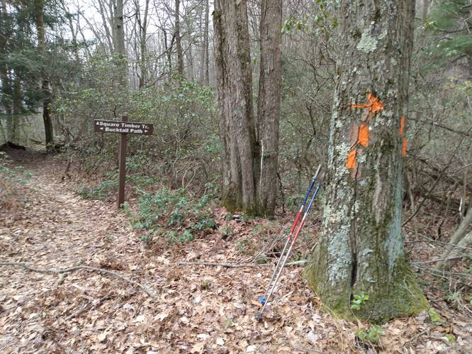
This trailhead begins at the eastern terminus for the Square Timber Trail, but anyone doing this for a day hike may want to start on the opposite end (at the parking lot) instead. This GPS track, and starting at the Square Timber Trail, was our one-way route back to parking after exploring that trail on the same day.
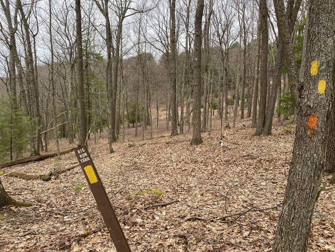
The hike follows the orange blazes of the Bucktail Path - heading south - as it runs along the mountain top ridges of the Square Timber Wild Area.
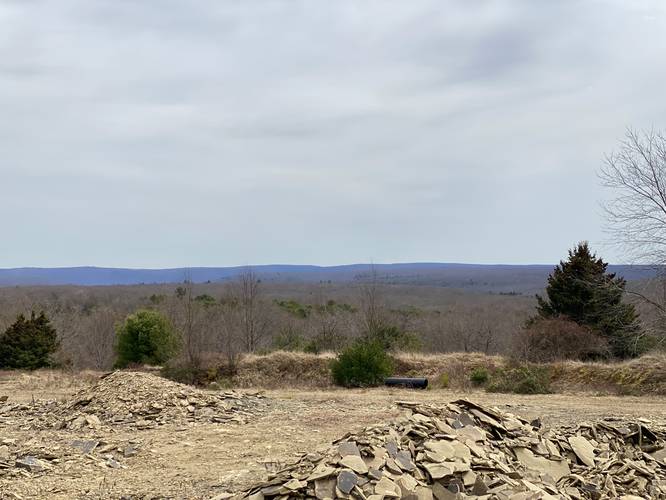
Mountain Top Surface Mining View - Mile 0.85
At mile 0.85, the trail has a clear opening with large piles of what appear to be shale rocks. Here, the state appears to be surface mining some bedrock below, but there's a view of the distant mountain tops (rolling hills) that faces eastward toward Sinnemahoning State Park.
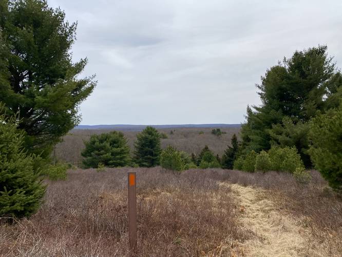
Mixed Evergreen Forest - Mile 0.9
After the surface mining view, hikers will be lead through a mixed evergreen forest which include white pine and different varieties of spruce. There appears to be at least one old-growth white pine along this section (see the photos). We assumed this area may have been a private tree farm before it was acquired by the state; however, that's just speculation.
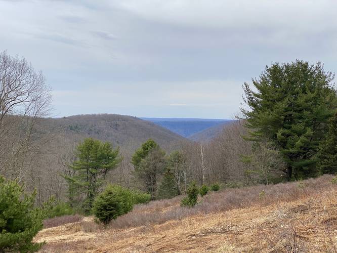
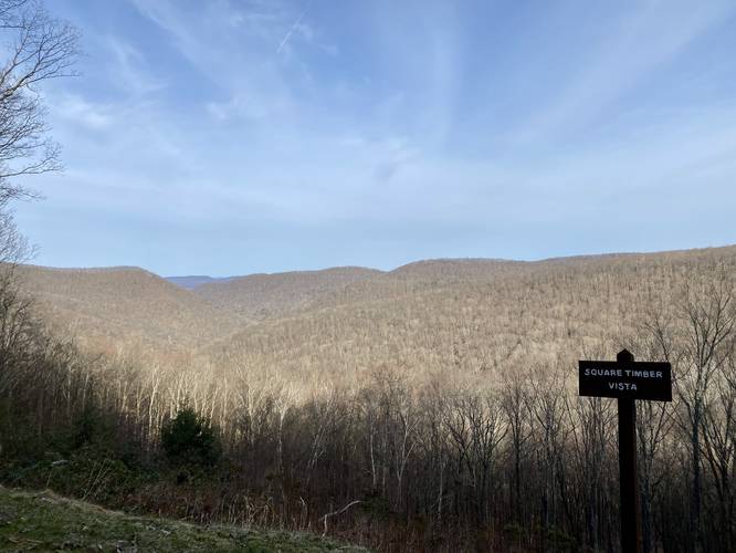
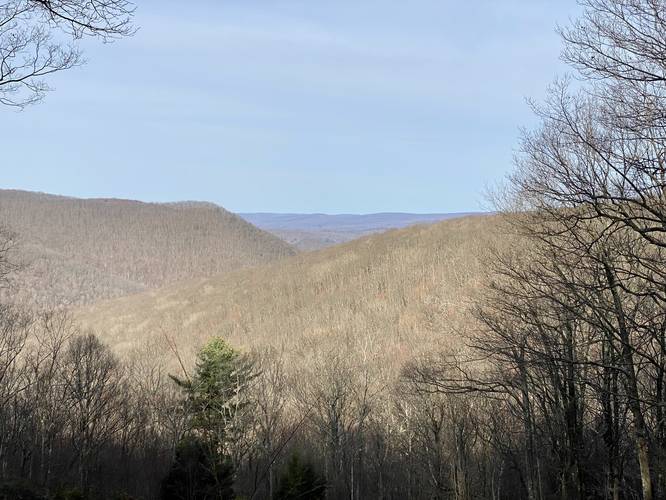
Square Timber Wild Area Vista - Mile 1.06
Finally, around mile 1.06, hikers will reach the only on-trail vista that the Square Timber Wild Area has to offer to hikers. This open view peers into Right Fork Big Run Hollow and also includes some mountain ridges within the Bucktail Natural Area as well. Again, other than the on-road vistas located on Ridge Road (see the map and uploaded photos for reference), this is the only on-trail vista within the entire Square Timber Wild Area.
Reaching Parking
After visiting the "Square Timber Vista" area, hikers will probably want to head back or to parking at Pepper Hill. Simply follow the orange blazes of the Bucktail Path as it winds its way away from the Square Timber Wild Area and back toward the road. Eventually the trail begins to follow a natural gas pipeline. Follow the pipeline all the way back to parking.
Parking
Hikers will likely want to park at Pepper Hill at the coordinates provided. There's enough room for a half-dozen vehicles or so. Do not block the gate.
Pets
Dogs are allowed if leashed and their waste should be carried out by the hiker.
Camping and Backpacking
Backpacking is permitted along this trail, but we did not find any campsites during this hike in April 2022. There are plenty of spaces to setup a tent or hammock since the mountain top ridge is mostly flat and open in many places. Please follow all state forest rules and regulations when primitive / dispersed / backcountry camping.
Hike Description
This trailhead begins at the eastern terminus for the Square Timber Trail, but anyone doing this for a day hike may want to start on the opposite end (at the parking lot) instead. This GPS track, and starting at the Square Timber Trail, was our one-way route back to parking after exploring that trail on the same day.
The hike follows the orange blazes of the Bucktail Path - heading south - as it runs along the mountain top ridges of the Square Timber Wild Area.
Mountain Top Surface Mining View - Mile 0.85
At mile 0.85, the trail has a clear opening with large piles of what appear to be shale rocks. Here, the state appears to be surface mining some bedrock below, but there's a view of the distant mountain tops (rolling hills) that faces eastward toward Sinnemahoning State Park.
Mixed Evergreen Forest - Mile 0.9
After the surface mining view, hikers will be lead through a mixed evergreen forest which include white pine and different varieties of spruce. There appears to be at least one old-growth white pine along this section (see the photos). We assumed this area may have been a private tree farm before it was acquired by the state; however, that's just speculation.
Square Timber Wild Area Vista - Mile 1.06
Finally, around mile 1.06, hikers will reach the only on-trail vista that the Square Timber Wild Area has to offer to hikers. This open view peers into Right Fork Big Run Hollow and also includes some mountain ridges within the Bucktail Natural Area as well. Again, other than the on-road vistas located on Ridge Road (see the map and uploaded photos for reference), this is the only on-trail vista within the entire Square Timber Wild Area.
Reaching Parking
After visiting the "Square Timber Vista" area, hikers will probably want to head back or to parking at Pepper Hill. Simply follow the orange blazes of the Bucktail Path as it winds its way away from the Square Timber Wild Area and back toward the road. Eventually the trail begins to follow a natural gas pipeline. Follow the pipeline all the way back to parking.
Parking
Hikers will likely want to park at Pepper Hill at the coordinates provided. There's enough room for a half-dozen vehicles or so. Do not block the gate.
Pets
Dogs are allowed if leashed and their waste should be carried out by the hiker.
Camping and Backpacking
Backpacking is permitted along this trail, but we did not find any campsites during this hike in April 2022. There are plenty of spaces to setup a tent or hammock since the mountain top ridge is mostly flat and open in many places. Please follow all state forest rules and regulations when primitive / dispersed / backcountry camping.