The Square Timber Trail at Elk State Forest within the Square Timber Wild Area and the Bucktail Natural Area in Lumber Township, Pennsylvania is a moderate 8.4-mile one-way trail that leads through the heart of the Square Timber Wild Area. This trail includes obstructed seasonal views of the surrounding mountains in and around the Square Timber Wild Area, but there are no stunning or open vistas from this trail.
Trails
This hike follows just one named trail: Square Timber Trail which follows yellow blazes as of April 2022.
Hike Description
This trail starts along Stillhouse Road in Lumber Township, Pennsylvania along the steep slopes of Stillhouse Hollow, following the yellow blazes of the Square Timber Trail. Hikers will have to cross Stillhouse Run creek around 0.3-miles into the hike. This is the first of many creek crossings, but almost all of them are along the Square Timber Run section of the hike.
Easy Hiking - Trailhead to Mile 3.1
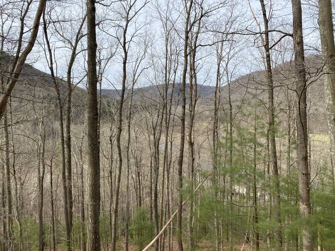
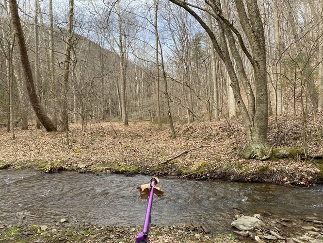
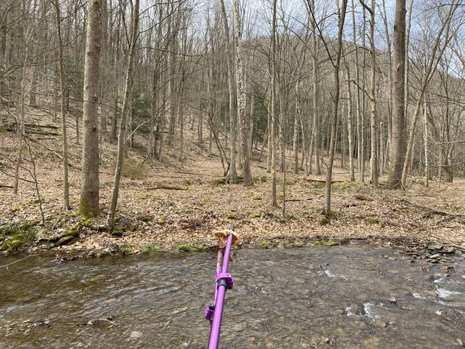
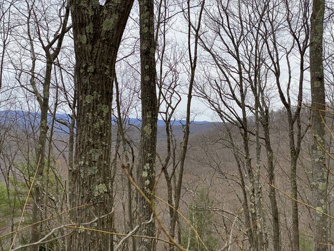
From the trailhead, until the hiker reaches mile 3.1, the hike is actually mostly-flat and easy walking. Between miles 0.75 and 1.5, hikers will be walking along private property - please stay on the trail at all times during this section of the trail. As the trail makes its way around the mountain, within private property, there's a nice obstructed view of the surrounding mountains.
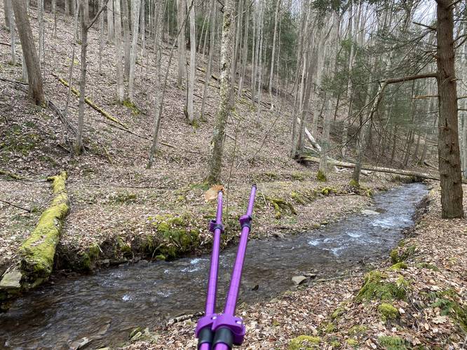
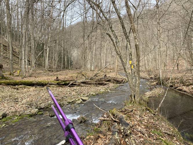
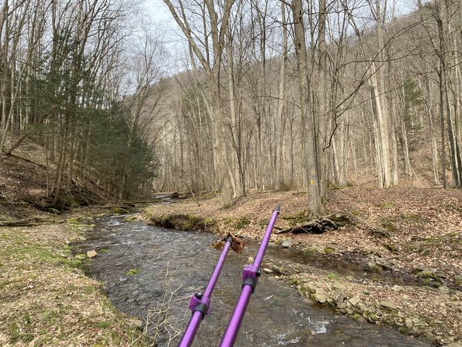
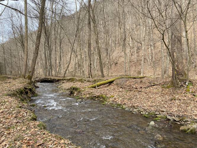
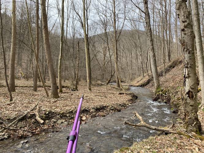
Square Timber Run Creek Crossings - Mile 2.3 to 3.2
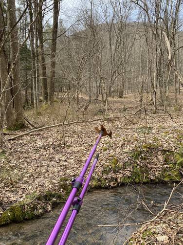
Between miles 2.3 and 3.2, hikers will be following the Square Timber Run section of the trail. During wet months, the creek is usually flowing pretty well - meaning the most-shallow spots in the creek are probably 2-inches deep, while the deepest sections can be 1-foot or more. The trail also crosses the creek several times - approximately 7 or 8 times. If you aren't prepared, these creek crossings will leave your feet wet for the remainder of the hike.
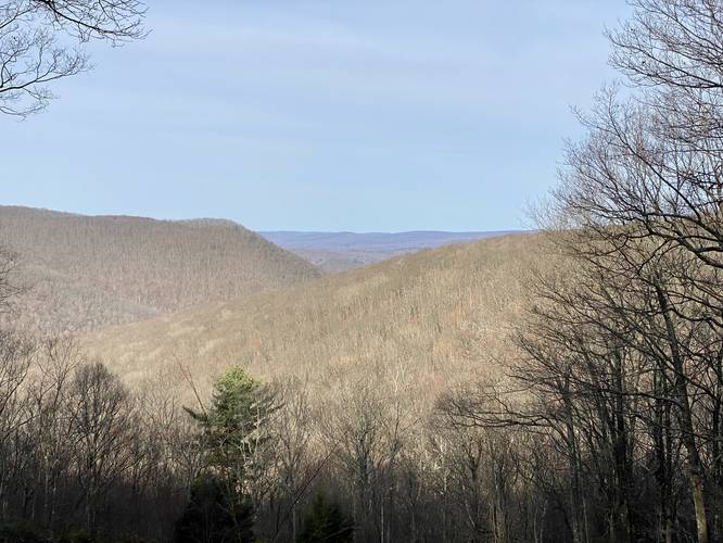
Mountain Ascent - Mile 3.2 to 6
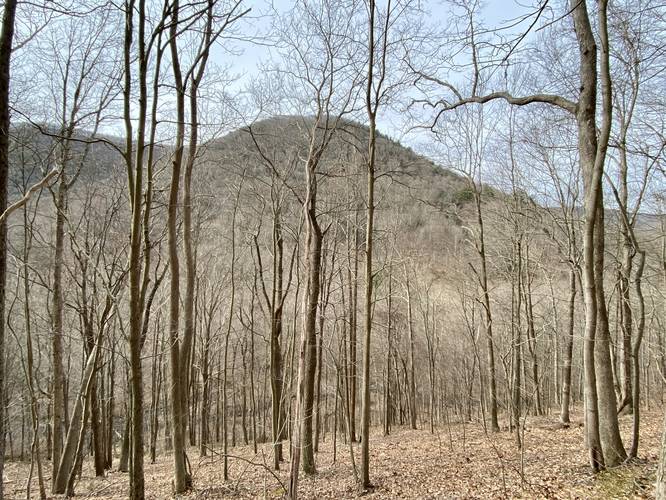
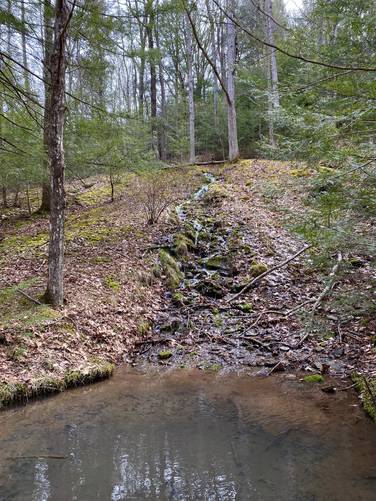
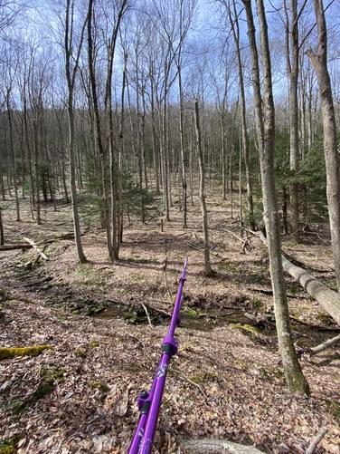
The trail will take a 90-degree left-hand turn to begin the ascent up to the mountain ridge around mile 3.2. Just beyond this turn is an old spring house where a small waterfall spring cascades down into the human-made deep rock pool below. This pool was filled with silt - assuming it must have been piling up for ~100-years or so - so much so that my trekking pole poked 2/3 of its length to reach the bottom. This old spring house pool must be 4-feet deep. After passing the old spring house and waterfall, the trail slowly makes its way up the mountain along a moderate grade. While the hike up take a long time, the hiking is not difficult. The only part about it that's difficult are the skinny sections of trail that follow steep mountain slopes. These skinny trail sections are sometimes 8-inches wide along a slightly-sloped grade - we found that trekking poles really helped for this part of the hike. During cold months, hikers also get an obstructed view of Fox Mountain in the distance - a triangle knob poking up from the flat mountainous plateau (see the photos).
Mountain Ridge Hiking - Mile 6 to 8.4
Once on the mountain ridge, the hiking becomes a bit easier again. Hikers will officially enter the Square Timber Wild Area around mile 6 as well, as they exit the boundaries of the Bucktail Natural Area. Once on the mountain ridge, hikers will follow the yellow blazes of the Square Timber Trail as it meanders its way east toward the Bucktail Path. Along the way are sections of overgrown mountain laurel that require a bit of bushwhacking, a mountain saddle (miles 7 to 7.3) where the trail heads downhill and then back uphill immediately after - this section of elevation grade is by far the "most steep" along the trail, but it's not difficult and does not last for very long. After passing the mountain saddle, the trail will head back downhill and then skirt around another steep mountain top before ending, where it ends at the Bucktail Path.
Hiking Out
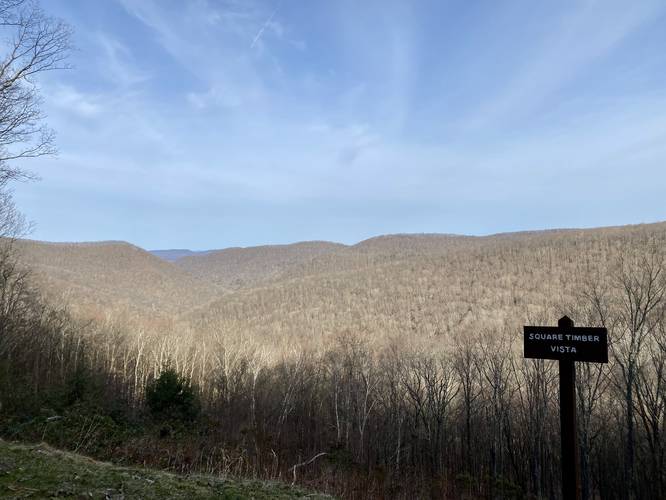
On this hike, since we parked at the Pepper Hill parking area, hiking out simply meant following the Bucktail Path, which you can read about in our Square Timber Vista via Bucktail Path guide. This additional 1.7-miles is an easy scenic route that passes a beautiful vista (seemingly the only on-trail vista in the entire Wild Area) that peers into the Square Timber Wild Area and the Bucktail Natural Area in the distance.
Parking
Hikers will find parking for the main trailhead at the coordinates provided along Stillhouse Road in Lumber Township, PA. Note that to hike this trail in full, the hiker might want to hike with a friend, thus using two cars, to shuttle back to the trailhead. During this hike, we used the Pepper Hill trailhead located at: 41.39971, -78.115492.
Warnings
Timber Rattlesnakes: This area is known to be home to the Timber Rattlesnake. These snakes are usually out of their dens hunting, or sunning in tall valley grass between the months of late April and early October.
Camping and Backpacking
Backpacking is allowed off-trail along the public land sections of this trail. Please follow all state forest rules and regulations when dispersed / primitive / backcountry camping. Also note that as of April 2022, we did not find any campsites off-trail anywhere along the Square Timber Trail, surprisingly.
Pets
Dogs are allowed if leashed.
Looking For Elk?
This trail showed many different signs of elk - like scat, hair, and tree rub marks (where the bark was stripped from rubbing antlers). Almost all of the signs of elk were in the lower valleys - predominantly along Square Timber Run within the Square Timber Hollow. While we did not see any elk, we did notice a large animal crashing through the brush up on the mountain ridge, closer to the Pepper Hill parking lot. Was it an elk? Possibly.
Old-Growth Trees
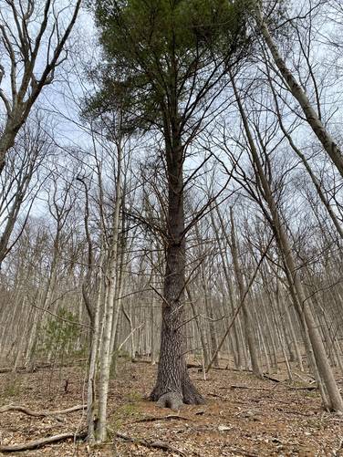
There are several old-growth trees along this trail, but there don't appear to be any old-growth groves. It seems these old-growth trees (usually a singular species in each case) was left over to ensure that new trees of that variety start new life. One of them can be found before crossing Stillhouse Run, the other is a white pine located along Square Timber Run (see the photos).
On-Road Vistas
Please note that I uploaded photos from two different on-road vistas that peer into the Square Timber Wild Area - both located on Ridge Road.
Cell Signal Coverage
As of April 2022, with Verizon, I was able to get several scraps of 3G and LTE while on this trail. The signals seem to stem from the Emporium, PA area, so once you get further south along the mountain ridge, the coverage drops. This is actually quite handy for several reasons, especially if you need help.
Waterfalls
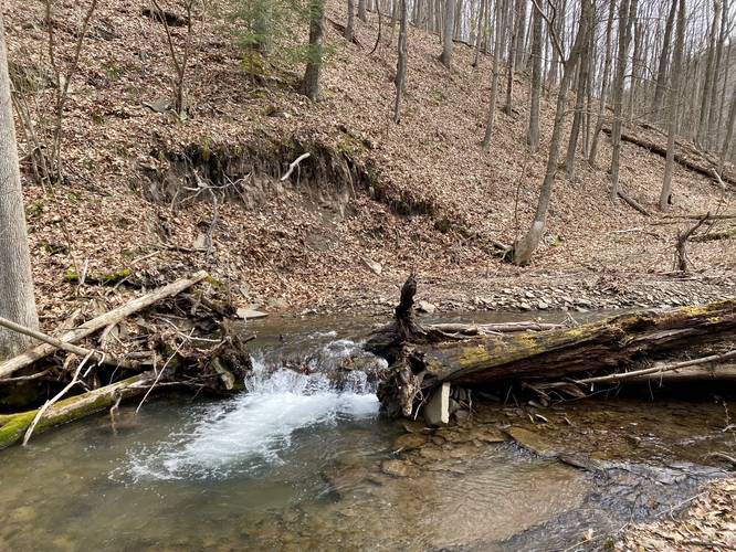
There's a small cascade near where the trail starts to head up the mountain hollow, but it appears to be made from blowdowns, which helps the fish and critters living in the creek. The other waterfall is a small hillside cascade that spills out of a mountain spring and flows into a man-made spring house. During the Summer, it's possible that these mostly dry up based on seasonal rainfall conditions.
Trails
This hike follows just one named trail: Square Timber Trail which follows yellow blazes as of April 2022.
Hike Description
This trail starts along Stillhouse Road in Lumber Township, Pennsylvania along the steep slopes of Stillhouse Hollow, following the yellow blazes of the Square Timber Trail. Hikers will have to cross Stillhouse Run creek around 0.3-miles into the hike. This is the first of many creek crossings, but almost all of them are along the Square Timber Run section of the hike.
Easy Hiking - Trailhead to Mile 3.1
From the trailhead, until the hiker reaches mile 3.1, the hike is actually mostly-flat and easy walking. Between miles 0.75 and 1.5, hikers will be walking along private property - please stay on the trail at all times during this section of the trail. As the trail makes its way around the mountain, within private property, there's a nice obstructed view of the surrounding mountains.
Square Timber Run Creek Crossings - Mile 2.3 to 3.2
Between miles 2.3 and 3.2, hikers will be following the Square Timber Run section of the trail. During wet months, the creek is usually flowing pretty well - meaning the most-shallow spots in the creek are probably 2-inches deep, while the deepest sections can be 1-foot or more. The trail also crosses the creek several times - approximately 7 or 8 times. If you aren't prepared, these creek crossings will leave your feet wet for the remainder of the hike.
Mountain Ascent - Mile 3.2 to 6
The trail will take a 90-degree left-hand turn to begin the ascent up to the mountain ridge around mile 3.2. Just beyond this turn is an old spring house where a small waterfall spring cascades down into the human-made deep rock pool below. This pool was filled with silt - assuming it must have been piling up for ~100-years or so - so much so that my trekking pole poked 2/3 of its length to reach the bottom. This old spring house pool must be 4-feet deep. After passing the old spring house and waterfall, the trail slowly makes its way up the mountain along a moderate grade. While the hike up take a long time, the hiking is not difficult. The only part about it that's difficult are the skinny sections of trail that follow steep mountain slopes. These skinny trail sections are sometimes 8-inches wide along a slightly-sloped grade - we found that trekking poles really helped for this part of the hike. During cold months, hikers also get an obstructed view of Fox Mountain in the distance - a triangle knob poking up from the flat mountainous plateau (see the photos).
Mountain Ridge Hiking - Mile 6 to 8.4
Once on the mountain ridge, the hiking becomes a bit easier again. Hikers will officially enter the Square Timber Wild Area around mile 6 as well, as they exit the boundaries of the Bucktail Natural Area. Once on the mountain ridge, hikers will follow the yellow blazes of the Square Timber Trail as it meanders its way east toward the Bucktail Path. Along the way are sections of overgrown mountain laurel that require a bit of bushwhacking, a mountain saddle (miles 7 to 7.3) where the trail heads downhill and then back uphill immediately after - this section of elevation grade is by far the "most steep" along the trail, but it's not difficult and does not last for very long. After passing the mountain saddle, the trail will head back downhill and then skirt around another steep mountain top before ending, where it ends at the Bucktail Path.
Hiking Out
On this hike, since we parked at the Pepper Hill parking area, hiking out simply meant following the Bucktail Path, which you can read about in our Square Timber Vista via Bucktail Path guide. This additional 1.7-miles is an easy scenic route that passes a beautiful vista (seemingly the only on-trail vista in the entire Wild Area) that peers into the Square Timber Wild Area and the Bucktail Natural Area in the distance.
Parking
Hikers will find parking for the main trailhead at the coordinates provided along Stillhouse Road in Lumber Township, PA. Note that to hike this trail in full, the hiker might want to hike with a friend, thus using two cars, to shuttle back to the trailhead. During this hike, we used the Pepper Hill trailhead located at: 41.39971, -78.115492.
Warnings
Timber Rattlesnakes: This area is known to be home to the Timber Rattlesnake. These snakes are usually out of their dens hunting, or sunning in tall valley grass between the months of late April and early October.
Camping and Backpacking
Backpacking is allowed off-trail along the public land sections of this trail. Please follow all state forest rules and regulations when dispersed / primitive / backcountry camping. Also note that as of April 2022, we did not find any campsites off-trail anywhere along the Square Timber Trail, surprisingly.
Pets
Dogs are allowed if leashed.
Looking For Elk?
This trail showed many different signs of elk - like scat, hair, and tree rub marks (where the bark was stripped from rubbing antlers). Almost all of the signs of elk were in the lower valleys - predominantly along Square Timber Run within the Square Timber Hollow. While we did not see any elk, we did notice a large animal crashing through the brush up on the mountain ridge, closer to the Pepper Hill parking lot. Was it an elk? Possibly.
Old-Growth Trees
There are several old-growth trees along this trail, but there don't appear to be any old-growth groves. It seems these old-growth trees (usually a singular species in each case) was left over to ensure that new trees of that variety start new life. One of them can be found before crossing Stillhouse Run, the other is a white pine located along Square Timber Run (see the photos).
On-Road Vistas
Please note that I uploaded photos from two different on-road vistas that peer into the Square Timber Wild Area - both located on Ridge Road.
Cell Signal Coverage
As of April 2022, with Verizon, I was able to get several scraps of 3G and LTE while on this trail. The signals seem to stem from the Emporium, PA area, so once you get further south along the mountain ridge, the coverage drops. This is actually quite handy for several reasons, especially if you need help.
Waterfalls
There's a small cascade near where the trail starts to head up the mountain hollow, but it appears to be made from blowdowns, which helps the fish and critters living in the creek. The other waterfall is a small hillside cascade that spills out of a mountain spring and flows into a man-made spring house. During the Summer, it's possible that these mostly dry up based on seasonal rainfall conditions.