Loading...

🎉 Enjoy a Free 7-Day Supporter Trial and Unlock Exclusive Perks — No Credit Card Required. Learn more.

Spring Falls

Directions
Map
Pictures
Send to App
Distance:
0.2 Miles / 0.3 km
Type:
Out-and-Back
Difficulty:
Easy
Time to Hike:
~6 minutes
Features:
PA Wilds
Surface Type:
Dirt
Park:
Tiadaghton State Forest
Town:
Cammal, Pennsylvania
Directions:
41.406204, -77.423261
Added:
January 22, 2023
Updated:
January 22, 2023
Copy Trail Link Hiking this trail? Send a friend or family member a link to this trail guide for your own safety. Hike at your own risk (disclaimer)
Loading...
Loading...
57'

Total Change
57'

Ascent
56'

Descent

Download the Trail Route for Offline Use

Supporters get exclusive access to download trail routes to the MyHikes app for offline use. Stay prepared on your adventure, even without an internet connection! Become a Supporter today to unlock this feature and hike with confidence.

Send to App

Spring Falls

Spring Falls at Tiadaghton State Forest near Cammal, Pennsylvania is an easy 0.2-mile out-and-back walk that leads up a 50-foot tall, 200-foot long mountain spring waterfall.

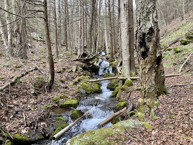
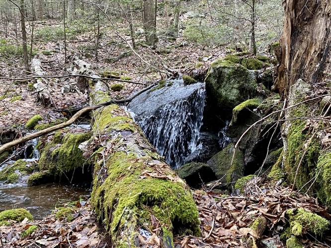
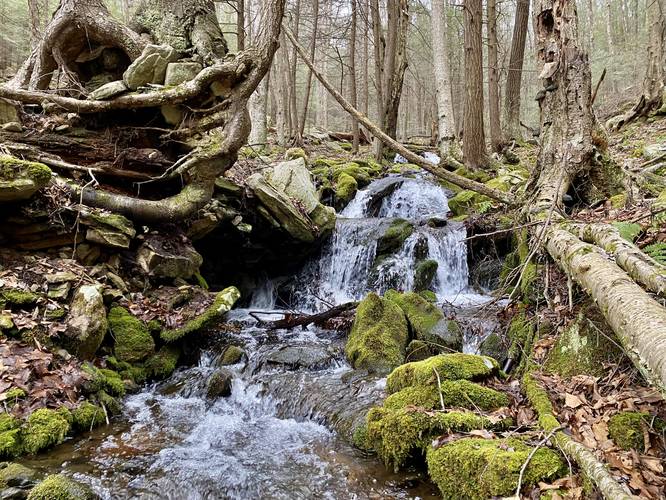
This is not really a hike, but rather a walk that leads up alongside a mountain spring that gushes out of the mountain. The spring, during the Winter or early Spring flows so heavily that it creates a multitude of cascading waterfalls, some 1-foot tall, others 3-feet tall that spill down the mountain. Many of these small waterfalls spill over large boulders or massive tree roots that jut out into the creek and while there isn't a large plunging waterfall here, this long cascade of smaller waterfalls makes for an interesting sight, especially due to the fact that all of this water is coming from underground within the mountain itself, hence Spring Falls. This mountain spring feeds Truman Run downstream.

Parking
Hikers will find a road turnout that bends down toward the waterfall and back to the road. Otherwise, you can park right off of the road in a small turnout and use this path as a trail instead.
Explore 264 trails near Cammal, PA
  1. Parking

    41.406204, -77.423261
  2. Main Trailhead

    41.40619, -77.423233
  3. Spring Falls

    41.406303, -77.4227
    Spring Falls
  4. Spring Falls (multi-cascade waterfall)

    41.406422, -77.422158
    Spring Falls (multi-cascade waterfall)
  5. Spring Falls (multi-cascade waterfall)

    41.40632, -77.42259
    Spring Falls (multi-cascade waterfall)
No community routes found. To add your own hike as a Community Route for this Trail guide, leave a Trip Report with an attached GPX file.

Hazards

Ticks - Lyme Disease More Info (CDC)

Seasons

All

Trip Reports

Trail Guide By:
Admin user profile picture
0.2 miles / 0.3 km
0.2 miles / 0.3 km
January 23, 2023
Dogs Hiking

Weather Forecast

In Cammal, PA

Explore Hiking Trails

You May Also Like

Colorado's Million Dollar Highway - Plan a day's drive adventure along the iconic Million Dollar Highway in Colorado. Explore the best short trails, roadside stops, waterfalls, vistas, ghost towns, and hot springs within a ~6 hour road trip.
Explore

Colorado's Million Dollar Highway

Plan a day's drive adventure along the iconic Million Dollar Highway in Colorado. Explore the best short trails, roadside stops, waterfalls, vistas, ghost towns, and hot springs within a ~6 hour road trip.

Read
New York's Best Waterfalls - Whether you're planning a day hike, roadside stop, or a leisurely short walk, this guide provides hikers, travelers, and locals alike with 63 different locations to over 100 scenic waterfalls to help plan your next adventure!
Explore

New York's Best Waterfalls

Whether you're planning a day hike, roadside stop, or a leisurely short walk, this guide provides hikers, travelers, and locals alike with 63 different locations to over 100 scenic waterfalls to help plan your next adventure!

Read

Before you boogie...

Find our trail guides useful? Consider becoming a Supporter to unlock perks!

MyHikes is an indie platform that makes exploring public trails easier for everyone. The platform has no investors, no ads, and is owned and operated by one person, Dave Miller. Dave has personally mapped and written over 1,800 trail guides on MyHikes for the public to explore. MyHikes has helped millions outdoor enthusiasts plan their next adventure.

But it takes a lot of time 🕦, money 💰, work, and espresso shots ☕ to run MyHikes, including hiking , mapping , writing , and publishing new trails with high-quality (accurate) information... along with software engineering (coding) the platform like building new features, website and mobile app development (iOS and Android), site maintainance . and much much more.

Supporters unlock website and mobile app perks with an annual one-time payment of $25 (you renew) 😎👍. Or you can simply make a Donation of your choice. Otherwise, you can support us by telling your friends about MyHikes - both quick and free 🎉

Admin user profile picture

Dave Miller
MyHikes Founder