Sugarlands Valley Nature Loop Trail
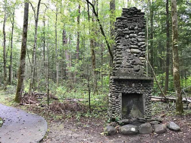
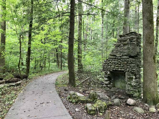
On this trail you'll find the remains of two homesteads - the only remaining features are two fireplaces and a stonewall right on the trail.
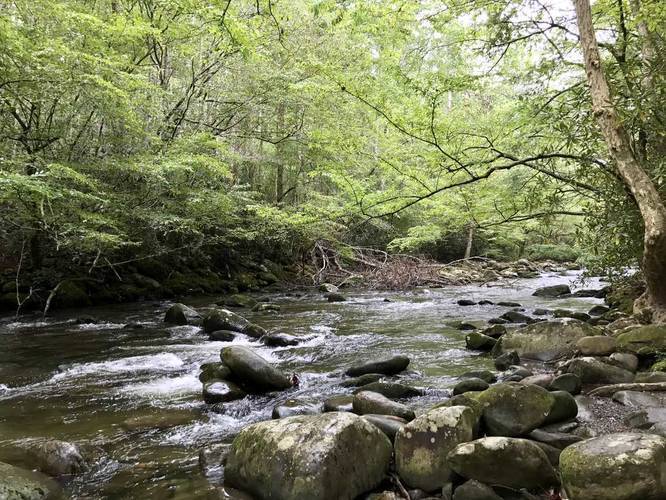
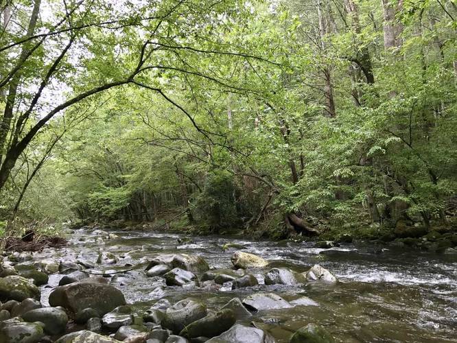
The trail also runs next to a creek that cuts through the Sugarlands Valley. There are benches along the creek and along the trail itself.
The trail is concrete and fully accessible except for the creek's banks.
Know Before You Go
Interactive topographic map for Sugarlands Valley Nature Loop Trail located in Gatlinburg, TN. Click the "View Map" button to load GPS coordinates and trail markers.
View map
Get directions
- Distance
- 0.7 mi
- Difficulty
- Easy
- Type
- Loop
- Est. Time
- 21 min
- Elev. Gain
- 40'
- Rating
- 0.0
- Added
- September 06, 2017
- Updated
- February 22, 2024
Weather Forecast
Overnight
Low
66°F
Mostly Cloudy
Monday
High
75°F
Showers And Thunderstorms Likely
Monday Night
Low
66°F
Showers And Thunderstorms Likely then Mostly Cloudy
Tuesday
High
78°F
Mostly Sunny then Chance Showers And Thunderstorms
Tuesday Night
Low
67°F
Showers And Thunderstorms Likely then Chance Showers And Thunderstorms
Wednesday
High
78°F
Showers And Thunderstorms
Wednesday Night
Low
67°F
Showers And Thunderstorms then Partly Cloudy
Thursday
High
80°F
Showers And Thunderstorms Likely
Thursday Night
Low
67°F
Showers And Thunderstorms Likely
Friday
High
80°F
Showers And Thunderstorms Likely
Friday Night
Low
68°F
Showers And Thunderstorms Likely then Slight Chance Showers And Thunderstorms
Saturday
High
80°F
Showers And Thunderstorms
Saturday Night
Low
67°F
Showers And Thunderstorms then Slight Chance Showers And Thunderstorms
Sunday
High
80°F
Showers And Thunderstorms Likely
Don't let Google decide who you trust.


Loading...
<strong>Trail map and elevation chart not rendering in print mode?</strong> Simply scroll to the trail map section, then try printing again!
Total Change
29 ft.
9 m
9 m
Ascent
40 ft.
12 m
12 m
Descent
43 ft.
13 m
13 m
Loading...
Features
- Water Source
Points of interest
-
Parking
35.679324, -83.531214 -
Main Trailhead
35.679482, -83.531025 -
Along the creek
35.678619, -83.52855 -
Along the creek
35.678561, -83.528542
-
Parking
35.679324, -83.531214 -
Main Trailhead
35.679482, -83.531025
Safety information
For your own safety: plan ahead, let someone know where you'll be, and hike at your own risk.
Availability
Summer
Surface type
Universal Access
Trip Reports (Reviews)
Ready to help fellow hikers? Add a trip report to share your experience!
No community routes found. To add your own hike as a Community Route for this Trail guide, leave a Trip Report with an attached GPX file.


You may also like

Explore
Best of the Alps: Hiking, Adventure & Scenery
Plan your ultimate European Alps adventure! Discover the best hiking trails, epic scenery, and villages in the Swiss Alps, Dolomites, Chamonix, and Lake Como.

Explore
Colorado's Million Dollar Highway
Plan a day's drive adventure along the iconic Million Dollar Highway in Colorado. Explore the best short trails, roadside stops, waterfalls, vistas, ghost towns, and hot springs within a ~6 hour road trip.

Explore
Glacier's Going-to-the-Sun Road
Discover the breathtaking beauty of Glacier National Park along the iconic Going-to-the-Sun Road. From stunning roadside stops to picturesque waterfalls and vistas, this engineering marvel offers endless opportunities for exploration.

Explore
Hike Washington's National Parks & Forests
Find the best day hikes in Washington's National Parks and Forests. Explore panoramic alpine vistas, turquoise lakes, and stunning waterfalls.
great smoky mountains national park

