Loading...

WINTER SALE! 50% OFF Supporter Accounts — now through January 31st. Learn More.

Laurel Falls Trail

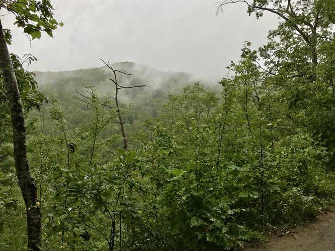
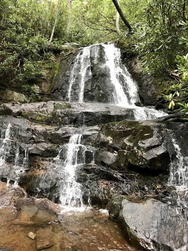
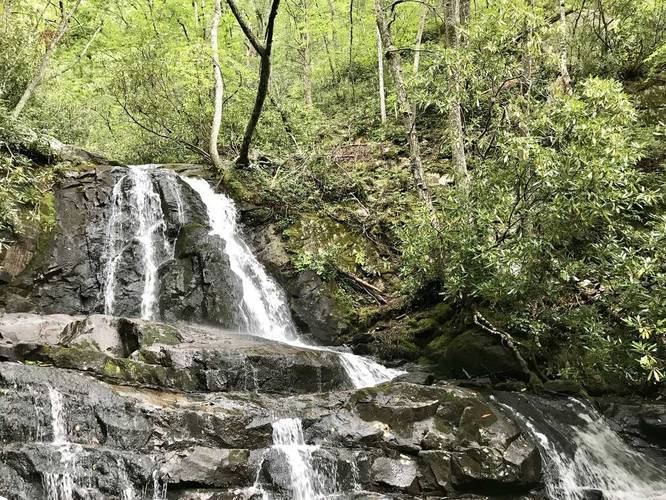
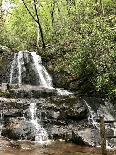
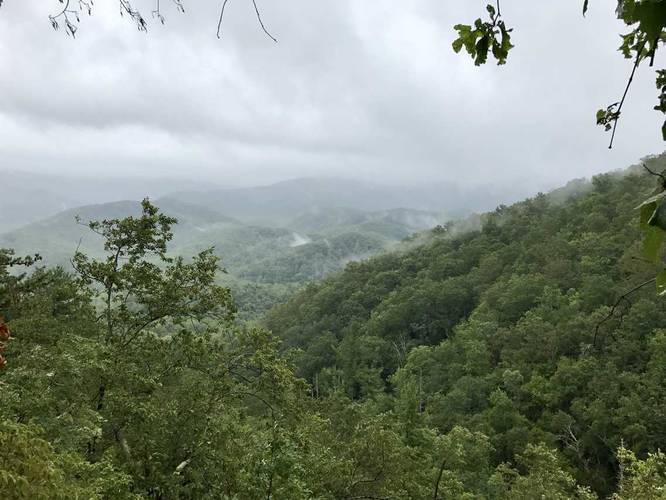
The Laurel Falls Trail at the Great Smoky Mountains National Park near Gatlinburg, TN is a moderate heavily-trafficked 2.5 mile out-and-back hike from Fighting Creek Gap rd to Laurel Falls - one of the Smoky's most iconic waterfalls.

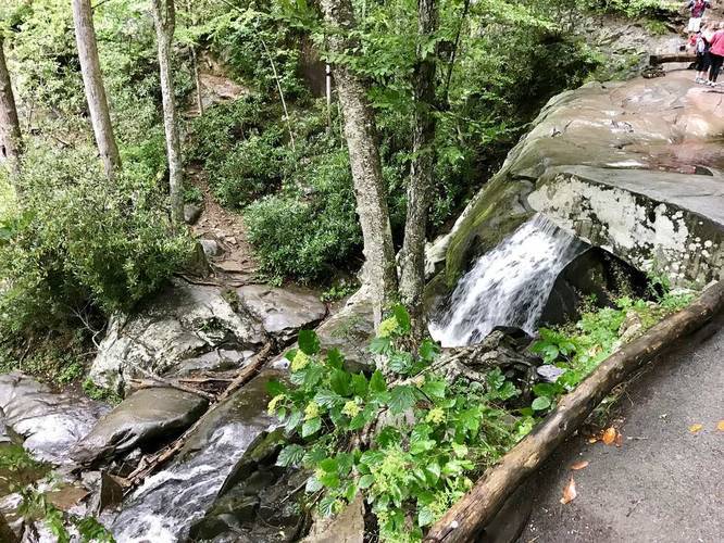
The hike is very dangerous as there are many places along the trail where there are 50 to 70 foot cliffs. Some of them are right by the waterfall itself where traffic tends to pile up, so be careful. On our hike out, a group of people did not move over for us and blocked the trail in multiple dangerous places - do not be these people. Trail etiquette and space is highly recommended because people have died hiking this trail.

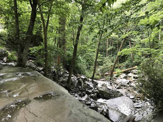
All dangers aside, this is one of the best day hikes in the Great Smoky Mountains because it's not a difficult hike. The entire trail is paved up to Laurel Falls, but has fallen apart in certain areas, so watch your step.

Prepare for a ton of people here. This is one of the most popular hikes at the Smokys, so the trail is often littered with people. If you like hikes with less people, Spruce Flat Falls is a much better option and quite honestly is just as good as Laurel Falls.

Dogs and biking are not allowed here.
Explore 19 trails near Sevierville, TN

Know Before You Go

  • Laurel Falls Trail is a popular, moderate 2.5-mile hike in Great Smoky Mountains National Park leading to a scenic waterfall.
  • The trail presents significant dangers due to steep cliffs and heavy foot traffic, requiring hikers to practice caution and trail etiquette.
  • While paved, the trail is deteriorating in sections, and alternative hikes like Spruce Flat Falls offer similar beauty with fewer crowds.
Interactive topographic map for Laurel Falls Trail located in Sevierville, TN. Click the "View Map" button to load GPS coordinates and trail markers.
Get directions
Distance
2.5 mi
Difficulty
Moderate
Type
Out-and-Back
Est. Time
1.3 hrs
Elev. Gain
406'
Rating
5.0
Added
September 06, 2017
Updated
January 23, 2020

Weather Forecast

Loading...
Total Change
332'
Ascent
406'
Descent
404'
Loading...

Download the GPX Data for Offline Use

Supporters get exclusive access to download trail routes to the MyHikes app for offline use. Stay prepared on your adventure, even without an internet connection! Become a Supporter today to unlock this feature and hike with confidence.

Download Laurel Falls Trail GPX Data to the MyHikes Mobile App

Features

Vista / Lookout Point
Waterfalls

Points of interest

  1. Parking

    35.671843, -83.580483
  2. Main Trailhead

    35.672135, -83.580835
  3. Vista of neighboring mountains

    35.672242, -83.591042
    Vista of neighboring mountains
  4. Laurel Falls

    35.677464, -83.593164
    Laurel Falls

Safety information

For your own safety: plan ahead, let someone know where you'll be, and hike at your own risk.

Availability

Summer

Surface type

Paved

Trip Reports (Reviews)

Rated 5.0 out of 5 based on 1 rating.

Ready to help fellow hikers? Add a trip report to share your experience and provide valuable insights for other hikers!

2.5 miles / 4.0 km
March 09, 2018
Hiking
2.5 miles / 4.0 km
September 02, 2017
Hiking
No community routes found. To add your own hike as a Community Route for this Trail guide, leave a Trip Report with an attached GPX file.

Popular categories

Scenic mountain view representing vista trails
Vista trails
Scenic gorge of cascades representing waterfall trails
Waterfall hikes
Rugged mountain terrain representing summit trails
Summit trails
Scenic mountain view representing dog-friendly trails
Dog-friendly
Scenic campsite with a view representing camping trails
Camping trails
Appalachian Trail logo representing A.T. hikes
A.T. hikes

You May Also Like

Colorado's Million Dollar Highway - Plan a day's drive adventure along the iconic Million Dollar Highway in Colorado. Explore the best short trails, roadside stops, waterfalls, vistas, ghost towns, and hot springs within a ~6 hour road trip.
Explore

Colorado's Million Dollar Highway

Plan a day's drive adventure along the iconic Million Dollar Highway in Colorado. Explore the best short trails, roadside stops, waterfalls, vistas, ghost towns, and hot springs within a ~6 hour road trip.

Read
Glacier's Going-to-the-Sun Road - Discover the breathtaking beauty of Glacier National Park along the iconic Going-to-the-Sun Road. From stunning roadside stops to picturesque waterfalls and vistas, this engineering marvel offers endless opportunities for exploration.
Explore

Glacier's Going-to-the-Sun Road

Discover the breathtaking beauty of Glacier National Park along the iconic Going-to-the-Sun Road. From stunning roadside stops to picturesque waterfalls and vistas, this engineering marvel offers endless opportunities for exploration.

Read
🍪 We use cookies to learn about site usage and to serve map tiles. You may block cookies manually in the browser. By continuing you agree. Learn more