The Six Mile Waterfalls Hike at Six Mile Creek Natural Area in Ithaca, New York is an easy 1.7-mile out-and-back hike that features several waterfalls like a 50-foot gorge cascade and ends at two large dam waterfalls.
Hike Description
This hike begins at the main parking lot for the Six Mile Creek Natural Area and the Mulholland Wildflower Preserve.
Mulholland Wildflower Preserve
In early Summer, the wildflowers within the Mulholland Wildflower Preserve are usually popping including Black-eyed Susans and more. Hikers can enjoy the wildflower preserve right off the bat as they begin their hike.
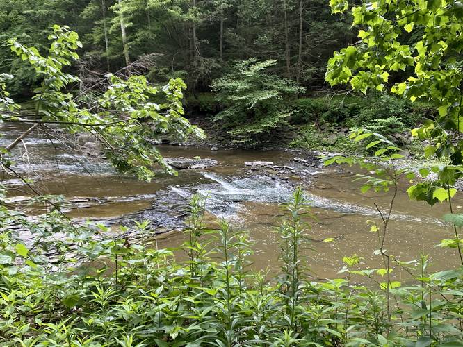
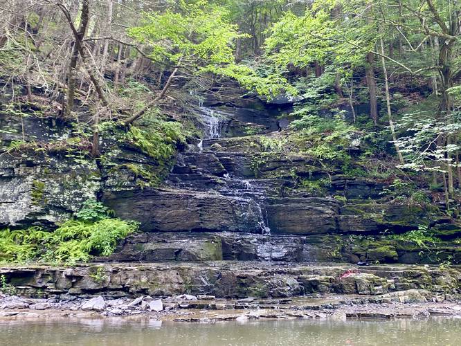
The trail itself is mostly-flat, but undulates gradually as it meanders its way south along Six Mile Creek. Along the way are several very short, but wide slide waterfalls - some were photographed and included as points-of-interest in this guide but not all of them.
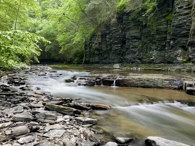
50-foot Gorge Falls - Mile 0.66
Around mile 0.66, hikers ill reach the 50-foot tall (or taller) waterfall that cascades down multi-tiered bedrock before reaching Six Mile Creek. This is the largest natural waterfall that's found along the hike, but the flow of water was a bit weaker in early July, 2023.
Concrete Embankment Walk - Mile 0.8
Around mile 0.8, hikers will reach a concrete embankment where a water pipe passes through. Hikers will walk on this to reach bedrock in the creek located further upstream.
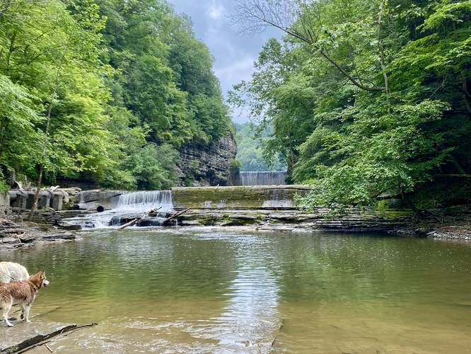
Six Mile Dam Waterfalls - Mile 0.85
At mile 0.85, hikers will reach the lower waterfall, which is a human-made dam, that sits in Six Mile Creek. The Lower Dam Falls is approximately 10-feet tall or slightly taller. Behind Lower Dam Falls is Upper Dam Falls - a significantly-taller waterfall, that appears to be about 50-feet tall.
Lower Dam Falls is where we ended our hike, however, hikers can continue exploring more of Six Mile Creek Natural Area if they wish. The hike back is easy and scenic - you pass the same waterfalls that you passed on the way in.
Parking
Hikers will find a small parking lot at the coordinates provided, located off of Giles Street in Ithaca, NY.
Pets
Dogs are allowed if leashed and must be cleaned up after.
Hike Description
This hike begins at the main parking lot for the Six Mile Creek Natural Area and the Mulholland Wildflower Preserve.
Mulholland Wildflower Preserve
In early Summer, the wildflowers within the Mulholland Wildflower Preserve are usually popping including Black-eyed Susans and more. Hikers can enjoy the wildflower preserve right off the bat as they begin their hike.
The trail itself is mostly-flat, but undulates gradually as it meanders its way south along Six Mile Creek. Along the way are several very short, but wide slide waterfalls - some were photographed and included as points-of-interest in this guide but not all of them.
50-foot Gorge Falls - Mile 0.66
Around mile 0.66, hikers ill reach the 50-foot tall (or taller) waterfall that cascades down multi-tiered bedrock before reaching Six Mile Creek. This is the largest natural waterfall that's found along the hike, but the flow of water was a bit weaker in early July, 2023.
Concrete Embankment Walk - Mile 0.8
Around mile 0.8, hikers will reach a concrete embankment where a water pipe passes through. Hikers will walk on this to reach bedrock in the creek located further upstream.
Six Mile Dam Waterfalls - Mile 0.85
At mile 0.85, hikers will reach the lower waterfall, which is a human-made dam, that sits in Six Mile Creek. The Lower Dam Falls is approximately 10-feet tall or slightly taller. Behind Lower Dam Falls is Upper Dam Falls - a significantly-taller waterfall, that appears to be about 50-feet tall.
Lower Dam Falls is where we ended our hike, however, hikers can continue exploring more of Six Mile Creek Natural Area if they wish. The hike back is easy and scenic - you pass the same waterfalls that you passed on the way in.
Parking
Hikers will find a small parking lot at the coordinates provided, located off of Giles Street in Ithaca, NY.
Pets
Dogs are allowed if leashed and must be cleaned up after.