The Shikellamy Lookout Loop at Shikellamy State Park near Northumberland, Pennsylvania is a moderate 1.3-mile loop hike that features beautiful views of the Susquehanna River and the greater Northumberland area.
Trails
This hike follows two named trails and one road in the following order: Deer Trail (yellow blazes), Oak Ridge Trail (yellow blazes), and Shikellamy State Park Road.
Hike Description
This hike begins at a small parking lot adjacent to the Deer Trail, located along the entrance road -- at the parking coordinates provided.
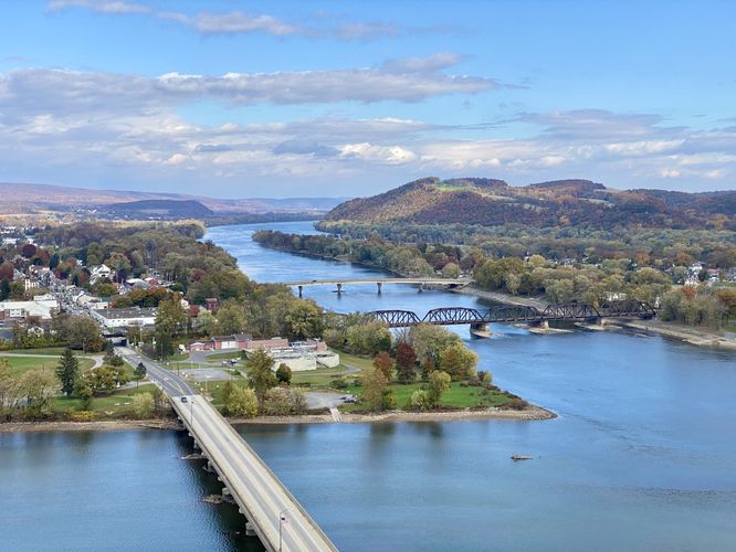
Susquehanna River View - Mile 0
Hikers will first head to the overlook of the Susquehanna River located right at the parking lot. This view is by far the best along the trail, but there are other views along the way too. Hikers will get views of both the West Branch Susquehanna River and Susquehanna River as they come to a junction below your feet. In the view is also the town of Northumberland, PA which sits nestled between the two rivers.
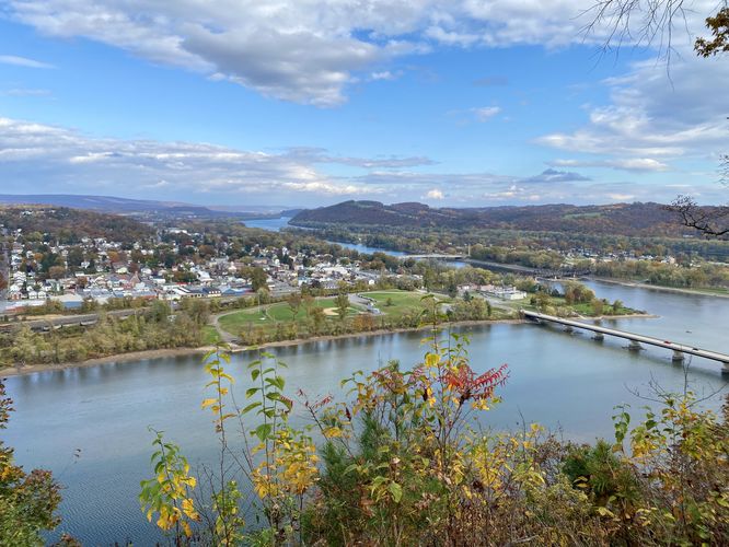
Deer Trail to 2nd Lookout - Mile 0 to 0.17
Around mile 0.17, after hiking uphill along the Deer Trail, hikers will reach another view of the Susquehanna River and Northumberland, PA.
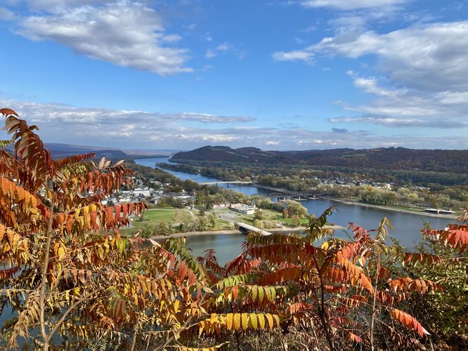
3rd Lookout - Mile 0.3
At mile 0.3, the trail leads to the last unique lookout high above the West Branch Susquehanna River. This view is similar to the two previous -- you'll see the same points-of-interest including the West Branch Susquehanna River, Susquehanna River, river junction, Northumberland, the bridges that span the rivers, and the surrounding hills.
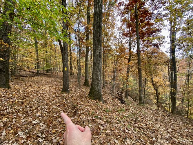
Deer Trail to Oak Ridge Trail - Mile 0.3 to 0.95
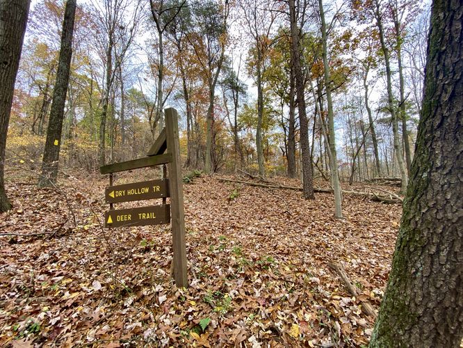
After visiting the last vista / lookout, hikers will follow the yellow blazes of the Deer Trail to hike the loop toward the Oak Ridge Trail (in this GPS track). The Deer Trail heads west from the 3rd lookout and then heads southward, passing through a grove of Larch Trees, before turning to the east. Once the Deer Trail heads eastward, it will hit a junction with the Dry Hollow Trail -- here head straight / right-ish to stay on the Deer Trail. Finally, after passing through one more pine grove, the Deer Trail will reach an unmarked yellow blaze trail junction. If you wish to take a harder hike, you can stay on the Deer Trail which will lead back to parking - stay right for that option. If you wish to follow this GPS track, take a left-hand turn at mile 0.95 to start hiking the Oak Ridge Trail. The Oak Ridge Trail will head back uphill through the forest to reach the park entrance road.
Park Road to Parking - Mile 1.2 to 1.35
At mile 1.2, hikers will exit the Oak Ridge Trail to find themselves on the park entrance road. Hike down the road to reach the parking lot around mile 1.35.
Parking
Hikers will find a small parking lot at the coordinates provided, located along Shikellamy Park Road. The lot is large enough to fit a half-dozen vehicles.
Pets
Dogs are allowed only if leashed and must be cleaned up after.
Trails
This hike follows two named trails and one road in the following order: Deer Trail (yellow blazes), Oak Ridge Trail (yellow blazes), and Shikellamy State Park Road.
Hike Description
This hike begins at a small parking lot adjacent to the Deer Trail, located along the entrance road -- at the parking coordinates provided.
Susquehanna River View - Mile 0
Hikers will first head to the overlook of the Susquehanna River located right at the parking lot. This view is by far the best along the trail, but there are other views along the way too. Hikers will get views of both the West Branch Susquehanna River and Susquehanna River as they come to a junction below your feet. In the view is also the town of Northumberland, PA which sits nestled between the two rivers.
Deer Trail to 2nd Lookout - Mile 0 to 0.17
Around mile 0.17, after hiking uphill along the Deer Trail, hikers will reach another view of the Susquehanna River and Northumberland, PA.
3rd Lookout - Mile 0.3
At mile 0.3, the trail leads to the last unique lookout high above the West Branch Susquehanna River. This view is similar to the two previous -- you'll see the same points-of-interest including the West Branch Susquehanna River, Susquehanna River, river junction, Northumberland, the bridges that span the rivers, and the surrounding hills.
Deer Trail to Oak Ridge Trail - Mile 0.3 to 0.95
After visiting the last vista / lookout, hikers will follow the yellow blazes of the Deer Trail to hike the loop toward the Oak Ridge Trail (in this GPS track). The Deer Trail heads west from the 3rd lookout and then heads southward, passing through a grove of Larch Trees, before turning to the east. Once the Deer Trail heads eastward, it will hit a junction with the Dry Hollow Trail -- here head straight / right-ish to stay on the Deer Trail. Finally, after passing through one more pine grove, the Deer Trail will reach an unmarked yellow blaze trail junction. If you wish to take a harder hike, you can stay on the Deer Trail which will lead back to parking - stay right for that option. If you wish to follow this GPS track, take a left-hand turn at mile 0.95 to start hiking the Oak Ridge Trail. The Oak Ridge Trail will head back uphill through the forest to reach the park entrance road.
Park Road to Parking - Mile 1.2 to 1.35
At mile 1.2, hikers will exit the Oak Ridge Trail to find themselves on the park entrance road. Hike down the road to reach the parking lot around mile 1.35.
Parking
Hikers will find a small parking lot at the coordinates provided, located along Shikellamy Park Road. The lot is large enough to fit a half-dozen vehicles.
Pets
Dogs are allowed only if leashed and must be cleaned up after.