Loading...

🎉 Enjoy a Free 7-Day Supporter Trial and Unlock Exclusive Perks — No Credit Card Required. Learn more.

Seneca Trail

Directions
Map
Pictures
Send to App
Distance:
0.5 Miles / 0.8 km
Type:
One-Way
Difficulty:
Easy
Time to Hike:
~15 minutes
Features:
PA Wilds
Surface Type:
Dirt
Park:
Two Mile Run County Park
Town:
Franklin, Pennsylvania
Directions:
41.475949, -79.769905
Added:
December 31, 2018
Updated:
August 23, 2020
Copy Trail Link Hiking this trail? Send a friend or family member a link to this trail guide for your own safety. Hike at your own risk (disclaimer)
Loading...
Loading...
59'

Total Change
93'

Ascent
74'

Descent

Download the Trail Route for Offline Use

Supporters get exclusive access to download trail routes to the MyHikes app for offline use. Stay prepared on your adventure, even without an internet connection! Become a Supporter today to unlock this feature and hike with confidence.

Send to App

Seneca Trail

The Seneca Trail at Two Mile Run County Park in Franklin, Pennsylvania is an easy 0.5 mile one-way trail that runs along the eastern shore of Justus Lake.

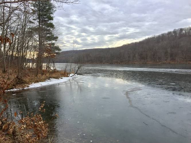
The trailhead can be found in the northwest corner of the main parking lot at the end of Beach Rd at the park. Look between the Beachside shelter and Lakeside shelter to find it. Hike north for about a quarter mile before you reach a small lookout point along the shore of Justus Lake next to a paved road.

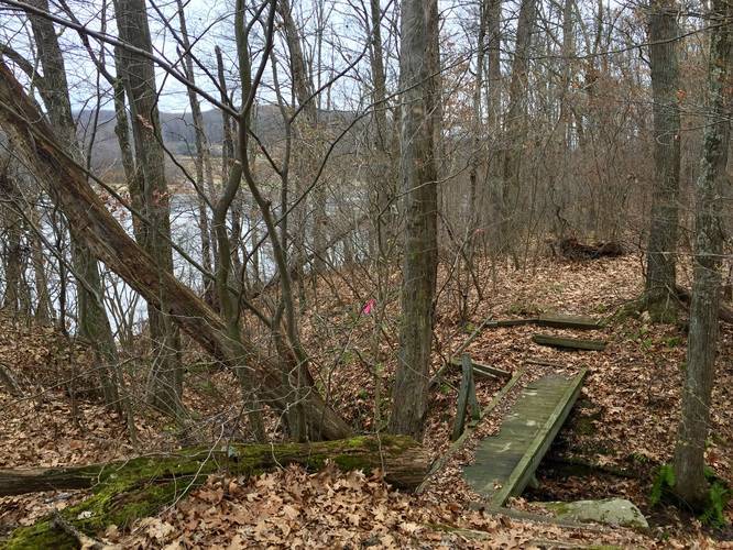
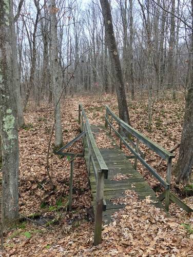
Continue north along the paved road for a hundred feet or so to where the road turns toward Beach Rd - look for pink blazes and a small trail with a wooden bridge, as this is the continuation of the Seneca Trail.

Follow the trail all the way until you reach what's seemingly a dead-end. Just by the dead end is the Roadside Trail, which you can use to hike back for a different route.

Dogs and biking are both allowed on this trail.
Explore 9 trails near Franklin, PA
  1. Parking

    41.475949, -79.769905
  2. Main Trailhead

    41.476317, -79.769854
  3. View of Two Mile Run Reservoir

    41.479825, -79.771417
    View of Two Mile Run Reservoir
  4. Footbridge creek crossing

    41.480756, -79.770683
    Footbridge creek crossing
  5. Footbridge creek crossing

    41.481011, -79.7706
    Footbridge creek crossing
No community routes found. To add your own hike as a Community Route for this Trail guide, leave a Trip Report with an attached GPX file.

Hazards

Ticks - Lyme Disease More Info (CDC)

Seasons

All

Blaze Color

Pink

Weather Forecast

In Franklin, PA

Explore Hiking Trails

You May Also Like

Colorado's Million Dollar Highway - Plan a day's drive adventure along the iconic Million Dollar Highway in Colorado. Explore the best short trails, roadside stops, waterfalls, vistas, ghost towns, and hot springs within a ~6 hour road trip.
Explore

Colorado's Million Dollar Highway

Plan a day's drive adventure along the iconic Million Dollar Highway in Colorado. Explore the best short trails, roadside stops, waterfalls, vistas, ghost towns, and hot springs within a ~6 hour road trip.

Read
New York's Best Waterfalls - Whether you're planning a day hike, roadside stop, or a leisurely short walk, this guide provides hikers, travelers, and locals alike with 63 different locations to over 100 scenic waterfalls to help plan your next adventure!
Explore

New York's Best Waterfalls

Whether you're planning a day hike, roadside stop, or a leisurely short walk, this guide provides hikers, travelers, and locals alike with 63 different locations to over 100 scenic waterfalls to help plan your next adventure!

Read

Before you boogie...

Find our trail guides useful? Consider becoming a Supporter to unlock perks!

MyHikes is an indie platform that makes exploring public trails easier for everyone. The platform has no investors, no ads, and is owned and operated by one person, Dave Miller. Dave has personally mapped and written over 1,800 trail guides on MyHikes for the public to explore. MyHikes has helped millions outdoor enthusiasts plan their next adventure.

But it takes a lot of time 🕦, money 💰, work, and espresso shots ☕ to run MyHikes, including hiking , mapping , writing , and publishing new trails with high-quality (accurate) information... along with software engineering (coding) the platform like building new features, website and mobile app development (iOS and Android), site maintainance . and much much more.

Supporters unlock website and mobile app perks with an annual one-time payment of $25 (you renew) 😎👍. Or you can simply make a Donation of your choice. Otherwise, you can support us by telling your friends about MyHikes - both quick and free 🎉

Admin user profile picture

Dave Miller
MyHikes Founder