Scargo Tower in Dennis, Massachusetts is an easy 0.1-mile out-and-back walk that leads to the top of the historical lookout tower and features panoramic views.
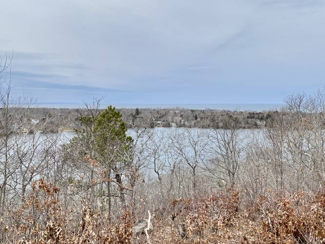
This is not a hike, but rather a quick walk that leads from the parking area to an accessible view point adjacent to parking. Visitors then have the option to walk up the 30-foot metal spiral staircase that leads to the viewing platform atop Scargo Tower as well. From the top of Scargo Tower, visitors get a better view of the surrounding area - mostly north-facing - of Scargo Lake, Cape Cod Bay, and on a clear day views from Sandy Neck all the way to Provincetown, MA. Also note that Scargo Hill is one of Cape Cod's highest points.
History
In 1874 a 28-foot tall wooden tower was built here, funded by donations, as an attraction for public observation. In 1876, the tower was blown over in a storm and once again rebuilt with donations. In 1890 it was sold to Frank Tobey, owner of the Nobscussett House, to be offered as an attraction for locals and guests at his hotel. The second tower was destroyed in 1900 by a wildfire and rebuilt for a third time by Frank Tobey - this time using Cape Cod stone. In 1929, Tobey family heirs donated the tower and land to the Town of Dennis for the public and everyone to enjoy forever. In 2019 restorations began to fix the stonework, parapet, and staircase, but was once again opened in 2021 to the public.
Parking
Visitors will find a large parking lot that surrounds the tower. Do not block the road as this parking area is also used as a turn-around point. The lot is large enough to fit about 10 vehicles at most.
Pets
Dogs are allowed if leashed and must be cleaned up after.
Universal Access
The parking lot and parking lot view are all universally accessible; however, the tower is not universally accessible due to the 30-foot tall spiral staircase.