The Scar Run Loop is a difficult 3.7-mile loop hike near Forksville, Pennsylvania that passes through a beautiful area of Loyalsock State Forest often covered in vibrant green moss, reminiscent of the Pacific Northwest, with several small waterfalls and pools to explore.
The next part of hike is the most beautiful and difficult. There is an old grade that follows down Scar Run, however it has eroded away in places and there are several spots of trees down. Descending along Scar Run is a combination of hiking the grade, making water crossings and navigating around and through downed trees. There is also likely to be an abundance of stinging nettle to deal with in the summer months.
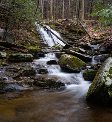
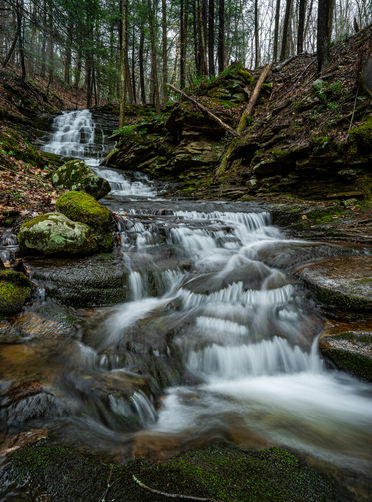
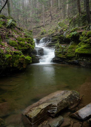
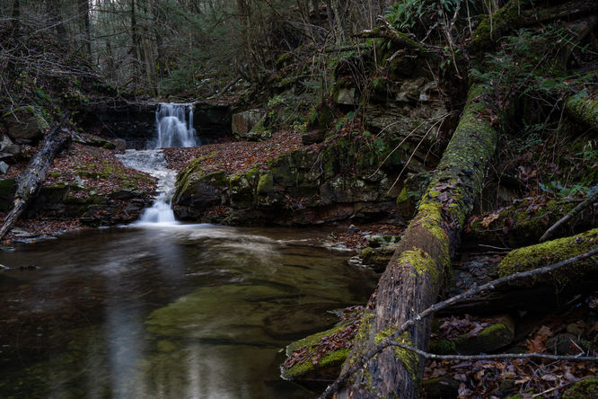
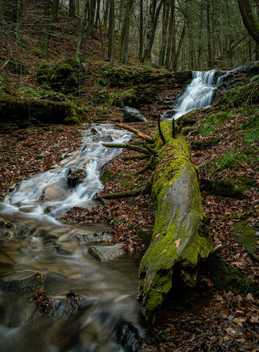
At approximately 1.25 miles into the hike you will reach a small grotto like waterfall. Just down stream will be another small waterfall with a somewhat slide down into the large pool. I was impressed how much this area changed as far as the downed moss covered trees that had moved since my previous visit. The final waterfall will be at just over 1.5 miles into the hike, this my favorite waterfall and cascade of the hike.
As you continue down Scar Run, you will bypass several small cascades and pools that may be good for native fishing. Near the bottom you will see some cabins and may begin hearing traffic on Route 87, you will want to work your way left or west away from the run and meet up with Scar Run Trail.
Scar Run Trail is blazed red, but the blazes are faint. This trail will loop you back up Scar Run but keeping you high above the run. The trail will eventually lead you to a power line and follows the opening up that can be somewhat difficult to follow. Stay in the powerline opening and look for the double blazed tree to leave the powerline at 41.46507, -76.62780.
Follow Scar Run Trail and as it gets close to the right branch of the run, pick your best route to get back to the old grade you started on and return back to the parking area off of Coal Mine Road.
Parking
There is a small pull-off just off Coal Mine Road at a gated forest road which is open during hunting season (41.464043, -76.610064). Winter weather conditions could make this start point inaccessible and it is possible to start this hike from the bottom at Route 87, but I'm unsure of the parking.Hiking Scar Run
Start this hike by following the forest road away from Coal Mine Road, but you will leave the road almost immediately. As the road bears to the right, look for an old grade off to the left. The hike will follow this grade and at about 0.7 of a mile you will reach the confluence of the two branches of Scar Run. The left branch has a couple waterfalls and a small stone campfire ring just above where it meets with the right branch. It does not appear the site is used much.The next part of hike is the most beautiful and difficult. There is an old grade that follows down Scar Run, however it has eroded away in places and there are several spots of trees down. Descending along Scar Run is a combination of hiking the grade, making water crossings and navigating around and through downed trees. There is also likely to be an abundance of stinging nettle to deal with in the summer months.
At approximately 1.25 miles into the hike you will reach a small grotto like waterfall. Just down stream will be another small waterfall with a somewhat slide down into the large pool. I was impressed how much this area changed as far as the downed moss covered trees that had moved since my previous visit. The final waterfall will be at just over 1.5 miles into the hike, this my favorite waterfall and cascade of the hike.
As you continue down Scar Run, you will bypass several small cascades and pools that may be good for native fishing. Near the bottom you will see some cabins and may begin hearing traffic on Route 87, you will want to work your way left or west away from the run and meet up with Scar Run Trail.
Scar Run Trail is blazed red, but the blazes are faint. This trail will loop you back up Scar Run but keeping you high above the run. The trail will eventually lead you to a power line and follows the opening up that can be somewhat difficult to follow. Stay in the powerline opening and look for the double blazed tree to leave the powerline at 41.46507, -76.62780.
Follow Scar Run Trail and as it gets close to the right branch of the run, pick your best route to get back to the old grade you started on and return back to the parking area off of Coal Mine Road.