The Russian Fort Elizabeth Loop at the Russian Fort Elizabeth State Historical Park (Pa'ula'ula) in Waimea, Hawaii (Kauai) is an easy 0.7-mile loop hike brings visitors around and through 19th-century Russian fort.
Hike Description
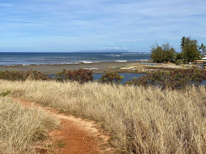
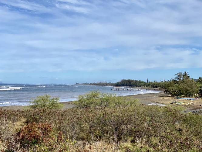
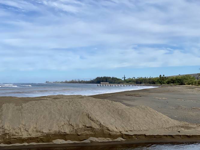
This hike begins at the parking lot and heads towards the old fort - which essentially looks like a 7-foot lava rock wall. The trail leads to the western side of the fort where hikers first get a nice view of the mouth of the Waimea River as it spills into the Pacific Ocean in addition to the island of Ni'ihau offshore. Here is also where the trail heads directly into the fort, between a break in the fort's rock walls.
Inside the fort is nothing special, but hikers get a better feel for what the fort's "star shape" looks like from within. There's a large pole sticking out of the ground around what appears to be a mound. This looks like a very old flag pole of sorts. The trail then leads up the rock wall and over it, extending the walk over to the Waimea River once again.
After visiting the shoreline, the trail meanders south - leading to the ocean, but there's nothing to find down there. During my hike in June 2022, there was at least one homeless person's camp down here - he had a dog and his dog was protecting him - I felt like an intruder in someone else's home, so I turned back. Please respect anyone who finds temporary shelter along this trail - leave them alone and please don't overcrowd what they consider their home.
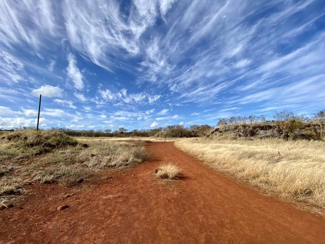
After checking out the southern section of the trail, I turned back toward the fort to complete the loop from the southern side up to the parking lot for ~0.7-miles in total length. For folks who wish to avoid the wooded area that leads to the ocean, feel free to skip that part to make for a shorter hike - closer to 0.4-miles total.
Parking
Hikers and visitors will find a large parking lot at the coordinates provided. The lot is large enough to fit a dozen vehicles or more, but it's generally pretty quiet and empty.
Pets
Dogs are allowed if leashed. Please clean up after your pet.
History
The Russian Fort Elizabeth was built in 1817 when Russia saw Hawaii as a critical point for trade across the Pacific. The Russians, at that time, were attempting to gain political influence within Hawaii's monarchy. This land was acquired by the State of Hawaii in 1972 to preserve the site, but also to allow the public to visit the fort and learn about the history. The fort itself is a mixture of Hawaiian construction and Russian design.
Respecting the Land
Hawaiian land is considered sacred to native Hawaiians and many locals, so please stay on-trail, take nothing but photos, and leave nothing but footprints. Respect the locals - don't stay for long and have a backup hike planned in case the parking lot is full.
Hike Description
This hike begins at the parking lot and heads towards the old fort - which essentially looks like a 7-foot lava rock wall. The trail leads to the western side of the fort where hikers first get a nice view of the mouth of the Waimea River as it spills into the Pacific Ocean in addition to the island of Ni'ihau offshore. Here is also where the trail heads directly into the fort, between a break in the fort's rock walls.
Inside the fort is nothing special, but hikers get a better feel for what the fort's "star shape" looks like from within. There's a large pole sticking out of the ground around what appears to be a mound. This looks like a very old flag pole of sorts. The trail then leads up the rock wall and over it, extending the walk over to the Waimea River once again.
After visiting the shoreline, the trail meanders south - leading to the ocean, but there's nothing to find down there. During my hike in June 2022, there was at least one homeless person's camp down here - he had a dog and his dog was protecting him - I felt like an intruder in someone else's home, so I turned back. Please respect anyone who finds temporary shelter along this trail - leave them alone and please don't overcrowd what they consider their home.
After checking out the southern section of the trail, I turned back toward the fort to complete the loop from the southern side up to the parking lot for ~0.7-miles in total length. For folks who wish to avoid the wooded area that leads to the ocean, feel free to skip that part to make for a shorter hike - closer to 0.4-miles total.
Parking
Hikers and visitors will find a large parking lot at the coordinates provided. The lot is large enough to fit a dozen vehicles or more, but it's generally pretty quiet and empty.
Pets
Dogs are allowed if leashed. Please clean up after your pet.
History
The Russian Fort Elizabeth was built in 1817 when Russia saw Hawaii as a critical point for trade across the Pacific. The Russians, at that time, were attempting to gain political influence within Hawaii's monarchy. This land was acquired by the State of Hawaii in 1972 to preserve the site, but also to allow the public to visit the fort and learn about the history. The fort itself is a mixture of Hawaiian construction and Russian design.
Respecting the Land
Hawaiian land is considered sacred to native Hawaiians and many locals, so please stay on-trail, take nothing but photos, and leave nothing but footprints. Respect the locals - don't stay for long and have a backup hike planned in case the parking lot is full.