The Rouge River Gateway Trail in Dearborn Michigan is an easy 1-mile out-and-back walk that features views of the Rouge River.
Note that this hike follows just a short section o the Rouge River Gateway Trail.
Hike Description
This hike begins on Michigan Ave and follows the paved and accessible trail as it heads east toward the Rouge River. Around mile 0.2, the trail bends northward and heads away from the main road, where you can walk through a more peaceful and quiet woodland setting.
Bridge Closed (Sept 2022) - Mile 0.35
At mile 0.35, there's a bridge that's closed, until further notice, as of September 2022. This bridge could have been used as a way to access the Rouge River waterfall if it were open (see notes below for additional waterfall access, or lack-there-of).
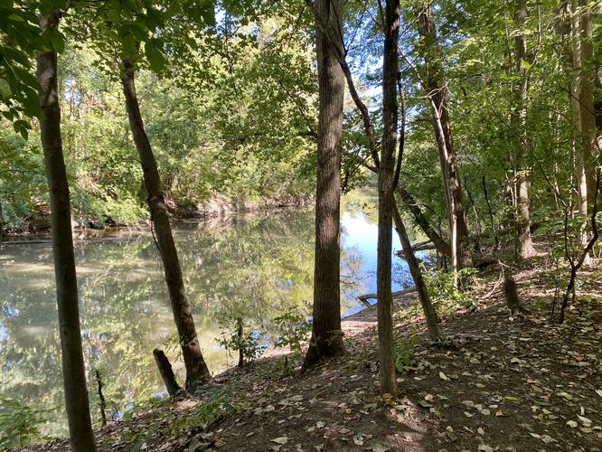
Rouge River Bridge - Mile 0.4
Around mile 0.4, hikers will reach a bridge that spans the Rouge River. Here, you can get a view of the water, albeit maybe it's not the prettiest view.
Waterfall Access Denied / Fence - Mile 0.52
The purpose of this hike, originally, was to try and locate the short waterfall that sits within the Rouge River just upstream from where this trail ends. According to OpenStreetMap tiles, a trail used to cut northwest from the bridge to reach the waterfall; however, I found out that this overgrown trail has a property fence that sits around mile 0.52 of this recording -- making it impossible to reach the waterfall from this route. If you wish to reach the waterfall, do not start at this trailhead.
Accessibility
The main trail, the Rouge River Gateway Trail is paved and fully accessible. Note that the off-shoot trails (near the bridge) in the GPS data provided are not paved or accessible, but considering there's nothing to see along them, that should not matter.
Parking
Hikers will find parking at the coordinates provided in a large lot that can fit about a dozen cars.
Pets
Dogs are allowed if leashed and their waste should be carried out by the hiker.
Biking
Biking is allowed along this trail.
Note that this hike follows just a short section o the Rouge River Gateway Trail.
Hike Description
This hike begins on Michigan Ave and follows the paved and accessible trail as it heads east toward the Rouge River. Around mile 0.2, the trail bends northward and heads away from the main road, where you can walk through a more peaceful and quiet woodland setting.
Bridge Closed (Sept 2022) - Mile 0.35
At mile 0.35, there's a bridge that's closed, until further notice, as of September 2022. This bridge could have been used as a way to access the Rouge River waterfall if it were open (see notes below for additional waterfall access, or lack-there-of).
Rouge River Bridge - Mile 0.4
Around mile 0.4, hikers will reach a bridge that spans the Rouge River. Here, you can get a view of the water, albeit maybe it's not the prettiest view.
Waterfall Access Denied / Fence - Mile 0.52
The purpose of this hike, originally, was to try and locate the short waterfall that sits within the Rouge River just upstream from where this trail ends. According to OpenStreetMap tiles, a trail used to cut northwest from the bridge to reach the waterfall; however, I found out that this overgrown trail has a property fence that sits around mile 0.52 of this recording -- making it impossible to reach the waterfall from this route. If you wish to reach the waterfall, do not start at this trailhead.
Accessibility
The main trail, the Rouge River Gateway Trail is paved and fully accessible. Note that the off-shoot trails (near the bridge) in the GPS data provided are not paved or accessible, but considering there's nothing to see along them, that should not matter.
Parking
Hikers will find parking at the coordinates provided in a large lot that can fit about a dozen cars.
Pets
Dogs are allowed if leashed and their waste should be carried out by the hiker.
Biking
Biking is allowed along this trail.