The Jackson Trail at Rothrock State Forest in State College, Pennsylvania is a moderate 4.4 mile out-and-back hike that leads to the Mid State Trail atop a mountain ridge and features views along the way, like at David's Vista.
Hike Description
The hike begins along S Water Rd and follows the yellow blazes of the Jackson Trail heading east. The Jackson Trail eventually turns to a mostly-rocky path which can be really difficult to hike on for long periods of time as hikers will want to watch their step to ensure they don't roll an ankle.
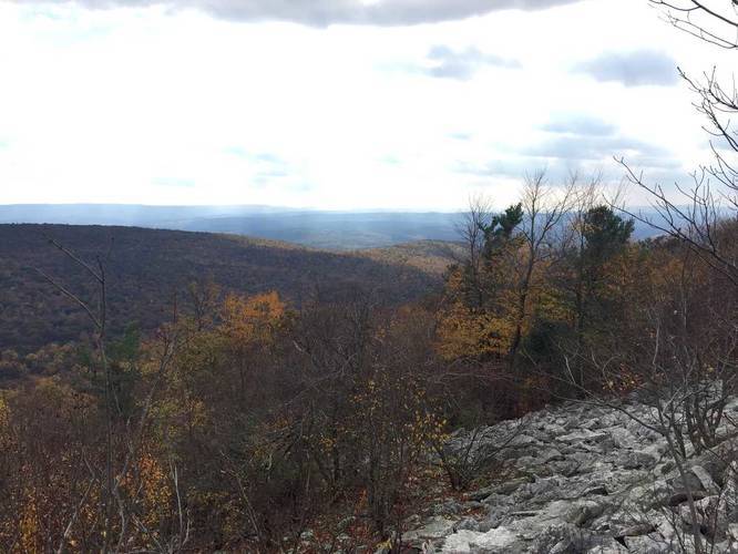
David's Vista - Mile 0.77
Around mile 0.77 from the trailhead is a vista point called David's Vista with sweeping views facing south. David's Vista isn't the only view along this trail, though, so hikers may want to continue hiking east to get even more views from the mountain ridge.
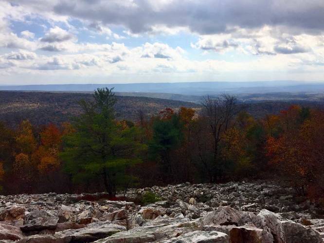
Vista - Mile 1.35
After hiking along more exposed rock, hikers will reach yet another vista around mile 1.35. Here, hikers will get more views facing south along rock fields.
Rocky Mountain Spine - Mile 2.1
Around mile 2.1, just before this track ends, the trail will narrow even more to a point where hikers will be walking on the spine of the mountain's bedrock. This is a really cool spot to turn around if you don't plan to hike any further.
Parking
Hikers will find parking across the street from the trailhead. The lot is large enough to fit a dozen vehicles.
Camping & Backpacking
Dispersed / primitive / backcountry camping is allowed off of this trail, but all state forest rules must be followed. Camping is allowed within 25 feet off of the trail and dogs are allowed. Great views, but the rocks on the trail make this hike a challenge. Trekking poles may come in handy here.
Pets
Dogs are allowed if leashed and their waste should be carried out by the hiker.
Hike Description
The hike begins along S Water Rd and follows the yellow blazes of the Jackson Trail heading east. The Jackson Trail eventually turns to a mostly-rocky path which can be really difficult to hike on for long periods of time as hikers will want to watch their step to ensure they don't roll an ankle.
David's Vista - Mile 0.77
Around mile 0.77 from the trailhead is a vista point called David's Vista with sweeping views facing south. David's Vista isn't the only view along this trail, though, so hikers may want to continue hiking east to get even more views from the mountain ridge.
Vista - Mile 1.35
After hiking along more exposed rock, hikers will reach yet another vista around mile 1.35. Here, hikers will get more views facing south along rock fields.
Rocky Mountain Spine - Mile 2.1
Around mile 2.1, just before this track ends, the trail will narrow even more to a point where hikers will be walking on the spine of the mountain's bedrock. This is a really cool spot to turn around if you don't plan to hike any further.
Parking
Hikers will find parking across the street from the trailhead. The lot is large enough to fit a dozen vehicles.
Camping & Backpacking
Dispersed / primitive / backcountry camping is allowed off of this trail, but all state forest rules must be followed. Camping is allowed within 25 feet off of the trail and dogs are allowed. Great views, but the rocks on the trail make this hike a challenge. Trekking poles may come in handy here.
Pets
Dogs are allowed if leashed and their waste should be carried out by the hiker.