This section of the Rotary Centennial Trail in Benton, Maine is an easy 1.7-mile out-and-back hike that features a peaceful walk through the woods alongside the Kennebec River and ends along the river banks before heading back to parking.
Private Property
This trail runs adjacent to private property. Please stay on the trail and respect land owner's privacy and rights.
Hike Description
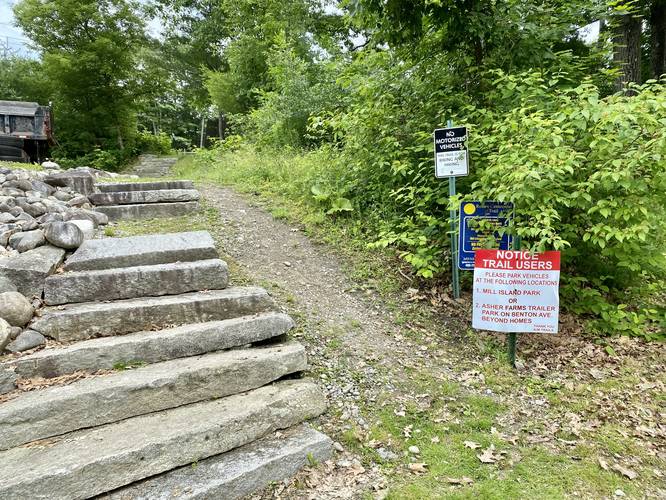
This trail technically starts along Crummet Street right next to a private property - signage can be found for the trail along with a staircase that follows the trail uphill adjacent to the private property. This track starts at the parking lot, located at the corner of Crummet St and Bridge St in Benton, Maine and follow Crummet Street south to the trailhead.
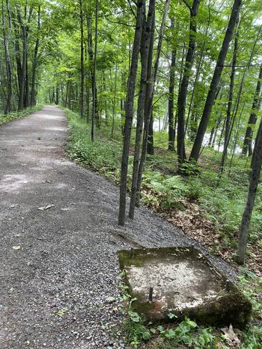
The trail then heads south, passing more private property fence-lines, before reaching a larger sign for the Rotary Centennial Trail. Here, the trail becomes more secluded and quiet as it follows an old railroad bed that runs parallel to the Kennebec River.
This track ends about 0.9-miles from the start of the recording, located not very far down the trail, but makes for a short 1.7-mile out-and-back hike.
Parking
Parking can be found at the coordinates provided and the lot is large enough to fit over a dozen vehicles.
History
This trail is located on the old railroad bed of the Penobscot & Kennebec Railroad. This segment of the line, from Waterville to Benton, was in operation from 1853 until 1918 when the present trestle up river in Fairfield, Maine was completed.
Pets
Dogs are allowed if leashed and their waste should be carried out by the hiker.
Private Property
This trail runs adjacent to private property. Please stay on the trail and respect land owner's privacy and rights.
Hike Description
This trail technically starts along Crummet Street right next to a private property - signage can be found for the trail along with a staircase that follows the trail uphill adjacent to the private property. This track starts at the parking lot, located at the corner of Crummet St and Bridge St in Benton, Maine and follow Crummet Street south to the trailhead.
The trail then heads south, passing more private property fence-lines, before reaching a larger sign for the Rotary Centennial Trail. Here, the trail becomes more secluded and quiet as it follows an old railroad bed that runs parallel to the Kennebec River.
This track ends about 0.9-miles from the start of the recording, located not very far down the trail, but makes for a short 1.7-mile out-and-back hike.
Parking
Parking can be found at the coordinates provided and the lot is large enough to fit over a dozen vehicles.
History
This trail is located on the old railroad bed of the Penobscot & Kennebec Railroad. This segment of the line, from Waterville to Benton, was in operation from 1853 until 1918 when the present trestle up river in Fairfield, Maine was completed.
Pets
Dogs are allowed if leashed and their waste should be carried out by the hiker.