Loading...

WINTER SALE! 50% OFF Supporter Accounts — now through January 31st. Learn More.

Rosy Mound Natural Area Trail

The Rosy Mound Natural Area Trail at the Rosy Mound Natural Area in Grand Haven, Michigan is a moderate 1.5-mile out-and-back trail that features beautiful vistas of Lake Michigan.

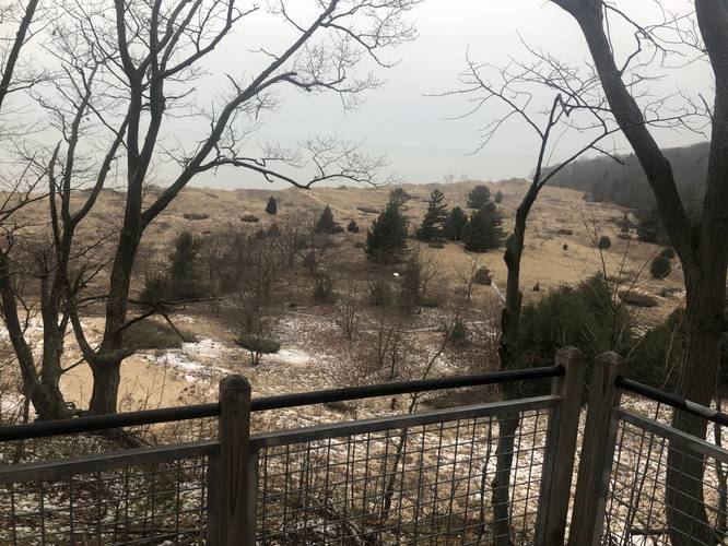
This trail begins at the parking lot and follows the main trail west, along the main trail that leads further into the natural area. Hikers will pass a forest overlook vista point, a slightly-obstructed vista of Lake Michigan, and finally the last vista point of Lake Michigan along the shores at the end of the trail.

Hikers can choose to head back to parking for a 1.5-mile out-and-back hike or continue north along another trail at the park (not shown in this GPS track).

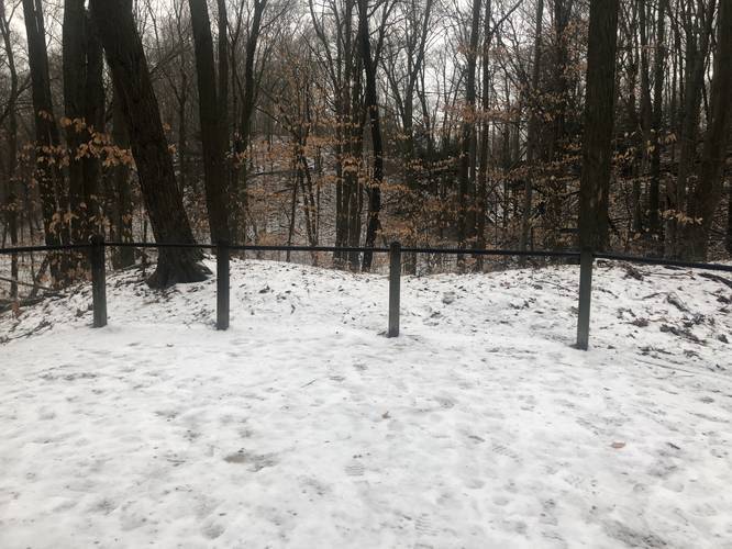
The difficulty for this hike is easy to moderate, but there is a series of staircases along two hillsides to reach the shores of Lake Michigan. These stairs can be steep for some hikers based on skill level or disabilities, hence the moderate rating.

Fees
Hikers must pay a fee between Memorial Day and Labor Day. More information can be found at https://miottawa.org/Parks/rosymound.htm.

Parking
Parking is located at the coordinates provided and the lot is large enough to accommodate a few dozen vehicles.

Pets
Dogs are not allowed at Rosy Mound Natural Area. Only leader dogs for persons with disabilities are permitted.
Explore 16 trails near Grand Haven, MI

Know Before You Go

  • Rosy Mound Natural Area Trail is a 1.5-mile out-and-back trail in Grand Haven, MI, offering scenic Lake Michigan views.
  • The trail is rated easy to moderate due to staircases on hillsides leading to the lake.
  • Fees apply between Memorial Day and Labor Day, and dogs are prohibited (except for leader dogs).
Interactive topographic map for Rosy Mound Natural Area Trail located in Grand Haven, MI. Click the "View Map" button to load GPS coordinates and trail markers.
Get directions
Distance
1.5 mi
Difficulty
Moderate
Type
Out-and-Back
Est. Time
45 min
Elev. Gain
280'
Rating
0.0
Added
January 15, 2020
Updated
February 04, 2020

Weather Forecast

Loading...
Total Change
85'
Ascent
280'
Descent
280'
Loading...

Download the GPX Data for Offline Use

Supporters get exclusive access to download trail routes to the MyHikes app for offline use. Stay prepared on your adventure, even without an internet connection! Become a Supporter today to unlock this feature and hike with confidence.

Download Rosy Mound Natural Area Trail GPX Data to the MyHikes Mobile App

Features

Vista / Lookout Point

Points of interest

  1. Parking

    43.020918, -86.222479
  2. Main Trailhead

    43.02084, -86.222343
  3. Forest overlook

    43.019494, -86.226961
    Forest overlook
  4. Vista of the Rosy Mound Recreation Area and Lake Michigan

    43.019967, -86.230514
    Vista of the Rosy Mound Recreation Area and Lake Michigan

Safety information

For your own safety: plan ahead, let someone know where you'll be, and hike at your own risk.

Hazards

Poison Ivy or Poison Oak

Availability

All seasons

Surface type

Dirt

Trip Reports (Reviews)

Your opinion matters! Be the first to rate this trail.

Ready to help fellow hikers? Add a trip report to share your experience and provide valuable insights for other hikers!

No community routes found. To add your own hike as a Community Route for this Trail guide, leave a Trip Report with an attached GPX file.

Popular categories

Scenic mountain view representing vista trails
Vista trails
Scenic gorge of cascades representing waterfall trails
Waterfall hikes
Rugged mountain terrain representing summit trails
Summit trails
Scenic mountain view representing dog-friendly trails
Dog-friendly
Scenic campsite with a view representing camping trails
Camping trails
Appalachian Trail logo representing A.T. hikes
A.T. hikes

You May Also Like

Colorado's Million Dollar Highway - Plan a day's drive adventure along the iconic Million Dollar Highway in Colorado. Explore the best short trails, roadside stops, waterfalls, vistas, ghost towns, and hot springs within a ~6 hour road trip.
Explore

Colorado's Million Dollar Highway

Plan a day's drive adventure along the iconic Million Dollar Highway in Colorado. Explore the best short trails, roadside stops, waterfalls, vistas, ghost towns, and hot springs within a ~6 hour road trip.

Read
Glacier's Going-to-the-Sun Road - Discover the breathtaking beauty of Glacier National Park along the iconic Going-to-the-Sun Road. From stunning roadside stops to picturesque waterfalls and vistas, this engineering marvel offers endless opportunities for exploration.
Explore

Glacier's Going-to-the-Sun Road

Discover the breathtaking beauty of Glacier National Park along the iconic Going-to-the-Sun Road. From stunning roadside stops to picturesque waterfalls and vistas, this engineering marvel offers endless opportunities for exploration.

Read
🍪 We use cookies to learn about site usage and to serve map tiles. You may block cookies manually in the browser. By continuing you agree. Learn more