The Rising Sun Trail at Glacier National Park near Saint Mary, Montana is an easy 0.8-mile out-and-back hike that features several views of alpine mountains, the Golden Staircase, and the crystal-clear water of Saint Mary Lake.
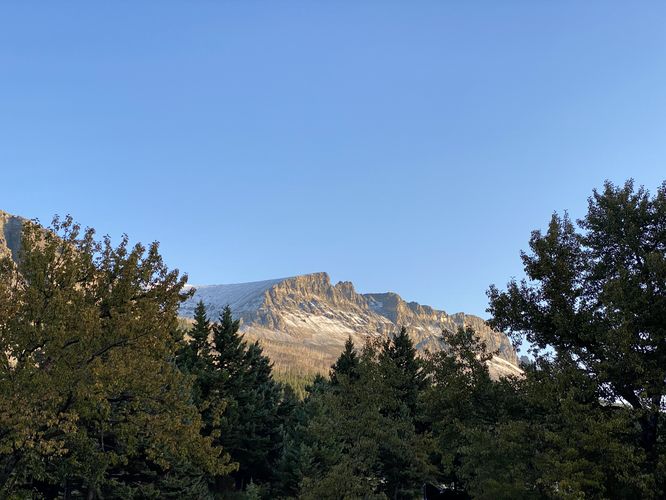
The trail then leads to an eastern parking lot, which appears to be used as an overflow lot or for park maintenance. This route ends at the edge of the forest where you'll find a view of Singleshot Mountain hanging overhead. The trail then leads back to the western parking lot following the same path you hiked eastward on. If you wish to enjoy the views once more you can stop along the shore of Saint Mary Lake on your way out. The hike is over at 0.8-miles at the western parking lot.
Hiking the Rising Sun Trail
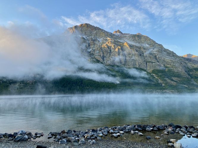
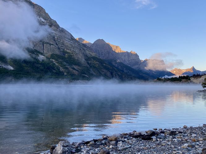
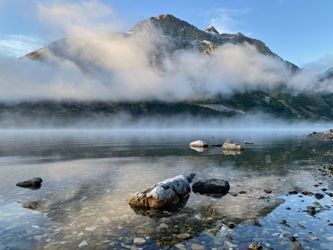
This short but scenic hike begins at the Rising Sun boat launch located at the large parking lot at the coordinates provided. Hikers will find a trailhead sign on the southeast side of the parking lot where the path leads through the forest heading east. Along the way, you'll find several off-shoot trails that lead to the shore of Saint Mary Lake. Views to the west include the Golden Staircase, Red Eagle Mountain, and a plethora of other alpine mountains that line the lake or sit off in the distance far beyond the water's boundaries. The trail continues through the forest and crosses Rose Creek around mile 0.25 where hikers will find a bridge that spans the water. On the east side of Rose Creek, located around mile 0.4 is the last shore side view of Saint Mary Lake. Here, you can find crystal-clear water with colorful rocks that sit at the bottom of the lake -- here you'll find a great place to take photos of the colorful rocks in the water, the lake, and Red Eagle Mountain's alpine ramparts towering overhead.The trail then leads to an eastern parking lot, which appears to be used as an overflow lot or for park maintenance. This route ends at the edge of the forest where you'll find a view of Singleshot Mountain hanging overhead. The trail then leads back to the western parking lot following the same path you hiked eastward on. If you wish to enjoy the views once more you can stop along the shore of Saint Mary Lake on your way out. The hike is over at 0.8-miles at the western parking lot.