Loading...

WINTER SALE! 50% OFF Supporter Accounts — now through January 31st. Learn More.

Ridge Trail

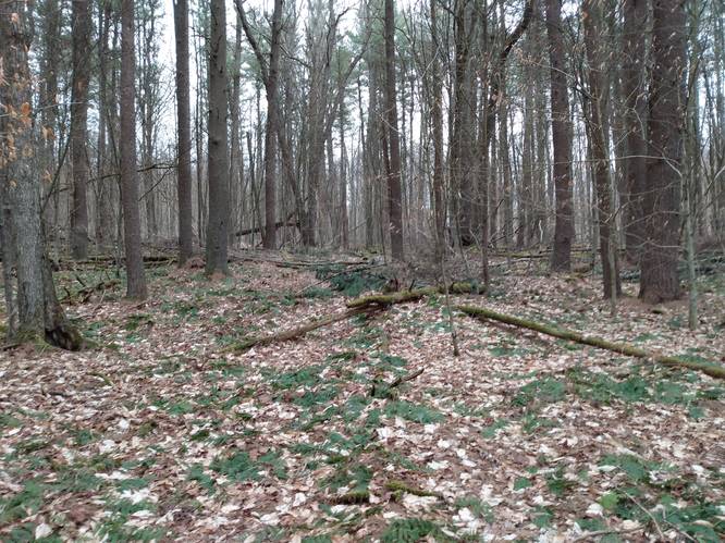
The Ridge Trail near Austin Dam Memorial Park in Austin, Pennsylvania is a moderate 2-mile trail to connect the Austin Dam Memorial Park to the Odin Hoxie Trail. This hiking trail transverses across the eastern ridgeline above the Austin Dam Memorial Park to the northeast to the junction with the Odin Hoxie Trail.  A favorite of this hike is a side-hill slope journey through an impressive stand of old-growth pine at the woodland draft on the hillside across the highway parking turnout.

Trails
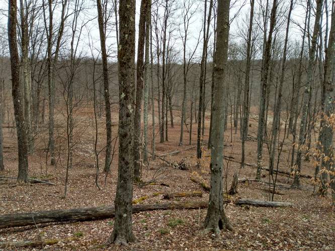
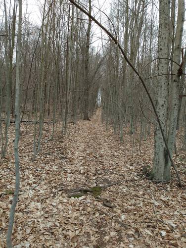
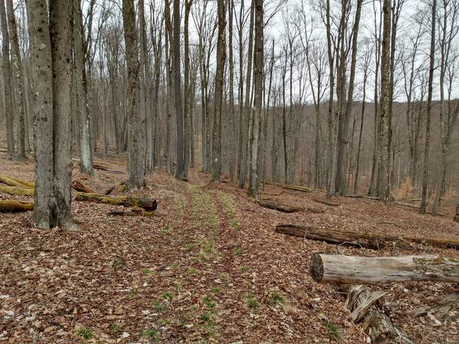
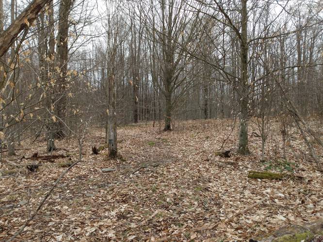
The northern terminus of this hiking trail begins on the ridgeline at the junction with the the Odin Hoxie Trail. The northern section of this track generally follows the ridgeline and treks along state forest boundary lands (borders blazed with white) that are adjoined by private land to the east and to south on this boundary. This tracks follows on a gradually ascending and descending ridgeline that leads to southwest and finishes through an old-growth pine forest as the hiker descends from the high ridge to the parking area along PA Route 872 just north of the Austin Dam Memorial Park.

At the time of this initial publishing, a suitable footpath through an old-growth pine forest is yet to be defined. Additional scouting hikes are needed to track this section of the hike. At it stands, the hike from the southern terminus at the parking area along PA Route 872 up to the ridgeline terminus shown on the map should be considered to be a scramble for a one-half-mile-ascent following the pine forest woodland draft to the ridgeline pathway. Note that the total mileage here (approx. 2-miles) includes this scramble section that was left out of the GPS track.

Parking
Hikers can find parking at the coordinates provided; next to the trailhead, along PA Route 872about one-half-mile north of the Austin Dam Memorial Park. This Ridge Trail connects to the Odin Hoxie Trail.

Pets
Dogs are allowed if leashed.

Camping
Camping is permitted in Austin Dam Memorial Park and also on the state forest lands (borders blazed with white). No suitable campsites were identified along this short connector trail. For dispersed and primitive camping in other areas of the state forest, please follow the state forest rules and regulations and only camp on state lands.

Private Land
The northern section of this trail treks along state forest boundary lands (borders blazed with white) that are adjoined by private land to the east and to south on this boundary. Please respect the land owners and stay on the trail at all times.

Explore 96 trails near Austin, PA

Know Before You Go

  • The Ridge Trail is a 2-mile moderate hiking trail in Austin, PA, connecting Austin Dam Memorial Park and Odin Hoxie Trail.
  • The trail features a ridgeline walk, borders state forest and private land (respect boundaries), and includes a potentially difficult scramble through an old-growth pine forest.
  • Parking is available near the trailhead on PA Route 872, and camping is permitted in Austin Dam Memorial Park and on state forest lands, but not specifically along the Ridge Trail.
Interactive topographic map for Ridge Trail located in Austin, PA. Click the "View Map" button to load GPS coordinates and trail markers.
Get directions
Distance
2.0 mi
Difficulty
Easy
Type
One-Way
Est. Time
1 hrs
Elev. Gain
362'
Rating
0.0
Added
March 22, 2022
Updated
March 25, 2022

Weather Forecast

Loading...
Total Change
152'
Ascent
362'
Descent
236'
Loading...

Download the GPX Data for Offline Use

Supporters get exclusive access to download trail routes to the MyHikes app for offline use. Stay prepared on your adventure, even without an internet connection! Become a Supporter today to unlock this feature and hike with confidence.

Download Ridge Trail GPX Data to the MyHikes Mobile App

Features

Dogs
Mountain Summit
PA Wilds logo PA Wilds

Points of interest

  1. Parking

    41.669885, -78.088566
  2. Main Trailhead

    41.673365, -78.083171
  3. Open Forest (Private)

    41.680835, -78.069758
    Open Forest (Private)
  4. Top Of Pine Grove Draft

    41.673351, -78.083123
    Top Of Pine Grove Draft

Safety information

For your own safety: plan ahead, let someone know where you'll be, and hike at your own risk.

Markers

Blaze Color

White

Availability

Spring, Summer, Fall

Surface type

Dirt

Trip Reports (Reviews)

Your opinion matters! Be the first to rate this trail.

Ready to help fellow hikers? Add a trip report to share your experience and provide valuable insights for other hikers!

No community routes found. To add your own hike as a Community Route for this Trail guide, leave a Trip Report with an attached GPX file.

Popular categories

Scenic mountain view representing vista trails
Vista trails
Scenic gorge of cascades representing waterfall trails
Waterfall hikes
Rugged mountain terrain representing summit trails
Summit trails
Scenic mountain view representing dog-friendly trails
Dog-friendly
Scenic campsite with a view representing camping trails
Camping trails
Appalachian Trail logo representing A.T. hikes
A.T. hikes

You May Also Like

New York's Best Waterfalls - Whether you're planning a day hike, roadside stop, or a leisurely short walk, this guide provides hikers, travelers, and locals alike with 63 different locations to over 100 scenic waterfalls to help plan your next adventure!
Explore

New York's Best Waterfalls

Whether you're planning a day hike, roadside stop, or a leisurely short walk, this guide provides hikers, travelers, and locals alike with 63 different locations to over 100 scenic waterfalls to help plan your next adventure!

Read
🍪 We use cookies to learn about site usage and to serve map tiles. You may block cookies manually in the browser. By continuing you agree. Learn more