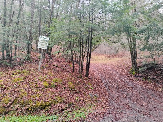
Update (November 27, 2024): At the Odin Hoxie trailhead on South Woods Road, the trailhead sign is missing (appears to have been damaged during roadside brush clearing activities over the summer). There is an alternate trailhead entry point with "TREES NOT TRASH" signage located about 200 feet south of the damaged sign to indicate where this trail also intersects onto the South Woods Road. Once on the alternate trailhead, the hiker begins the hike in a mostly westward direction along the pathway for about 500 feet and then bears to right to connect to the the Odin Hoxie Trail that continues to the northwest. This alternate entry pathway is easy to follow, and allows the hiker to bypass some of the trailhead springs, that cause the trailhead area to be wet where the missing Odin Hoxie Trailhead sign once stood.
Original Trail Notes (December 13, 2021): Back in an earlier time, when almost everyone traveled by foot or on horseback, the Odin Hoxie Trail came to be. This was likely more than a hundred-and-fifty years ago. The good news is this old footpath is still here and it can be hiked on still yet today.
The Odin Hoxie Trail in the Susquehannock State Forest lands near Austin, Pennsylvania is a moderate 4.3-mile one-way trek and can be hiked as an out-and-back for a total of 8.6-miles. The western terminus of this trail is on the highway State Route 872, near the village of Odin. This out-and-back hike begins and ends on the eastern terminus along the low-volume South Woods Road in Homer Township -- maybe, once presumably called Hoxie. In fact, the old F. W. Beers Map of Potter Co., Penna. made by J.W. Vose & Company had Hoxie Run as the name of dell in this area. The trail transverses over a wooded ridgeline, and treks along on a rather well taken care of pathway so that the modern-light-footed traveler can have a joyous journey from one small dell to another.
Trails
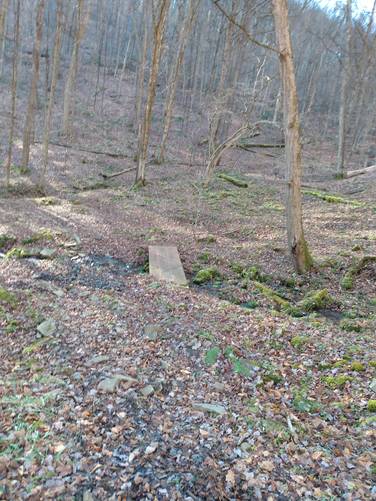
This out-and-back starts along a small creek known as South Woods Branch, a tributary to the First Fork Sinnemahoning Creek. There is a sign marker "ODIN HOXIE TRAIL" to indicate where the trail intersects onto the South Woods Road. There is a turn-out suitable for parking along the east-side of South Woods Road about 300 feet north of the trail marker. At the entrance, from the South Woods Road for about 500 feet, the trail starts off wet and soggy. There are a few springs here, that cause the area to be wet. This lower end on the trail could benefit from some better drainage and clearing of some brush at the entrance to the trail, but it is only for a short distance until the conditions improve. Some of the poor trail conditions are likely just mostly due to lack of use nowadays.
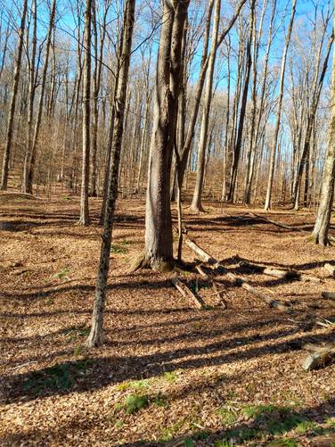
After the soggy bottom start, a more agreeable Treadway soon begins on the ascend up the woodland draft for the distance of about one-mile to the hilltop above the Baker Hollow. Once atop, the hiker continues in a mostly northward direction along a forested trail that transverses across the mostly-flat ridgeline. The hardwood forest is scenic along the way. Along the ridgeline, the trek follows along the State Forest boundary which appears to be an multi-use trail. The out-bound track finishes on descend down another woodland draft for about a distance of one-mile from the hilltop to the western terminus on the highway State Route 872. The hiker opted here to simply turn around and hike back to the starting point and complete the out-and-back.
And a note about trail blaze markings along the way. There are a variety. Along the way there are Red Dots (Multi-use Footpath), and Blue Bars (Horse Trail) and also White Dots (State Forest Boundary) Markers. On the western section of the trail, there are only red dots, which are faded and sparsely spaced, and can be somewhat difficult to follow. Be careful and prepared to hike this section. Hikers should bring an offline tracker, a physical map, and be prepared to understand how to traverse the topography in order to prepare for this part of the hike.
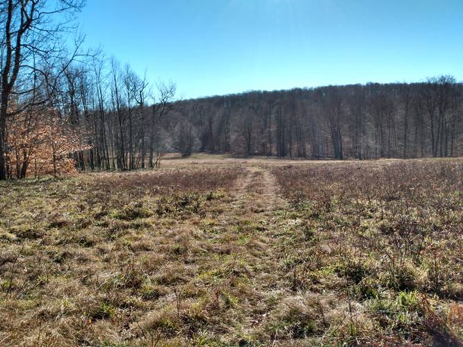
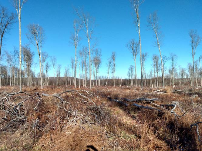
Considerable clear cutting on the State Forest lands has been done to large sections on the ridges between the hilltops at the head of Baker Hollow that detracts from the over-all beauty of these woods. The Odin Hoxie Trail is laid out so as to mostly avoid the clear-cut sections, which have a thick regrowth of brush and briars and are difficult to walk through. There is an about one-quarter mile section that crosses the regrowth from about the 3 miles mark to 3.2 miles on the out-bound (heading west) leg going from the eastern terminus on South Woods Road. This briary section is about 1 mile east of the western terminus of this trail on the highway State Route 872. Hiking through this part of the trail is not too-bad and can be walked across without too much trouble as the briars are short and sparse on the pathway. Long-pants for hiker wear is recommended.
In the section below, there is a description of Active Forest Management in use on the State Forest Lands.
Length and Difficulty
The difficulty should be considered moderate because of the elevation gain along the path. Also, some experience hiking on imperfectly marked trails is needed and as well as how to traverse terrain using topographic maps.
This hike begins and ends on the eastern terminus along the low-volume South Woods Road in Homer Township. There is a turn-out suitable for parking along the east-side of South Woods Road about 300 feet north of the trail marker.
Pets
Dogs are allowed if leashed.
Camping
Camping is permitted on the state forest lands (borders blazed with white). For dispersed and primitive camping in the state forest, please follow the state forest rules and regulations and only camp on state lands. An open forest area about the mile up the woodland draft above the eastern terminus along South Woods Road, appears to provide the best camping opportunity.
Soon to be published alert issued! Be on careful watch, and check back here soon, for some very important information regarding a hidden camping spot near this very trail, within a short spur hike, to a campsite that is sure to knock your hiking socks off. It has been explored by and charted on by yours truly, Oliver Phineas, on an earlier life journey.
Private Land
This trail borders along some private land adjoining to the state forest on top of the ridges. Please respect the land owners and stay on the trail at all times.
Water Source
Hikers can use water filters along the adjacent South Woods Branch and several springs that flow into South Woods Branch from the lower end on the Odin Hoxie Trail draft near the intersection with South Woods Road.
Active Forest Management (In Theory)
Active forest management involves harvesting or cutting trees to create desired future conditions.
Because of the broad and sweeping logging practices in the early part of the twentieth century, much of Pennsylvania's forests contains mature trees that are all approximately the same age. In Pennsylvania's even-aged forests, small trees are usually about the same age as large ones; however these small trees may be of a different species, genetically inferior, or in a poor location. Diameter-limit cutting shifts species composition toward more valuable species that grow best with lots of light, and it may improve quality by retaining and promoting healthy trees. Such cutting increases future management options, speeds recovery following disturbance, and may increases seed sources for trees species better suited to the site.
Proactive forest management can also be used to reduce insect or plant threats by removing invasive species, and diseased or dead or dying beech, white ash and hemlock to improve forest health.