Rexford Falls in Sherburne, New York is a an easy to moderate 0.4-mile out-and-back hike that features the 40-foot tall waterfall known as Rexford Falls.
Hike Description
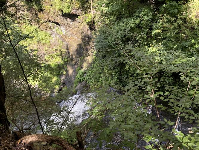
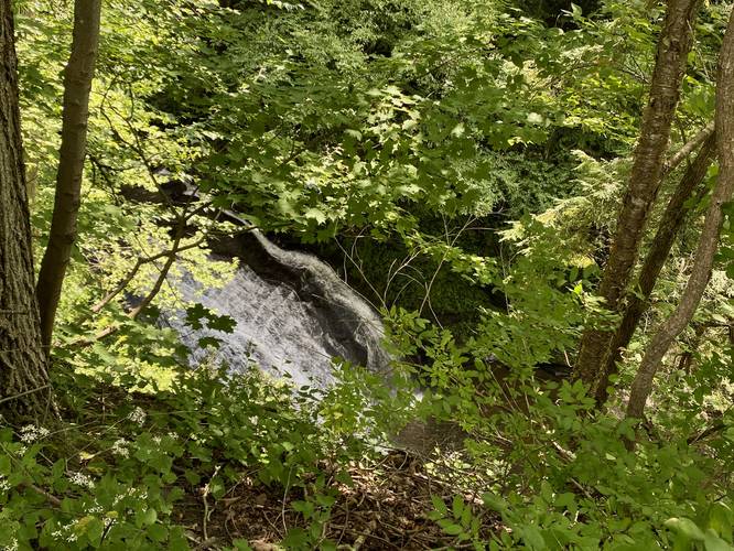
This hike begins at the northern parking lot for Rexford Falls, located on NY-80 at the coordinates provided and heads into the park, crossing the footbridge that crosses above Rexford Falls. Hikers should know that Rexford Falls is very difficult to see and photograph unless you're willing to hike down to the creek (following this trail) and then hike up the creek to reach the waterfall - which this hike does not include. For the average visitor, your best bet for viewing Rexford Falls is from the footbridge or from the northern banks near the pavilion (as depicted on the map).
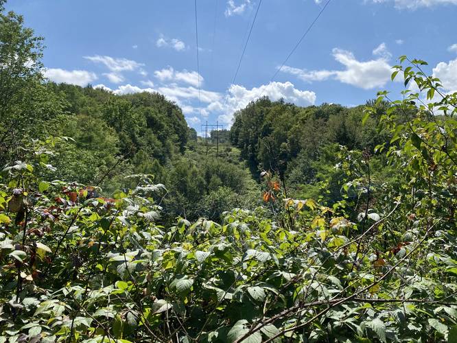
This trail is worth exploring due to the additional natural sights the park has to offer, like a vibrant green moss carpet that sits below a cool and dark pine forest - located on the south side of Rexford Falls Brook. The trail that leads down the ridge to reach the brook should be considered moderate if hiking it out-and-back. The trail features a "view" of the hills and powerlines and leads down to the brook. At the bottom of the trail is a small waterfall (did not photograph it) where hikers can also get down next to the creek banks.
Parking
Hikers will find parking on either side of the waterfall, but these parking coordinates will bring the hiker to the north side of Rexford Falls Brook.
Pets
Dogs are allowed only if leashed and should be cleaned up after.
Warning
Steep terrain: This trail and waterfall sit within a very steep gorge. Hikers should keep back at all times to prevent an accidental fall into the gorge, which could end in serious injury or worse.
Hike Description
This hike begins at the northern parking lot for Rexford Falls, located on NY-80 at the coordinates provided and heads into the park, crossing the footbridge that crosses above Rexford Falls. Hikers should know that Rexford Falls is very difficult to see and photograph unless you're willing to hike down to the creek (following this trail) and then hike up the creek to reach the waterfall - which this hike does not include. For the average visitor, your best bet for viewing Rexford Falls is from the footbridge or from the northern banks near the pavilion (as depicted on the map).
This trail is worth exploring due to the additional natural sights the park has to offer, like a vibrant green moss carpet that sits below a cool and dark pine forest - located on the south side of Rexford Falls Brook. The trail that leads down the ridge to reach the brook should be considered moderate if hiking it out-and-back. The trail features a "view" of the hills and powerlines and leads down to the brook. At the bottom of the trail is a small waterfall (did not photograph it) where hikers can also get down next to the creek banks.
Parking
Hikers will find parking on either side of the waterfall, but these parking coordinates will bring the hiker to the north side of Rexford Falls Brook.
Pets
Dogs are allowed only if leashed and should be cleaned up after.
Warning
Steep terrain: This trail and waterfall sit within a very steep gorge. Hikers should keep back at all times to prevent an accidental fall into the gorge, which could end in serious injury or worse.