The Redwood Grove Loop Trail at Henry Cowell Redwoods State Park near Felton, California is an easy 1-mile loop hike that features ancient redwood trees.
Trails
This hike follows one unnamed trail which leads to the named path, Redwood Grove Trail.
Hike Description
This trail begins at the main parking lot and follows an unmarked trail for 200-feet or so before reaching the trailhead for the Redwood Grove Trail (loop). Just before the trailhead is a cross-cut on display from one of the oldest redwood which was about 2,200-years old when it was cut in 1934. The cross-cut shows - very close to the center - that around year ~105 the Chinese had invented paper, amongst other interesting historical markers on the tree's rings.
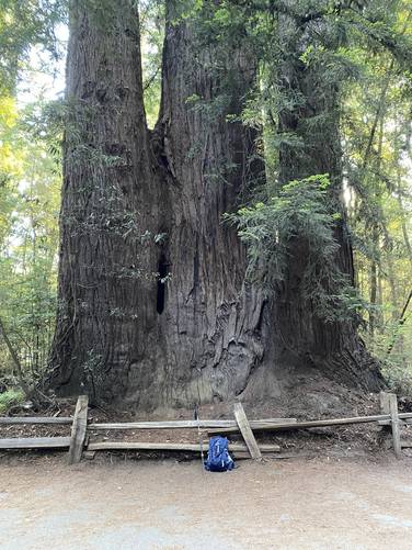
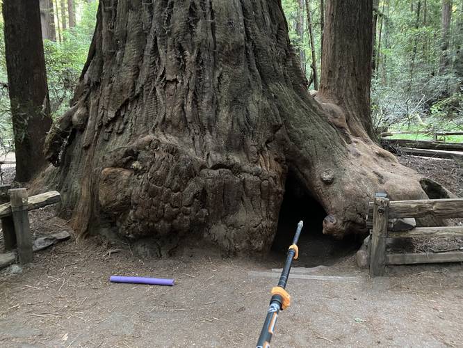
Just beyond the cross-cut section if a split redwood old-growth that has three towering trees that, when combined, have a trunk that appears to be about 20-feet wide at the base. Continuing to follow the loop, hikers will encounter more and more old-growth redwoods which are around 1,200-years old if not more.
Massive Ancient Redwood loop - Mile 0.45
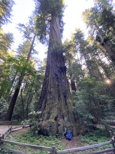
Around mile 0.45, hikers will reach a small loop in the trail where a massive ancient redwood towers over the trail. This towering tree can be seen in full view from down the trail.
Fremont Tree - Mile 0.55
Around mile 0.55, hikers will reach the Fremont Tree, dedicated to Lt. John C. Fremont who camped in this spot on February 25th, 1846 on an expedition to find the shortest route from the east coast to the west coast.
Prohibited
No dogs, no biking, no horses.
Parking & Fee
There's a small $10 entry fee for vehicles, as of May 2022. If you show up early, parking is abundant. Later in the day, parking may get tricky during certain times of the year as "no parking" signs are littered along the road where overflow usually occurs.
Trails
This hike follows one unnamed trail which leads to the named path, Redwood Grove Trail.
Hike Description
This trail begins at the main parking lot and follows an unmarked trail for 200-feet or so before reaching the trailhead for the Redwood Grove Trail (loop). Just before the trailhead is a cross-cut on display from one of the oldest redwood which was about 2,200-years old when it was cut in 1934. The cross-cut shows - very close to the center - that around year ~105 the Chinese had invented paper, amongst other interesting historical markers on the tree's rings.
Just beyond the cross-cut section if a split redwood old-growth that has three towering trees that, when combined, have a trunk that appears to be about 20-feet wide at the base. Continuing to follow the loop, hikers will encounter more and more old-growth redwoods which are around 1,200-years old if not more.
Massive Ancient Redwood loop - Mile 0.45
Around mile 0.45, hikers will reach a small loop in the trail where a massive ancient redwood towers over the trail. This towering tree can be seen in full view from down the trail.
Fremont Tree - Mile 0.55
Around mile 0.55, hikers will reach the Fremont Tree, dedicated to Lt. John C. Fremont who camped in this spot on February 25th, 1846 on an expedition to find the shortest route from the east coast to the west coast.
Prohibited
No dogs, no biking, no horses.
Parking & Fee
There's a small $10 entry fee for vehicles, as of May 2022. If you show up early, parking is abundant. Later in the day, parking may get tricky during certain times of the year as "no parking" signs are littered along the road where overflow usually occurs.