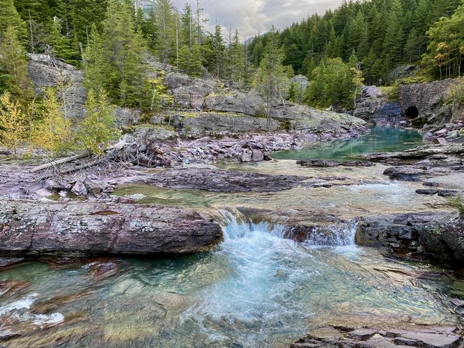
Red Rocks at Glacier National Park near West Glacier, Montana is an easy 0.1-mile out-and-back trail that leads to Redrock Falls and views of turquoise-colored pools within McDonald Creek.
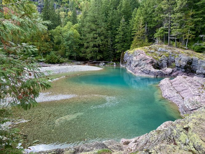
Just behind the overlook, if you head off-trail, you can walk out and on top of the red bedrock to find an even-better view of the turquoise-colored pools. This view of McDonald's Creek vibrant turquoise water is virtually unmatched at the park, especially with the juxtaposed red bedrock and surrounding evergreens. Due to this, Red Rocks is virtually always busy with visitors vying for a chance to take their own picture of this unique water feature.
Walk to Red Rocks
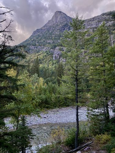
This short trail begins at the main parking lot for Red Rocks, located on the west side of Going-to-the-Sun Road and leads downhill to reach an overlook above McDonald Creek. On the way down the path, you'll pass an offshoot trail that leads to a bench with a view of the creek and nearby alpine slopes. From the end of the trail, at the overlook, you'll find Redrock Falls -- a very short but scenic waterfall that spills down the red-colored bedrock within McDonald Creek. Facing north (upstream) from the overlook includes more views of turquoise-colored water along with a dark tunnel carved under the Going-to-the-Sun Road. Surrounding the creek are evergreens that adorn the red-colored bedrock.Just behind the overlook, if you head off-trail, you can walk out and on top of the red bedrock to find an even-better view of the turquoise-colored pools. This view of McDonald's Creek vibrant turquoise water is virtually unmatched at the park, especially with the juxtaposed red bedrock and surrounding evergreens. Due to this, Red Rocks is virtually always busy with visitors vying for a chance to take their own picture of this unique water feature.