Loading...

Distance:
0.2 Miles / 0.3 km
Type:
Out-and-Back
Difficulty:
Easy
Time to Hike:
~6 minutes
Features:
Surface Type:
Dirt
Park:
Red River Gorge Geological Area
Town:
Pine Ridge, Kentucky
Directions:
37.802201, -83.591041
Added:
May 01, 2018
Updated:
May 01, 2018
Loading...
Loading...
37 '

Total Change
25 '

Ascent
27 '

Descent

This short 0.2 mile out-and-back recording is a short trail at Red River Gorge National Geological Area in Pine Ridge, Kentucky that leads out to two campsites and a little lookout point of the surrounding hills at the end of the trail.

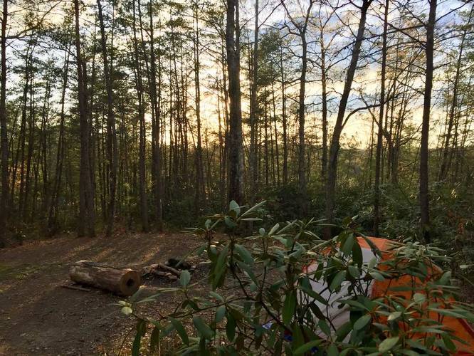
Parking can be found at the Rough Trail parking lot. The first campsite is visible from the parking lot, but there's a second campsite that sits further back hidden from view. You can fit at least two small tents in the campsite furthest back and you can fit at least 4 small tents in the first campsite.

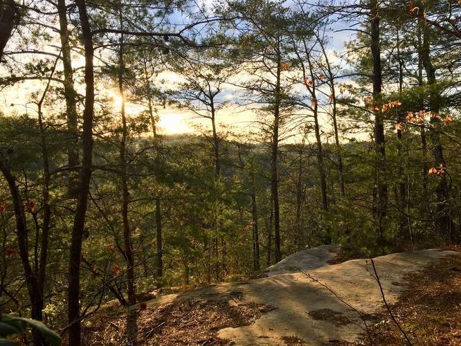
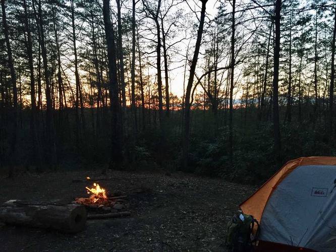
The lookout point at the end of the trail gives you a nice view of the sunset and after-sunset colors in the evening sky.

Camping permits required: Camping permits are required and can be purchased at local gas stations and other shops in the area. A 1-night pass will cost $3. You can also purchase 3-night passes.

Explore 6 trails near Pine Ridge, KY
  1. Parking

    37.802201, -83.591041
  2. Main Trailhead

    37.801752, -83.591046
  3. Campsite

    37.801536, -83.591858
    Campsite
  4. Obstructed vista point

    37.801434, -83.592355
    Obstructed vista point
  5. Campsite

    37.801486, -83.591872
    Campsite
No community routes found. To add your own hike as a Community Route for this Trail guide, leave a Trip Report with an attached GPX file.

Seasons

All

Photo Albums

2 Trip Reports

No Star-Ratings
Trail Guide By:
Admin user profile picture
0.2 miles / 0.3 km
Trail added
May 01, 2018
Hiked on
April 28, 2018
Updated on
May 01, 2018
0.2 miles / 0.3 km
April 28, 2018
Hiking

Weather Forecast

In Pine Ridge, KY

Explore Hiking Trails

New Hikes

West Rim Trail (Stony Brook)
0.7 Miles
1.1 km
Moderate
One-Way
Boulder Falls Trail
0.2 Miles
0.3 km
Moderate
Out-and-Back
Mary's Lake Trail
0.6 Miles
1 km
Easy
Out-and-Back
Lower Stony Brook Falls
0.2 Miles
0.3 km
Easy
Out-and-Back

Before you boogie...

Find our trail guides useful? Consider becoming a Supporter to unlock perks!

MyHikes is an indie platform that makes exploring public trails easier for everyone. The platform has no investors, runs no ads, and is owned and operated by one person, Dave Miller. Dave has personally mapped and written over 1,600 trail guides on MyHikes for the public to explore. As of 2024, MyHikes has helped over 1,300,000 outdoor enthusiasts plan their next adventure.

But it takes a lot of time 🕦, money 💰, and work, and espresso shots ☕ to run MyHikes, including hiking , mapping , writing , and publishing new trails with high-quality (accurate) information... along with software engineering (coding) the platform like building new features, site and mobile app development for iOS and Android, site maintainance . and much much more.

Supporters unlock website and mobile app perks with an annual one-time payment of $25 (you renew) 😎👍. Or you can simply make a Donation of your choice. Otherwise, you can support us by telling your friends about MyHikes - both quick and free 🎉

Admin user profile picture

Dave Miller
MyHikes Founder