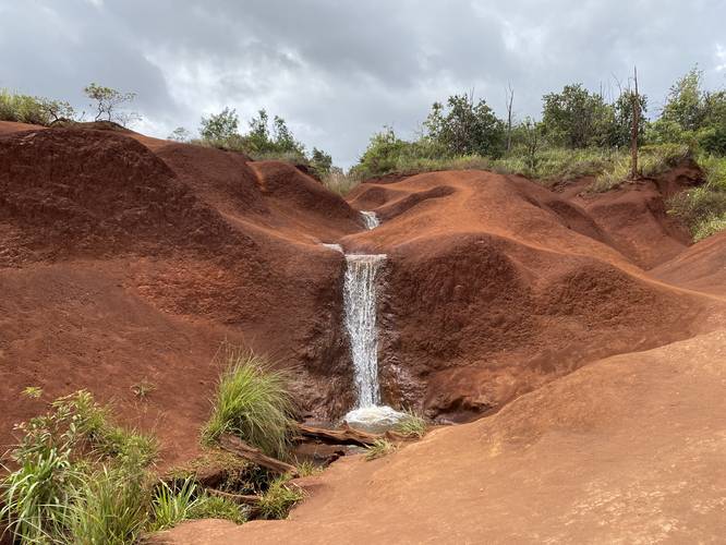
Red Dirt Falls at the Pu'u ka Pele Forest Reserve in Waimea, Hawaii (Kauai) is an easy 0.1-mile loop hike that features the scenic but small, Red Dirt Falls.
This short loop hike leads up alongside Red Dirt Falls, crossing above the main cascade, and heads down the west side of the stream. Red Dirt Falls has several cascades, but the main cascade is about 4 to 5 feet tall. The cascades above the main waterfall are between 2 - 3 feet tall or smaller, but regardless of its size, this waterfall is unique because of its location as its spills down ancient volcanic banks of Kauai's infamous red dirt.
Parking
Hikers will find parking along the road, but the spaces are limited and the road (as of June 2022) had a lot of drop-offs and missing chunks of asphalt, likely due to cars pulling off here. Please be respectful and only park if there's enough room.
Warning
Slippery terrain: Watch your steps along this trail, especially if visiting in shoes with minimal (or no) grip since the red dirt can be very slippery along some steep, but very quick-lasting terrain.
Respecting the Land
Hawaiian land is considered sacred to native Hawaiians and many locals, so please stay on-trail, take nothing but photos, and leave nothing but footprints. Respect the locals - don't stay for long and have a backup hike planned in case the parking lot is full.