Loading...

Distance:
0.1 Miles / 0.2 km
Type:
Out-and-Back
Difficulty:
Easy
Time to Hike:
~5 minutes
Features:
Surface Type:
Dirt
Park:
Crowes Pasture Conservation Area
Town:
Dennis, Massachusetts
Directions:
41.750589, -70.138043
Added:
April 04, 2023
Updated:
April 04, 2023
Loading...
Loading...
15 '

Total Change
15 '

Ascent
15 '

Descent

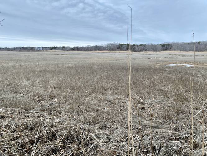
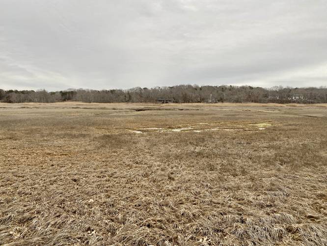
The Quivett Neck Creek Overlook at Crowes Pasture Conservation Area in Dennis, Massachusetts is an easy 0.1-mile out-and-back trail that leads to a bench and viewing area of the saltwater marsh and creek.

This is not a hike but rather a short walk through the woods that leads to a bench and viewing area of the marsh and creek. The trailhead is difficult to spot but sits at the southern end of the large parking lot provided. The trail is short and the substrate is all dirt; however, for the best views, one has to walk down and slightly into the wet muddy marsh to get a better view of the area.

Parking
Hikers will find a large parking lot at the coordinates provided - it's the first parking lot available at the conservation area located on the right-hand side (south side) of South Street.

Pets
Dogs are allowed if leashed and must be cleaned up after.

Explore 45 trails near Dennis, MA
  1. Parking

    41.750589, -70.138043
  2. Main Trailhead

    41.750459, -70.137859
  3. View of the Quivet Neck Creek

    41.750081, -70.137436
    View of the Quivet Neck Creek
  4. View of the Quivet Neck Creek

    41.749908, -70.137658
    View of the Quivet Neck Creek
No community routes found. To add your own hike as a Community Route for this Trail guide, leave a Trip Report with an attached GPX file.

Hazards

Ticks - Lyme Disease More Info (CDC)
Poison Ivy/Oak

Seasons

All

Photo Albums

1 Trip Report

No Star-Ratings
Write-up by:
Admin user profile picture
0.1 miles / 0.2 km
Trail added
April 04, 2023
Hiked on
March 31, 2023
Updated on
April 04, 2023

Weather Forecast

In Dennis, MA

Explore Hiking Trails

New Hikes

Silver Cascade
0.2 Miles
0.3 km
Easy
Out-and-Back
Cottonwood Falls Loop
1.2 Miles
1.9 km
Moderate
Loop
Angel Falls Loop
2.8 Miles
4.5 km
Moderate
Loop
Coquina Loop (Old Levi Mill Waterfall)
1.7 Miles
2.7 km
Moderate
Loop

Before you leave...

MyHikes is an indie web platform aimed to make exploring public trails easier for everyone. The site has no investors and is owned and operated by one person, Dave Miller (Founder & Admin). As the Founder, main contributor, and doer-of-all-things for MyHikes, I share my trips with over-detailed write-ups for fun on a volunteer basis and I believe that public trail information should be available to everyone.

It takes a lot of time 🕦, money 💰, and effort (including espresso shots ☕) to run MyHikes, including hiking , mapping , writing , and publishing new trails with high-quality content... along with building new features, moderating, site maintainance, and app development for iOS and Android . I simply ask that if you find MyHikes' trail guides helpful to please consider becoming a Supporter to help keep the site, iOS, and Android apps available to everyone.

Supporters unlock website and in-app perks with a one-time payment of $25 (you renew) 😎👍. Or you can simply make a Donation of your choice without a MyHikes user account. Otherwise, telling your friends about MyHikes is the next-best thing - both quick and free 🎉

Thanks for visiting MyHikes and have a great hike!️

Admin user profile picture

Dave Miller
MyHikes Founder & Admin