Loading...

🎉 Find content tailored to you in the For You tab! Learn More.

Quashnet River Trail

This section of the Quashnet River Trail at Quashnet Woods State Reservation in Falmouth, Massachusetts is an easy 0.9-mile out-and-back hike that leads to the banks of the Quashnet River.

Hike Description
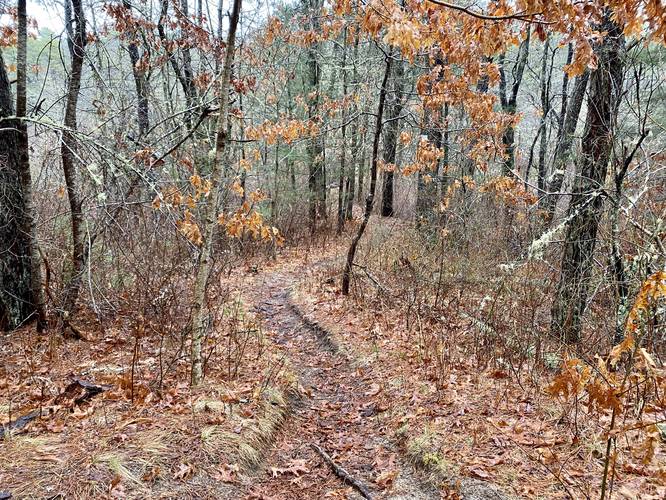
This hike begins at the main parking lot and trailhead located on Martin Road. The trail follows blue blazes along a mostly-flat, but undulating path that follows alongside the Quashnet River from high up on the banks. For the majority of the hike, you actually can't see the river due to the thick forest that sits between the trail and the water. The main trail is easy to follow, just stay right at any trail junctions - most of which are labeled as of April 2023.

River Access - Mile 0.5
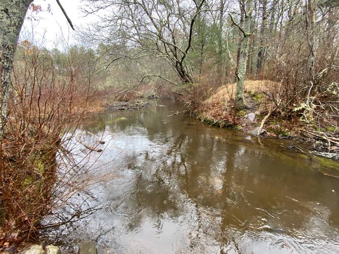
Around mile 0.5, hikers will reach a right-hand turn that leads down a small spur trail. This spur trail leads to the banks of the Quashnet River where you can either relax to watch the slow river float by, assuming it's not too buggy, or try your hand at some fishing opportunities here.

Parking
Hikers will find a parking lot at the coordinates provided along Martin Road in Falmouth. The lot is large enough to fit about 10 vehicles.

Pets
Dogs are allowed if leashed and must be cleaned up after.
Explore 32 trails near Falmouth, MA

Know Before You Go

  • The Quashnet River Trail is an easy, 0.9-mile out-and-back hike in Falmouth, MA, suitable for beginners.
  • The trail follows blue blazes through Quashnet Woods State Reservation, offering an undulating path alongside the Quashnet River, though the river is mostly hidden by trees.
  • A spur trail at the 0.5-mile mark provides access to the riverbank for relaxation or fishing; parking is available for about 10 cars on Martin Road, and leashed dogs are permitted.
Interactive topographic map for Quashnet River Trail located in Falmouth, MA. Click the "View Map" button to load GPS coordinates and trail markers.
Get directions
Distance
0.9 mi
Difficulty
Easy
Type
Out-and-Back
Est. Time
27 min
Elev. Gain
28'
Rating
0.0
Added
April 07, 2023
Updated
April 07, 2023

Weather Forecast

Loading...
Total Change
26'
Ascent
28'
Descent
28'
Loading...

Download the GPX Data for Offline Use

Supporters get exclusive access to download trail routes to the MyHikes app for offline use. Stay prepared on your adventure, even without an internet connection! Become a Supporter today to unlock this feature and hike with confidence.

Download Quashnet River Trail GPX Data to the MyHikes Mobile App

Features

Dogs

Points of interest

  1. Parking

    41.592151, -70.508074
  2. Main Trailhead

    41.59233, -70.507913
  3. Spur trail to Quashnet River

    41.597369, -70.504592
    Spur trail to Quashnet River
  4. Quashnet River

    41.597294, -70.504081
    Quashnet River

Safety information

For your own safety: plan ahead, let someone know where you'll be, and hike at your own risk.

Hazards

Poison Ivy or Poison Oak

Availability

All seasons

Surface type

Dirt

Trip Reports (Reviews)

Your opinion matters! Be the first to rate this trail.

Ready to help fellow hikers? Add a trip report to share your experience and provide valuable insights for other hikers!

No community routes found. To add your own hike as a Community Route for this Trail guide, leave a Trip Report with an attached GPX file.

Popular categories

Scenic mountain view representing vista trails
Vista trails
Scenic gorge of cascades representing waterfall trails
Waterfall hikes
Rugged mountain terrain representing summit trails
Summit trails
Scenic mountain view representing dog-friendly trails
Dog-friendly
Scenic campsite with a view representing camping trails
Camping trails
Appalachian Trail logo representing A.T. hikes
A.T. hikes

You May Also Like

Colorado's Million Dollar Highway - Plan a day's drive adventure along the iconic Million Dollar Highway in Colorado. Explore the best short trails, roadside stops, waterfalls, vistas, ghost towns, and hot springs within a ~6 hour road trip.
Explore

Colorado's Million Dollar Highway

Plan a day's drive adventure along the iconic Million Dollar Highway in Colorado. Explore the best short trails, roadside stops, waterfalls, vistas, ghost towns, and hot springs within a ~6 hour road trip.

Read
Glacier's Going-to-the-Sun Road - Discover the breathtaking beauty of Glacier National Park along the iconic Going-to-the-Sun Road. From stunning roadside stops to picturesque waterfalls and vistas, this engineering marvel offers endless opportunities for exploration.
Explore

Glacier's Going-to-the-Sun Road

Discover the breathtaking beauty of Glacier National Park along the iconic Going-to-the-Sun Road. From stunning roadside stops to picturesque waterfalls and vistas, this engineering marvel offers endless opportunities for exploration.

Read
🍪 We use cookies to learn about site usage and to serve map tiles. You may block cookies manually in the browser. By continuing you agree. Learn more