Loading...

Distance:
1.2 Miles / 1.9 km
Type:
Out-and-Back
Difficulty:
Easy
Time to Hike:
~36 minutes
Features:
Surface Type:
Dirt
Park:
Quabbin Reservoir
Town:
Shutesbury, Massachusetts
Directions:
42.449383, -72.387884
Added:
August 05, 2018
Updated:
January 17, 2022
Loading...
Loading...
187 '

Total Change
204 '

Ascent
204 '

Descent

Gate 16 at Quabbin Reservoir in Shutesbury, Massachusetts is an easy 1.2 mile out-and-back hike down to the northwestern shores of Quabbin.

The trail starts off at a large parking lot across the street from Prescott Rd, along Route-202 and cuts through the woods before hitting a service road. When you hit the service road, take a right-hand turn and continue hiking downhill until you reach the water. Around mile 0.4, you'll pass another trail/service road, but stay left to continue heading downhill.

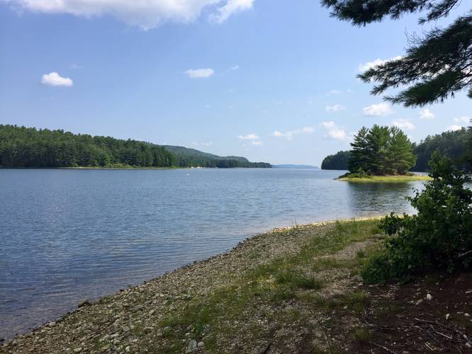
At the end of the trail is a popular fishing spot - which requires a state fishing license.

The hike back uphill is fairly gradual, hence the easy difficulty.

Pets
Dogs are not allowed on any trails at Quabbin.

Explore 201 trails near Shutesbury, MA
  1. Parking

    42.449383, -72.387884
  2. Main Trailhead

    42.449393, -72.387592
  3. Vista at the end of Gate 16

    42.442773, -72.380712
    Vista at the end of Gate 16
No community routes found. To add your own hike as a Community Route for this Trail guide, leave a Trip Report with an attached GPX file.

Hazards

Ticks - Lyme Disease More Info (CDC)

Seasons

All

Photo Albums

1 Trip Report

No Star-Ratings
Write-up by:
Admin user profile picture
1.2 miles / 1.9 km
Trail added
August 05, 2018
Hiked on
August 05, 2018
Updated on
January 17, 2022

Weather Forecast

In Shutesbury, MA

Explore Hiking Trails

New Hikes

Spencer Pond Loop
0.3 Miles
0.5 km
Easy
Loop
Sugar Hill Fire Tower Hike
0.7 Miles
1.1 km
Easy
Out-and-Back
Raven Rocks via Appalachian Trail
5.1 Miles
8.2 km
Strenuous
Out-and-Back
Sugar Hill Pond and Twin Lean-Tos Hike
2.3 Miles
3.7 km
Moderate
Out-and-Back

Before you leave...

MyHikes is an indie web platform aimed to make exploring public trails easier for everyone. The site has no investors and is owned and operated by one person, Dave Miller (Founder & Admin). As the Founder, main contributor, and doer-of-all-things for MyHikes, I share my trips with over-detailed write-ups for fun on a volunteer basis and I believe that public trail information should be available to everyone.

It takes a lot of time ๐Ÿ•ฆ, money ๐Ÿ’ฐ, and effort (including espresso shots โ˜•) to run MyHikes, including hiking , mapping , writing , and publishing new trails with high-quality content... along with building new features, moderating, site maintainance, and app development for iOS and Android . I simply ask that if you find MyHikes' trail guides helpful to please consider becoming a Supporter to help keep the site, iOS, and Android apps available to everyone.

Supporters unlock website and in-app perks with a one-time payment of $25 (you renew) ๐Ÿ˜Ž๐Ÿ‘. Or you can simply make a Donation of your choice without a MyHikes user account. Otherwise, telling your friends about MyHikes is the next-best thing - both quick and free ๐ŸŽ‰

Thanks for visiting MyHikes and have a great hike!๏ธ

Admin user profile picture

Dave Miller
MyHikes Founder & Admin