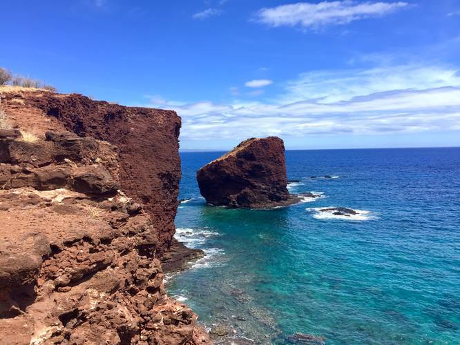
Puu Pehe (Sweetheart Rock) in Lanai, Hawaii is an easy 0.9 mile out-and-back hike to an ocean-side cliff with views of Puu Pehe, or Sweetheart Rock.
The trail starts at the eastern end of Hulopo'e Beach and passes a popular tide pool snorkeling area (follow the staircase down to the tide pool) before reaching the first lookout point of Puu Pehe.
Follow the trail for another quarter mile to reach the top of the cliff with the closest view of Sweetheart Rock.
The trail is rocky, so shoes are best if you plan to hike up to the cliff. Most people hike it in flip-flops to the first lookout point.
While in the area, be sure to check out the Hulopo'e - Huawai Fisherman's Trail at the western end of the beach.
Reaching Lanai: To reach this trail, you'll need to take a boat from Lahaina on Maui, which costs about $30/person one-way. Hulopo'e Beach's lack of people makes the trip well worth it.
Respecting the Land
Hawaiian land is considered sacred to native Hawaiians and many locals, so please stay on-trail, take nothing but photos, and leave nothing but footprints. Respect the locals - don't stay for long and have a backup hike planned in case the parking lot is full.