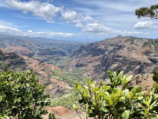
The Pu'u Hinahina Lookout at Waimea Canyon State Park in Waimea, Hawaii (Kauai) is an easy 0.1-miile paved and universal access out-and-back trail that leads to a beautiful overlook of the Waimea Canyon.
This is not a hike, but rather a quick walk along a paved path that leads to the lookout. For universal access, visitors can head toward the Canyon Trail (i.e. Waipo'o Falls hike) to where the paved portion of the trail meets the parking lot without any stairs.
Parking & Fees
Visitors will find a large parking lot at the coordinates provided. The lot is large enough to fit several dozen vehicles and overflow parking can be found on the road. There's a vehicle entry fee in addition to individual fees as of June, 2022. By paying for one parking lot, the tickets are valid for all parking lots that require fees for both the Waimea Canyon State Park and Koke'e State Park. Note that for visitors with valid Hawaiian drivers licenses, there are no fees to park or enter.
Warning
Cliffs: Do not cross the fence as these cliffs are thousands of feet tall.
Respecting the Land
Hawaiian land is considered sacred to native Hawaiians and many locals, so please stay on-trail, take nothing but photos, and leave nothing but footprints. Respect the locals - don't stay for long and have a backup hike planned in case the parking lot is full.