Loading...

🎆 50% off 4th of July sale on Supporter Accounts — now through July 6! Learn More.

Promenade du Vieux Port

Directions
Map
Pictures
Send to App
Distance:
1.9 km / 1.2 Miles
Type:
One-Way
Difficulty:
Easy
Time to Hike:
~36 minutes
Features:
Surface Type:
Universal Access
Town:
Montréal, Quebec - Canada
Directions:
45.502914, -73.5557
Added:
October 05, 2024
Updated:
December 20, 2024
Copy Trail Link Hiking this trail? Send a friend or family member a link to this trail guide for your own safety. Hike at your own risk (disclaimer)
Loading...
Loading...
10m

Total Change
9m

Ascent
9m

Descent

Download the Trail Route for Offline Use

Supporters get exclusive access to download trail routes to the MyHikes app for offline use. Stay prepared on your adventure, even without an internet connection! Become a Supporter today to unlock this feature and hike with confidence.

Send to App

Promenade du Vieux Port

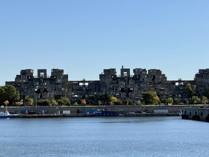
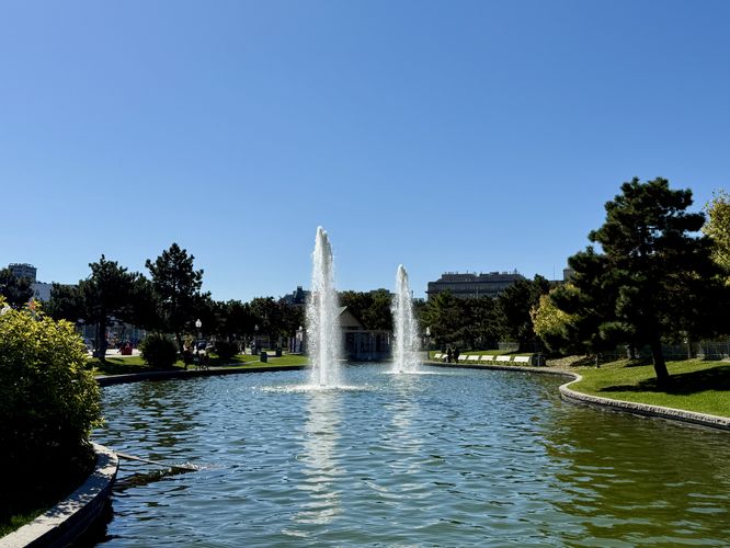
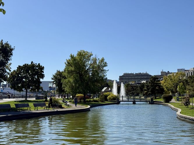
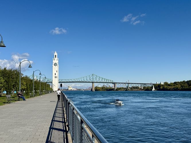
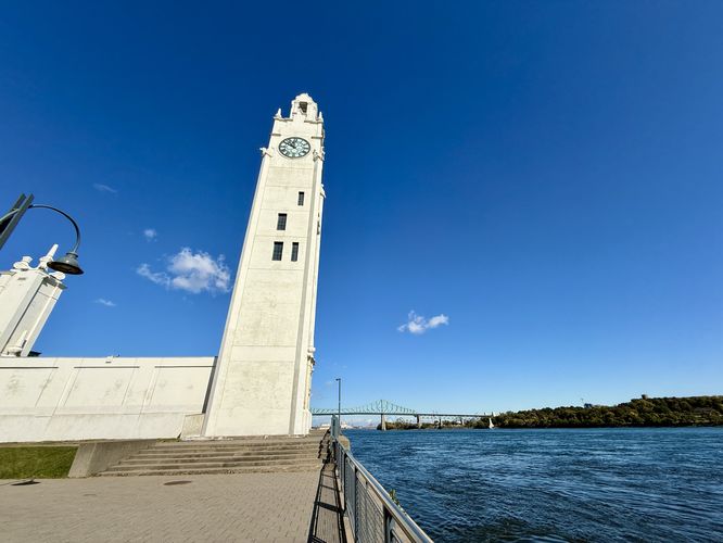
The Promenade du Vieux Port in Montréal, Quebec is an easy 2 km one-way paved walk that leads along the old port of Montréal and features views of the Saint Lawrence River, Habitat 67, La Grande Roue de Montréal, and the old port clock tower.

Walking Old Port

This is not a hike but rather a short and scenic stroll through Montréal's old port. The route begins in the south near the junction of McGill St and Rue de la Commune Ouest and follows the universally-accessible trail (sidewalk) north as it runs along the Saint Lawrence River.

Habitat 67 View - 0.3 km

Just up the trail from where the route starts lies a view of Habitat 67 to the east. Habitat 67 is a unique piece of architecture along the Saint Lawrence River that was built in 1967 for a World's Fair and is used for housing. The building's unique architecture leaves the viewing wondering how the "stacked boxes" form of concrete blocks can stand without tumbling down.

Old Port Park and Fountain - 0.6 km

Up the trail, around 0.6 km, the route leads across the street to reach Old Port Park where you'll find two ponds and a fountain with a backdrop of Old Town Montréal behind it. This is a nice spot to walk through and to get away from the larger crowds along the main route.

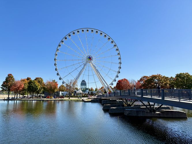
View of La Grande Roue de Montréal - 1.3 km

After exploring Old Port Park, this route hops back on the main trail as it leads northward, passing boat terminals and vendors, and eventually the scenic ferris wheel -- La Grande Roue de Montréal around 1.3 km.

Clock Tower - 2 km

Just up the trail from La Grande Roue de Montréal is the clock tower that sits at the very end of Old Port along the Saint Lawrence River. To get there, follow the trail north and then take a right-hand turn on the next main road. Walk out along the sidewalk and then head north -- you'll find views of the clock tower along the way. Eventually, around 2 km from the trailhead, you'll reach the base of the clock tower where this route ends.

Parking

Visitors will find various parking locations throughout Old Town and Old Port of Montréal; however, the parking coordinates here will bring you to a paid-parking lot near the southern trailhead for this route. Paid parking fees are subject to change.

Pets

Dogs are allowed only if leashed and cleaned up after.

Universal Accessibility

This route should be considered universally-accessible as it follows accessible city sidewalks.
Explore 4 trails near Montréal, QC
  1. Parking

    45.502914, -73.5557
  2. Main Trailhead

    45.498719, -73.552687
  3. View of Habitat 67

    45.501044, -73.552636
    View of Habitat 67
  4. Fountains at Old Port Park

    45.50375, -73.553122
    Fountains at Old Port Park
  5. Pond view at Old Port Park

    45.504347, -73.552903
    Pond view at Old Port Park
  6. View of La Grande Roue de Montreal

    45.508556, -73.550156
    View of La Grande Roue de Montreal
  7. View of the Old Port Clock Tower

    45.509828, -73.546311
    View of the Old Port Clock Tower
  8. Old Port Clock Tower

    45.512019, -73.545678
    Old Port Clock Tower
No community routes found. To add your own hike as a Community Route for this Trail guide, leave a Trip Report with an attached GPX file.

Seasons

All

Photo Albums

Trip Reports

Trail Guide By:
Admin user profile picture
1.2 miles / 1.9 km
1.2 miles / 1.9 km
October 05, 2024
Great way to see Old Port of Montreal
Hiking

Weather Forecast

In Montréal, QC

Explore Hiking Trails

You May Also Like

Colorado's Million Dollar Highway - Plan a day's drive adventure along the iconic Million Dollar Highway in Colorado. Explore the best short trails, roadside stops, waterfalls, vistas, ghost towns, and hot springs within a ~6 hour road trip.
Explore

Colorado's Million Dollar Highway

Plan a day's drive adventure along the iconic Million Dollar Highway in Colorado. Explore the best short trails, roadside stops, waterfalls, vistas, ghost towns, and hot springs within a ~6 hour road trip.

Read
Glacier's Going-to-the-Sun Road - Discover the breathtaking beauty of Glacier National Park along the iconic Going-to-the-Sun Road. From stunning roadside stops to picturesque waterfalls and vistas, this engineering marvel offers endless opportunities for exploration.
Explore

Glacier's Going-to-the-Sun Road

Discover the breathtaking beauty of Glacier National Park along the iconic Going-to-the-Sun Road. From stunning roadside stops to picturesque waterfalls and vistas, this engineering marvel offers endless opportunities for exploration.

Read
New York's Best Waterfalls - Whether you're planning a day hike, roadside stop, or a leisurely short walk, this guide provides hikers, travelers, and locals alike with 63 different locations to over 100 scenic waterfalls to help plan your next adventure!
Explore

New York's Best Waterfalls

Whether you're planning a day hike, roadside stop, or a leisurely short walk, this guide provides hikers, travelers, and locals alike with 63 different locations to over 100 scenic waterfalls to help plan your next adventure!

Read

Before you boogie...

Find our trail guides useful? Consider becoming a Supporter to unlock perks!

MyHikes is an indie platform that makes exploring public trails easier for everyone. The platform has no investors, no ads, and is owned and operated by one person, Dave Miller. Dave has personally mapped and written over 1,800 trail guides on MyHikes for the public to explore. MyHikes has helped millions outdoor enthusiasts plan their next adventure.

But it takes a lot of time 🕦, money 💰, work, and espresso shots ☕ to run MyHikes, including hiking , mapping , writing , and publishing new trails with high-quality (accurate) information... along with software engineering (coding) the platform like building new features, website and mobile app development (iOS and Android), site maintainance . and much much more.

Supporters unlock website and mobile app perks with an annual one-time payment of $25 (you renew) 😎👍. Or you can simply make a Donation of your choice. Otherwise, you can support us by telling your friends about MyHikes - both quick and free 🎉

Admin user profile picture

Dave Miller
MyHikes Founder