Pratt's Falls Trail at Pratt's Falls Park near Pompey, New York is a moderate 0.3-mile out-and-back hike that leads to an overlook of the 137-foot tall waterfall, Pratt's Falls.
Hike Description
This is less of a hike and more of a short walk that begins at the main large parking lot at Pratt's Falls Park and heads in along the paved trail that leads to the waterfall. Visitors will find a series of staircases just a couple-hundred feet into the walk where they'll follow the stairs downhill, most of the way, to reach the waterfall overlook. Note that visitors will want to take a left-hand turn at the junction shortly after reaching the bottom of the first set of stairs.
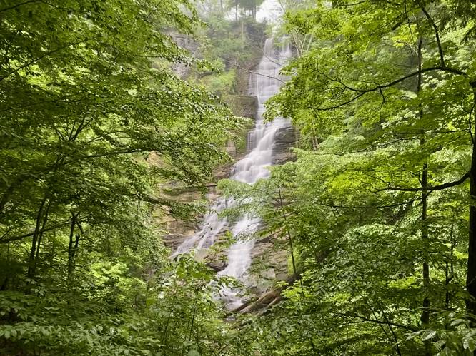
Pratt's Falls Overlook - Mile 0.15
The trail will end around mile 0.15 at the overlook for Pratt's Falls. Pratt's Falls cascades over the steep gorge at 137-feet tall, giving visitors a spectacular and quick payout.
Parking
Hikers will find a very large parking lot at the coordinates provided at Pratt's Falls Park. The parking lot is large enough to fit several dozen vehicles.
Pets
Dogs are allowed only if leashed and cleaned up after.
Surface Type
This trail follows a paved path which is universally accessible only to the staircase, located 200-feet from the trailhead at the parking lot. Once at the stairs, there are several staircases that lead down to the waterfall's overlook.
Hike Description
This is less of a hike and more of a short walk that begins at the main large parking lot at Pratt's Falls Park and heads in along the paved trail that leads to the waterfall. Visitors will find a series of staircases just a couple-hundred feet into the walk where they'll follow the stairs downhill, most of the way, to reach the waterfall overlook. Note that visitors will want to take a left-hand turn at the junction shortly after reaching the bottom of the first set of stairs.
Pratt's Falls Overlook - Mile 0.15
The trail will end around mile 0.15 at the overlook for Pratt's Falls. Pratt's Falls cascades over the steep gorge at 137-feet tall, giving visitors a spectacular and quick payout.
Parking
Hikers will find a very large parking lot at the coordinates provided at Pratt's Falls Park. The parking lot is large enough to fit several dozen vehicles.
Pets
Dogs are allowed only if leashed and cleaned up after.
Surface Type
This trail follows a paved path which is universally accessible only to the staircase, located 200-feet from the trailhead at the parking lot. Once at the stairs, there are several staircases that lead down to the waterfall's overlook.