Pohaku Hoohanau-Pohaku Piko & Japanese Cemetery at the Wailua River State Park near Kapa'a Hawaii (Kauai) is an easy 0.3-mile out-and-back trail that leads to the ancient birthstone site of Pohaku Hoonanau and Pohaku Piko along with an old Japanese cemetery which appears to be from the 1940s era.
Hike Description
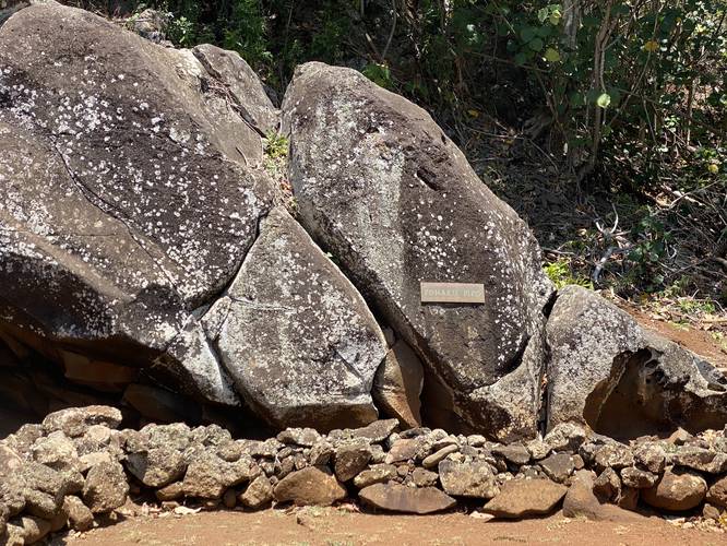
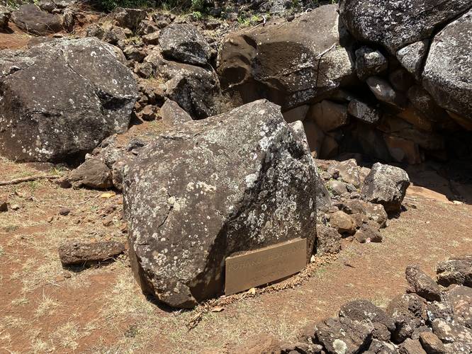
Visitors will begin their walk near the roadside turnout which is located on public land just adjacent to the brown "Wailua River State Park" sign near the parking coordinates provided. The walk over to the large stones, labelled "Pohaku Hoohanau" and "Pohaku Piko" can be found just beyond the sign; however, there's no information about these stones. "Pohaku Hoohanau" also reads "birthstone" and in addition, the Bishop Museum has some interesting information with regard to Hawaiian Pohaku and Piko respectively. Based on their information, it seems that this area was used in a birth ritual. Pohaku is simply the basalt rock that's used to build structures. Piko means an infants umbilical cord. So according to the Bishop Museum, ancient Hawaiians would use a Piko Stone, made of basalt rock (Pohaku), to carve a hole into - then place an infant's umbilical cord in the hole. Finally, they would seal the hole with a small stone by pounding it into place, locking in the Piko. If the next day, the Piko (umbilical cord) was gone, that meant the child would live a long life.
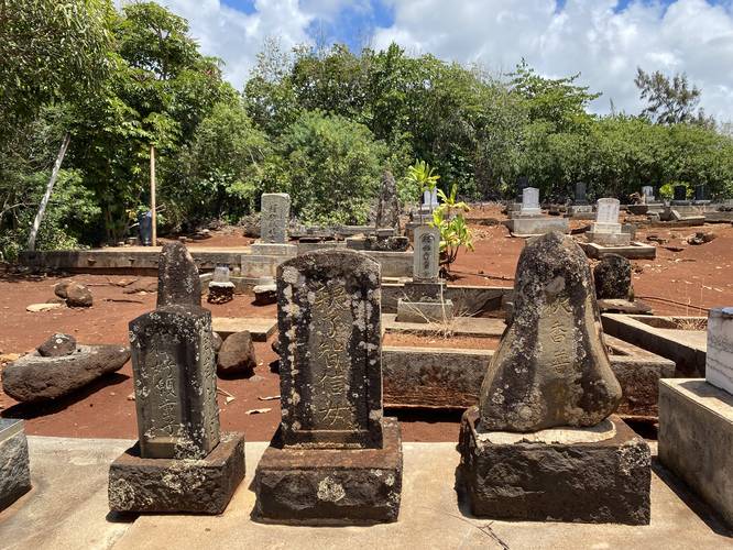
If you explore a bit further, there's a trail that leads uphill to an old Japanese cemetery. Some headstones reference the early 1940's; however, a lot of the headstones looked very old. It appears as though this area was acquired by Wailua River State Park sometime in the past.
Parking
Visitors will find parking at the coordinates provided at the large turnout in the road. Please note that this turnout is on State Park property; however, there are private residences that park adjacent along their own fences/properties. Please park on the public road side of the turnout.
Respecting the Land
Hawaiian land is considered sacred to native Hawaiians and many locals, so please stay on-trail, take nothing but photos, and leave nothing but footprints. Respect the locals - don't stay for long and have a backup hike planned in case the parking lot is full.
Hike Description
Visitors will begin their walk near the roadside turnout which is located on public land just adjacent to the brown "Wailua River State Park" sign near the parking coordinates provided. The walk over to the large stones, labelled "Pohaku Hoohanau" and "Pohaku Piko" can be found just beyond the sign; however, there's no information about these stones. "Pohaku Hoohanau" also reads "birthstone" and in addition, the Bishop Museum has some interesting information with regard to Hawaiian Pohaku and Piko respectively. Based on their information, it seems that this area was used in a birth ritual. Pohaku is simply the basalt rock that's used to build structures. Piko means an infants umbilical cord. So according to the Bishop Museum, ancient Hawaiians would use a Piko Stone, made of basalt rock (Pohaku), to carve a hole into - then place an infant's umbilical cord in the hole. Finally, they would seal the hole with a small stone by pounding it into place, locking in the Piko. If the next day, the Piko (umbilical cord) was gone, that meant the child would live a long life.
If you explore a bit further, there's a trail that leads uphill to an old Japanese cemetery. Some headstones reference the early 1940's; however, a lot of the headstones looked very old. It appears as though this area was acquired by Wailua River State Park sometime in the past.
Parking
Visitors will find parking at the coordinates provided at the large turnout in the road. Please note that this turnout is on State Park property; however, there are private residences that park adjacent along their own fences/properties. Please park on the public road side of the turnout.
Respecting the Land
Hawaiian land is considered sacred to native Hawaiians and many locals, so please stay on-trail, take nothing but photos, and leave nothing but footprints. Respect the locals - don't stay for long and have a backup hike planned in case the parking lot is full.