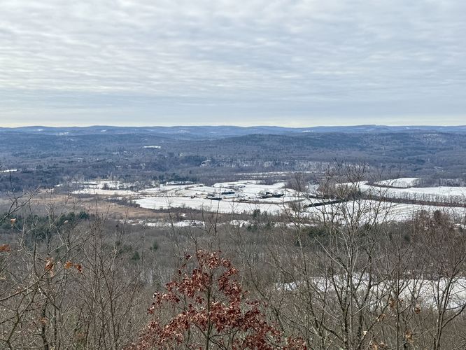
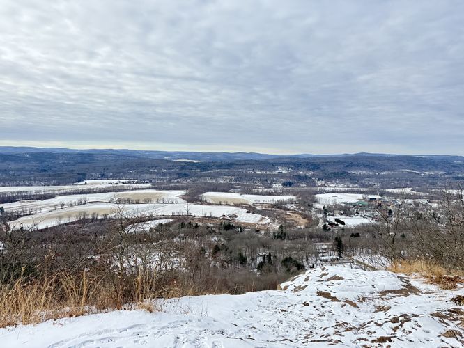
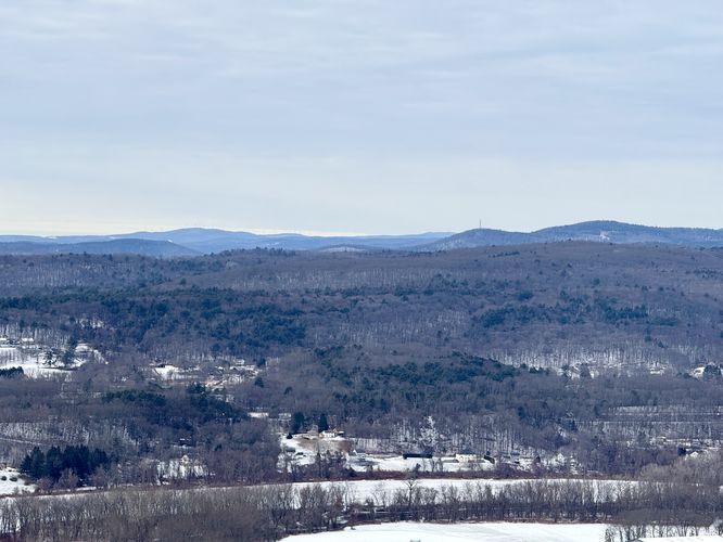
Pocumtuck Rock via Pocumtuck Ridge Trail in Deerfield, Massachusetts is a moderate 5.6-mile out-and-back hike that features several panoramic views high above the Deerfield River of the town of Deerfield, Mt. Tom, and the mountains in southern Vermont.
Interactive topographic map for Pocumtuck Rock via Pocumtuck Ridge Trail located in Deerfield, MA. Click the "View Map" button to load GPS coordinates and trail markers.
View map
Get directions
- Distance
- 5.6 mi
- Difficulty
- Moderate
- Type
- Out-and-Back
- Est. Time
- 2.8 hrs
- Elev. Gain
- 447'
- Rating
- 4.0
- Added
- December 23, 2024
- Updated
- January 02, 2025
Weather Forecast
Don't let Google decide who you trust.


Loading...
<strong>Trail map and elevation chart not rendering in print mode?</strong> Simply scroll to the trail map section, then try printing again!
Total Change
327 ft.
100 m
100 m
Ascent
447 ft.
136 m
136 m
Descent
447 ft.
136 m
136 m
Loading...
Features
- Vista / Lookout Point
- Dogs
- Mountain Summit
Points of interest
-
Parking
42.497282, -72.587097 -
Main Trailhead
42.497282, -72.587097 -
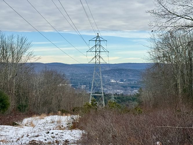
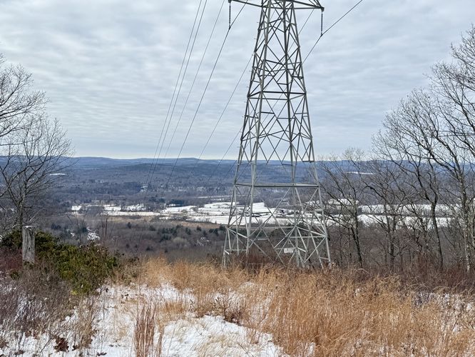
Power line View (West)
42.515397, -72.589853 -
Power line view (east)
42.515453, -72.590272

-
Parking
42.497282, -72.587097 -
Main Trailhead
42.497282, -72.587097
Safety information
For your own safety: plan ahead, let someone know where you'll be, and hike at your own risk.
Markers
Blaze Color
Blue
0000cc
Availability
All seasons
Surface type
Dirt
Trip Reports (Reviews)
Ready to help fellow hikers? Add a trip report to share your experience!
No community routes found. To add your own hike as a Community Route for this Trail guide, leave a Trip Report with an attached GPX file.


You may also like

Explore
Best of the Alps: Hiking, Adventure & Scenery
Plan your ultimate European Alps adventure! Discover the best hiking trails, epic scenery, and villages in the Swiss Alps, Dolomites, Chamonix, and Lake Como.

Explore
Colorado's Million Dollar Highway
Plan a day's drive adventure along the iconic Million Dollar Highway in Colorado. Explore the best short trails, roadside stops, waterfalls, vistas, ghost towns, and hot springs within a ~6 hour road trip.

Explore
Glacier's Going-to-the-Sun Road
Discover the breathtaking beauty of Glacier National Park along the iconic Going-to-the-Sun Road. From stunning roadside stops to picturesque waterfalls and vistas, this engineering marvel offers endless opportunities for exploration.

Explore
Hike Washington's National Parks & Forests
Find the best day hikes in Washington's National Parks and Forests. Explore panoramic alpine vistas, turquoise lakes, and stunning waterfalls.

