The Pinnacle Golf Loop at Pinnacle State Park in Addison, New York is an easy semi-paved 2-mile loop hike that encompasses the old golf grounds and features views of the mountains that surround Addison and Coopers Plain, New York.
Hike Description
This hike begins near the entrance to Pinnacle Rd in Addison - as of March, 2023, there's now a metal gate that blocks driving down this road, but foot traffic is still allowed; hence, the lollipop (out-and-back) section of the hike.
Hikers will head in, passing the entrance gate to walk down Pinnacle Rd, passing the Finger Lakes Trail / Crystal Hills Trail junction along the way.
Golf Path Start - Mile 0.3
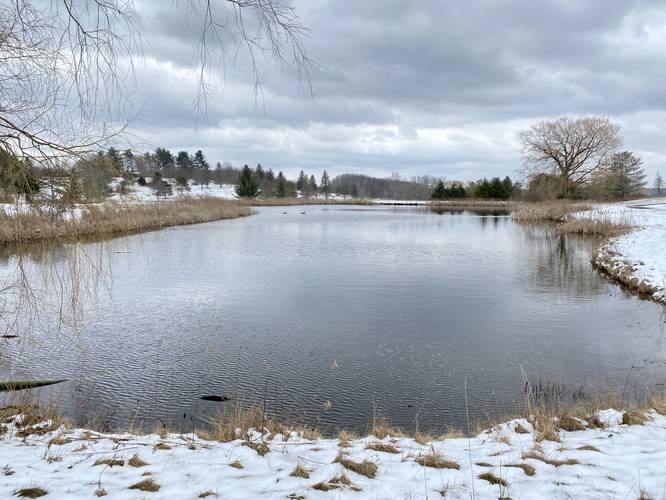
Around mile 0.3, hikers will reach the semi-paved golf path. Take a right-hand turn here to begin the golf loop. Once on the paved path, it first winds around a scenic pond with a weeping willow tree located on the northern end. Just beyond this pond is where the first section of pavement ends, as it will many times throughout the hike. Here, head eastward, through the grass (or snow, depending on the season) toward a pavilion building to pick up another paved section of path.
Picnic Tables, Pavilions, and more - Mile 0.5 to 0.8
After connecting the two paved sections, hikers will start heading uphill where they'll pass more pavilions, picnic tables, grills, and more. From the top of the hill, there's a nice view of the old golf course, the abandoned lodge, and the ponds you just hiked by. Here, the hike heads downhill after taking a hairpin turn.
Paved Path, Grass Path, Ponds, and Views - Mile 0.8 to 1.1
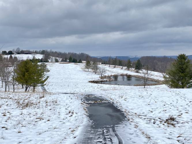
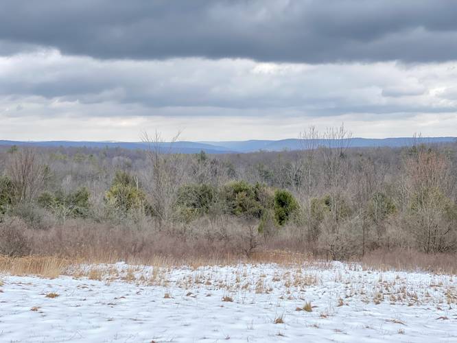
The paved path will end once again and force the hiker back onto the grass as they pass yet another pond. The trail heads up and around the backside of some old golf course sand traps before reaching the same pond you just passed earlier. Along the way, hikers get views of the Coopers Plains, NY area facing north. Once you reach the pond you just passed, you can take a left-hand turn to reach another paved path.
Paved Path, Grass Path, Views, and the Lodge - Mile 1.1 to 1.5
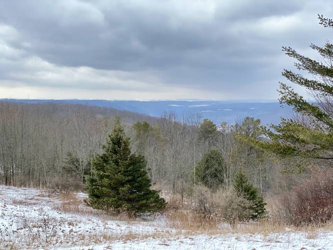
After hopping on another section of paved path, the walk heads towards the lodge, but not long before you have to walk on grass for a while longer. Along the way, again, are nice views of the mountains surrounding Coopers Plains, NY. Eventually, the paved path picks back up and winds its way uphill to reach the abandoned lodge.
Addison Vista - Mile 1.55
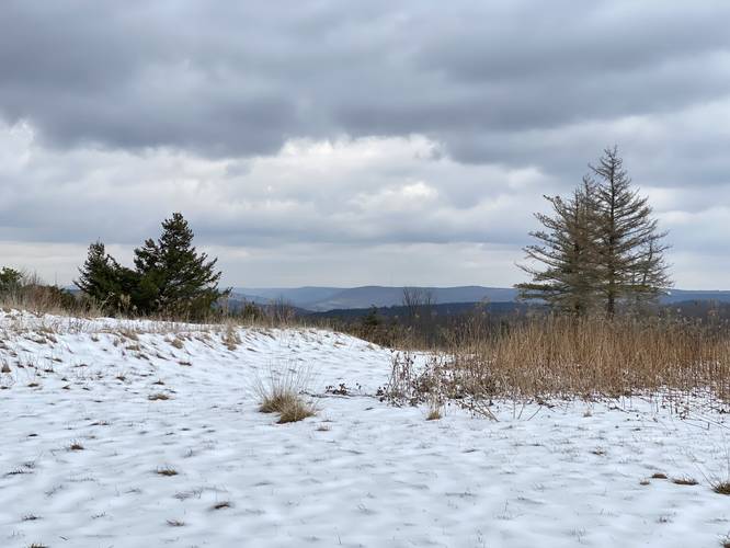
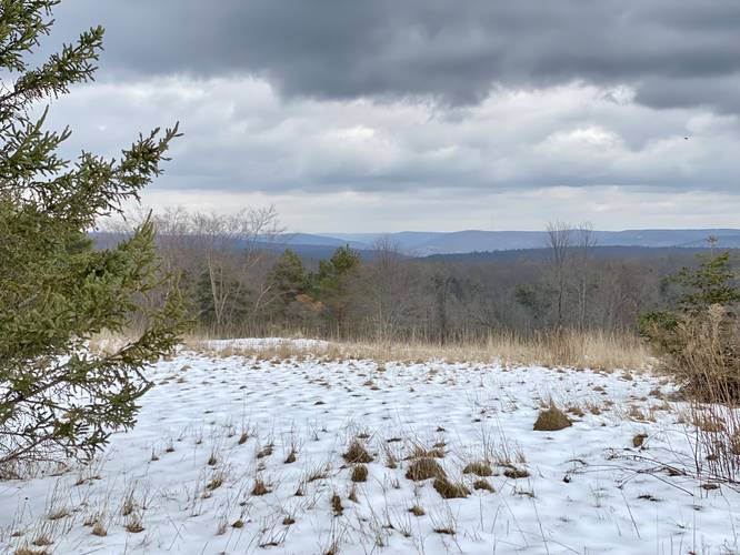
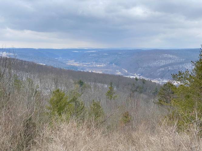
After reaching the old abandoned lodge, hikers may want to head over to the Addison Vista, located behind the lodge, around mile 1.55. There, you'll get views of the mountains surrounding Addison, NY and the Village of Addison in the valley below.
Hiking Out
After visiting the Addison Vista, hikers can take the last section of paved path - from the small check-in hut, down hill (passing yet another view of Addison, NY), before the pavement ends. Here, take and left-hand turn to head back to Pinnacle Road. Once on Pinnacle Road, the hike out just follows the road back to parking.
Parking
Hikers should note that there's no real parking lot available for the main section of Pinnacle State Park, as of March 2023. There's enough room to fit about 5 vehicles, maximum before the gate. There's a brand new gate (2023) that's been installed to keep cars from driving down this road; however, it's not clear when or if the gate will be opened. Assuming the gate is always closed to the public, you can find small parking turnouts located on Pinnacle Road, located near the junction of Ackerson Rd. This is a small quiet neighborhood, so please be respectful and do not overcrowd this parking area.
Pets
Dogs are allowed only if leashed and cleaned-up after.
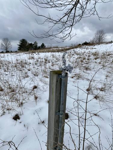
Water Source - Mile 1.05
Note that there's a water fountain located at mile 1.05; however, it's unclear if this water is actually potable. The water fountain sits atop a water pipe sticking out of the ground and despite the pipe's basic appearance, the fountain itself looks brand new and shiny as of March, 2023. One can only assume the water is potable in this case.
Hike Description
This hike begins near the entrance to Pinnacle Rd in Addison - as of March, 2023, there's now a metal gate that blocks driving down this road, but foot traffic is still allowed; hence, the lollipop (out-and-back) section of the hike.
Hikers will head in, passing the entrance gate to walk down Pinnacle Rd, passing the Finger Lakes Trail / Crystal Hills Trail junction along the way.
Golf Path Start - Mile 0.3
Around mile 0.3, hikers will reach the semi-paved golf path. Take a right-hand turn here to begin the golf loop. Once on the paved path, it first winds around a scenic pond with a weeping willow tree located on the northern end. Just beyond this pond is where the first section of pavement ends, as it will many times throughout the hike. Here, head eastward, through the grass (or snow, depending on the season) toward a pavilion building to pick up another paved section of path.
Picnic Tables, Pavilions, and more - Mile 0.5 to 0.8
After connecting the two paved sections, hikers will start heading uphill where they'll pass more pavilions, picnic tables, grills, and more. From the top of the hill, there's a nice view of the old golf course, the abandoned lodge, and the ponds you just hiked by. Here, the hike heads downhill after taking a hairpin turn.
Paved Path, Grass Path, Ponds, and Views - Mile 0.8 to 1.1
The paved path will end once again and force the hiker back onto the grass as they pass yet another pond. The trail heads up and around the backside of some old golf course sand traps before reaching the same pond you just passed earlier. Along the way, hikers get views of the Coopers Plains, NY area facing north. Once you reach the pond you just passed, you can take a left-hand turn to reach another paved path.
Paved Path, Grass Path, Views, and the Lodge - Mile 1.1 to 1.5
After hopping on another section of paved path, the walk heads towards the lodge, but not long before you have to walk on grass for a while longer. Along the way, again, are nice views of the mountains surrounding Coopers Plains, NY. Eventually, the paved path picks back up and winds its way uphill to reach the abandoned lodge.
Addison Vista - Mile 1.55
After reaching the old abandoned lodge, hikers may want to head over to the Addison Vista, located behind the lodge, around mile 1.55. There, you'll get views of the mountains surrounding Addison, NY and the Village of Addison in the valley below.
Hiking Out
After visiting the Addison Vista, hikers can take the last section of paved path - from the small check-in hut, down hill (passing yet another view of Addison, NY), before the pavement ends. Here, take and left-hand turn to head back to Pinnacle Road. Once on Pinnacle Road, the hike out just follows the road back to parking.
Parking
Hikers should note that there's no real parking lot available for the main section of Pinnacle State Park, as of March 2023. There's enough room to fit about 5 vehicles, maximum before the gate. There's a brand new gate (2023) that's been installed to keep cars from driving down this road; however, it's not clear when or if the gate will be opened. Assuming the gate is always closed to the public, you can find small parking turnouts located on Pinnacle Road, located near the junction of Ackerson Rd. This is a small quiet neighborhood, so please be respectful and do not overcrowd this parking area.
Pets
Dogs are allowed only if leashed and cleaned-up after.
Water Source - Mile 1.05
Note that there's a water fountain located at mile 1.05; however, it's unclear if this water is actually potable. The water fountain sits atop a water pipe sticking out of the ground and despite the pipe's basic appearance, the fountain itself looks brand new and shiny as of March, 2023. One can only assume the water is potable in this case.