The Pine Mountain Trail at F. D. Roosevelt State Park in Georgia is a mostly moderate (in places easy) 23-mile trail featuring multiple vista points, some waterfalls, and 16 designated named camping locations for backpackers. This trail runs along the Pine Mountain ridge in west-central Georgia, was built by volunteers working with the Pine Mountain Trail Association and has been maintained only by them since 1975. The trail and the Pine Mountain Trail Association (PMTA) were founded by the late D. Neal Wickham of Columbus.
The Pine Mountain Trail crosses land that was once owned by President Franklin D. Roosevelt - his farm was near the site of WJSP-TV (near the eastern trailhead terminus). FDR often visited Dowdell’s Knob and the area of the Wolfden and Cascade Falls as well as the fish hatchery ponds built by the Civilian Conservation Corps in the late 1930’s. A statue and kiosk at Dowdell’s Knob tell of this.
For even more details check out www.pinemountaintrail.org. See MAPS OF THE TRAIL to order by US mail a much suggested topo style printed on Tyvek trail map to aid in planning your trip along the Pine Mountain Trail. Maps are also available at the park office.
Mileage: The main Pine Mountain Trail is marked west to east with mileage markers along the way. There are also wooden directional signs at each trail and road intersection noting mileage to points ahead. There are no mileage markers on the named connector trails.
Road Crossings: The Pine Mountain Trail crosses several roads and state highways throughout the entire 23-mile one-way trek - including GA-190, GA-354, Kings Gap Rd, and Hines Gap Road. The longest stretch of continuous trail, without a road crossing, is about 5.5-miles.
Connector Trails: There are various named connector trails throughout FDR State Park, which you can use for day hikes or backpacking trips - some of which have lookout points, like the Odie Overlook on the White Candle Trail. For more information about the connector trails, check out this link. Please note that over time MyHikes will add these connector trails to link to this page and the FDR State Park.
Backpacking Permits: If you want to backpack the Pine Mountain Trail, you'll first need to obtain a permit from the FDR park office before entering the woods. . Reservations for the named sites can be made online and are suggested (see cost of backcountry permits at PERMITS on the PMTA website). You'll need to have either a Georgia Park Pass or buy a Daily Use Fee Pass to be displayed on the rear view mirror of each vehicle left parked overnight within the park. You must also display the blue copy of the backcountry permit on your dashboard as well as hang the white original copy from your backpack. If you travel in two or more vehicles, ask the clerk at the park office for a duplicate copy of your backcountry permit for each additional vehicle. Once you get a permit for a particular site, you CANNOT change the site you are staying at without first getting permission from the FDR Park Office. More information about backcountry permits can be found here.
Campsites: There are 14 designated named campsites directly along the Pine Mountain Trail and two on the named connector trails where backpackers can setup for the night. Each of the campsites are listed below with their mileage, names, and approximate coordinates: See the PMTA website under SITE DESCRITIONS for complete descriptions and photos and how far off the trails they are. Some sites have two fire rings (shared sites) and some have just one fire ring.
Little Bridges Campsite (32.82666, -84.83538) - this campsite is located on the Chestnut Oak Trail
Mile 2.3: Deadpine Campsite (32.83568, -84.82936).
Mile 5.19: Broken Tree Campsite (32.84073, -84.79936).
Mile 7.6: Turtle Hollow Campsite (32.85563, -84.79402). along with smaller Turtle Bluff (2 tents)
Mile 7.8: Big Knot Campsite (32.85693, -84.79223).
Mile 8.3: Jenkins Springs Campsite (32.85791, -84.78426).
Mile 9.3: Beech Bottom Campsite (32.85888, -84.7778).
Mile 11.6: Whiskey Still Campsite (32.84452, -84.76131)
Grindstone Gap Campsite is located on the Sawtooth Trail
Mile 13.05 (600’ past mile marker 13): Bethel Creek Campsite (32.8471, -84.74677).
Mile 15.95: Brown Dog Campsite (32.85057, -84.73953).
Mile 16.9 Sparks Creek Campsite (32.85695, -84.73079).
Mile 17.1: Big Oak Springs Campsite (32.85926, -84.72984).
Mile 18.4: Sassafras Hill Campsite (32.86635, -84.7158).
Mile 20.7: Old Sawmill Campsite (32.8732, -84.69758).
Mile 21.5 Bumblebee Ridge Campsite (32.86928, -84.69921).
See this link for more campsite descriptions along the Pine Mountain Trail.
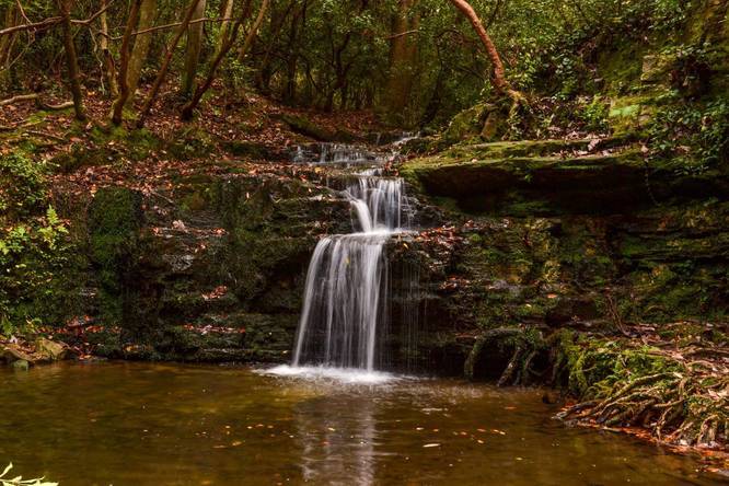
Waterfalls: The Pine Mountain Trail has four named waterfalls to see along the trek, that are along the Mile 20.9 to Mile 22 section (eastern section near the end of the trail.) The following waterfalls are listed by their approximate mileage and coordinates:
Mile 20.9: Cascade Falls (32.87023, -84.69534).
Mile 21.5: Big Rock Falls & Slippery Rock Falls (32.86737, -84.69901).
Mile 21.7: Csonka Falls (32.8644, -84.70165).
Pets: Dogs are allowed only if leashed, at all times, when outside of vehicles. They must be kept on 6-foot long leashes - no reel/extender leashes allowed unless locked down to 6-feet.
Parking: Parking on the west terminus can be found at the Gardens Country Kitchen/Store 380’ from the start of the trail. Parking at the eastern terminus can be found at these coordinates: 32.85213, -84.703390 (which is the WJSP TV Tower/Mile 23 trailhead at 609 White House Pkwy, Warm Springs, GA 31830 ). There are named off road parking area/trailheads noted on the trail map and noted on the FAQ section of the trails website noting distance to them from the park office.
The following approximate trail mileage marker corresponds to each parking coordinate: On the trails website there are directions to the trailhead parking areas from the park office also noted on
Directions to the Trail : https://www.pinemountaintrail.org/directions-to-the-pmt.html
Mile 1.3: Gardens Overlook Parking Area (32.823887, -84.838025).
Mile 3.1: Buzzards Roost Parking Area (32.833318, -84.824898).
Mile 3.7: FDR State Park Office Parking Area (32.838367,-84.817801).
Mile 6.2: Fox Den Cove Parking Lot (32.8471, -84.79651).
Mile 11.2: Mollyhugger Hill Parking Lot (32.849982, -84.766122).
Mile 14.7: Dowdell's Knob Trailhead Lot (32.83949, -84.74523).
Mile 18.05: Rocky Point Parking Lot (32.863164, -84.719382).
The Pine Mountain Trail crosses land that was once owned by President Franklin D. Roosevelt - his farm was near the site of WJSP-TV (near the eastern trailhead terminus). FDR often visited Dowdell’s Knob and the area of the Wolfden and Cascade Falls as well as the fish hatchery ponds built by the Civilian Conservation Corps in the late 1930’s. A statue and kiosk at Dowdell’s Knob tell of this.
For even more details check out www.pinemountaintrail.org. See MAPS OF THE TRAIL to order by US mail a much suggested topo style printed on Tyvek trail map to aid in planning your trip along the Pine Mountain Trail. Maps are also available at the park office.
Mileage: The main Pine Mountain Trail is marked west to east with mileage markers along the way. There are also wooden directional signs at each trail and road intersection noting mileage to points ahead. There are no mileage markers on the named connector trails.
Road Crossings: The Pine Mountain Trail crosses several roads and state highways throughout the entire 23-mile one-way trek - including GA-190, GA-354, Kings Gap Rd, and Hines Gap Road. The longest stretch of continuous trail, without a road crossing, is about 5.5-miles.
Connector Trails: There are various named connector trails throughout FDR State Park, which you can use for day hikes or backpacking trips - some of which have lookout points, like the Odie Overlook on the White Candle Trail. For more information about the connector trails, check out this link. Please note that over time MyHikes will add these connector trails to link to this page and the FDR State Park.
Backpacking Permits: If you want to backpack the Pine Mountain Trail, you'll first need to obtain a permit from the FDR park office before entering the woods. . Reservations for the named sites can be made online and are suggested (see cost of backcountry permits at PERMITS on the PMTA website). You'll need to have either a Georgia Park Pass or buy a Daily Use Fee Pass to be displayed on the rear view mirror of each vehicle left parked overnight within the park. You must also display the blue copy of the backcountry permit on your dashboard as well as hang the white original copy from your backpack. If you travel in two or more vehicles, ask the clerk at the park office for a duplicate copy of your backcountry permit for each additional vehicle. Once you get a permit for a particular site, you CANNOT change the site you are staying at without first getting permission from the FDR Park Office. More information about backcountry permits can be found here.
Campsites: There are 14 designated named campsites directly along the Pine Mountain Trail and two on the named connector trails where backpackers can setup for the night. Each of the campsites are listed below with their mileage, names, and approximate coordinates: See the PMTA website under SITE DESCRITIONS for complete descriptions and photos and how far off the trails they are. Some sites have two fire rings (shared sites) and some have just one fire ring.
Little Bridges Campsite (32.82666, -84.83538) - this campsite is located on the Chestnut Oak Trail
Mile 2.3: Deadpine Campsite (32.83568, -84.82936).
Mile 5.19: Broken Tree Campsite (32.84073, -84.79936).
Mile 7.6: Turtle Hollow Campsite (32.85563, -84.79402). along with smaller Turtle Bluff (2 tents)
Mile 7.8: Big Knot Campsite (32.85693, -84.79223).
Mile 8.3: Jenkins Springs Campsite (32.85791, -84.78426).
Mile 9.3: Beech Bottom Campsite (32.85888, -84.7778).
Mile 11.6: Whiskey Still Campsite (32.84452, -84.76131)
Grindstone Gap Campsite is located on the Sawtooth Trail
Mile 13.05 (600’ past mile marker 13): Bethel Creek Campsite (32.8471, -84.74677).
Mile 15.95: Brown Dog Campsite (32.85057, -84.73953).
Mile 16.9 Sparks Creek Campsite (32.85695, -84.73079).
Mile 17.1: Big Oak Springs Campsite (32.85926, -84.72984).
Mile 18.4: Sassafras Hill Campsite (32.86635, -84.7158).
Mile 20.7: Old Sawmill Campsite (32.8732, -84.69758).
Mile 21.5 Bumblebee Ridge Campsite (32.86928, -84.69921).
See this link for more campsite descriptions along the Pine Mountain Trail.
Waterfalls: The Pine Mountain Trail has four named waterfalls to see along the trek, that are along the Mile 20.9 to Mile 22 section (eastern section near the end of the trail.) The following waterfalls are listed by their approximate mileage and coordinates:
Mile 20.9: Cascade Falls (32.87023, -84.69534).
Mile 21.5: Big Rock Falls & Slippery Rock Falls (32.86737, -84.69901).
Mile 21.7: Csonka Falls (32.8644, -84.70165).
Pets: Dogs are allowed only if leashed, at all times, when outside of vehicles. They must be kept on 6-foot long leashes - no reel/extender leashes allowed unless locked down to 6-feet.
Parking: Parking on the west terminus can be found at the Gardens Country Kitchen/Store 380’ from the start of the trail. Parking at the eastern terminus can be found at these coordinates: 32.85213, -84.703390 (which is the WJSP TV Tower/Mile 23 trailhead at 609 White House Pkwy, Warm Springs, GA 31830 ). There are named off road parking area/trailheads noted on the trail map and noted on the FAQ section of the trails website noting distance to them from the park office.
The following approximate trail mileage marker corresponds to each parking coordinate: On the trails website there are directions to the trailhead parking areas from the park office also noted on
Directions to the Trail : https://www.pinemountaintrail.org/directions-to-the-pmt.html
Mile 1.3: Gardens Overlook Parking Area (32.823887, -84.838025).
Mile 3.1: Buzzards Roost Parking Area (32.833318, -84.824898).
Mile 3.7: FDR State Park Office Parking Area (32.838367,-84.817801).
Mile 6.2: Fox Den Cove Parking Lot (32.8471, -84.79651).
Mile 11.2: Mollyhugger Hill Parking Lot (32.849982, -84.766122).
Mile 14.7: Dowdell's Knob Trailhead Lot (32.83949, -84.74523).
Mile 18.05: Rocky Point Parking Lot (32.863164, -84.719382).