Pine Creek Falls at Tiadaghton State Forest near Cammal, Pennsylvania is an easy 0.3-mile out-and-back hike that leads to a 60-foot tall waterfall that spills down the side of a large mountain into Pine Creek.
This is not necessarily a hike, but rather a short walk that leads to the banks of Pine Creek where, across the water, lies a very large waterfall. This track heads in along the Pine Creek Trail, located just north of the Ross Run Access Area. Hikers will follow the Pine Creek Trail (rail trail) for 50-feet or so before heading west, off-trail. Walk into the field, then hike north once again to follow a maintenance path through the field which eventually leads west again and over to the banks of Pine Creek.
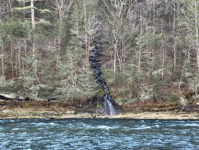
Pine Creek Falls View - Mile 0.15
At mile 0.15, hikers will reach the banks of Pine Creek. Across the water is Pine Creek Falls, which has a steady flow of water even in the middle of the winter. Pine Creek Falls cascades down an unnamed mountain drainage. From across the creek, the entire waterfall appears to be about 60-feet tall if you include all of the tiers that make up the cascade; however, those are just the visible tiers of falling water that visitors can see. Kayakers and canoers may have a better chance of viewing more of the waterfall, especially with a chance to get up-close to it.
Parking
Hikers can park in a small turnout at the coordinates provided or they can park at the Ross Run Access Area located 0.25-miles south along the same road. If parking at the Ross Run Access Area, this walk is more like 0.75-miles out-and-back.
Pets
Dogs are allowed if leashed and their waste should be carried out by the hiker.
This is not necessarily a hike, but rather a short walk that leads to the banks of Pine Creek where, across the water, lies a very large waterfall. This track heads in along the Pine Creek Trail, located just north of the Ross Run Access Area. Hikers will follow the Pine Creek Trail (rail trail) for 50-feet or so before heading west, off-trail. Walk into the field, then hike north once again to follow a maintenance path through the field which eventually leads west again and over to the banks of Pine Creek.
Pine Creek Falls View - Mile 0.15
At mile 0.15, hikers will reach the banks of Pine Creek. Across the water is Pine Creek Falls, which has a steady flow of water even in the middle of the winter. Pine Creek Falls cascades down an unnamed mountain drainage. From across the creek, the entire waterfall appears to be about 60-feet tall if you include all of the tiers that make up the cascade; however, those are just the visible tiers of falling water that visitors can see. Kayakers and canoers may have a better chance of viewing more of the waterfall, especially with a chance to get up-close to it.
Parking
Hikers can park in a small turnout at the coordinates provided or they can park at the Ross Run Access Area located 0.25-miles south along the same road. If parking at the Ross Run Access Area, this walk is more like 0.75-miles out-and-back.
Pets
Dogs are allowed if leashed and their waste should be carried out by the hiker.